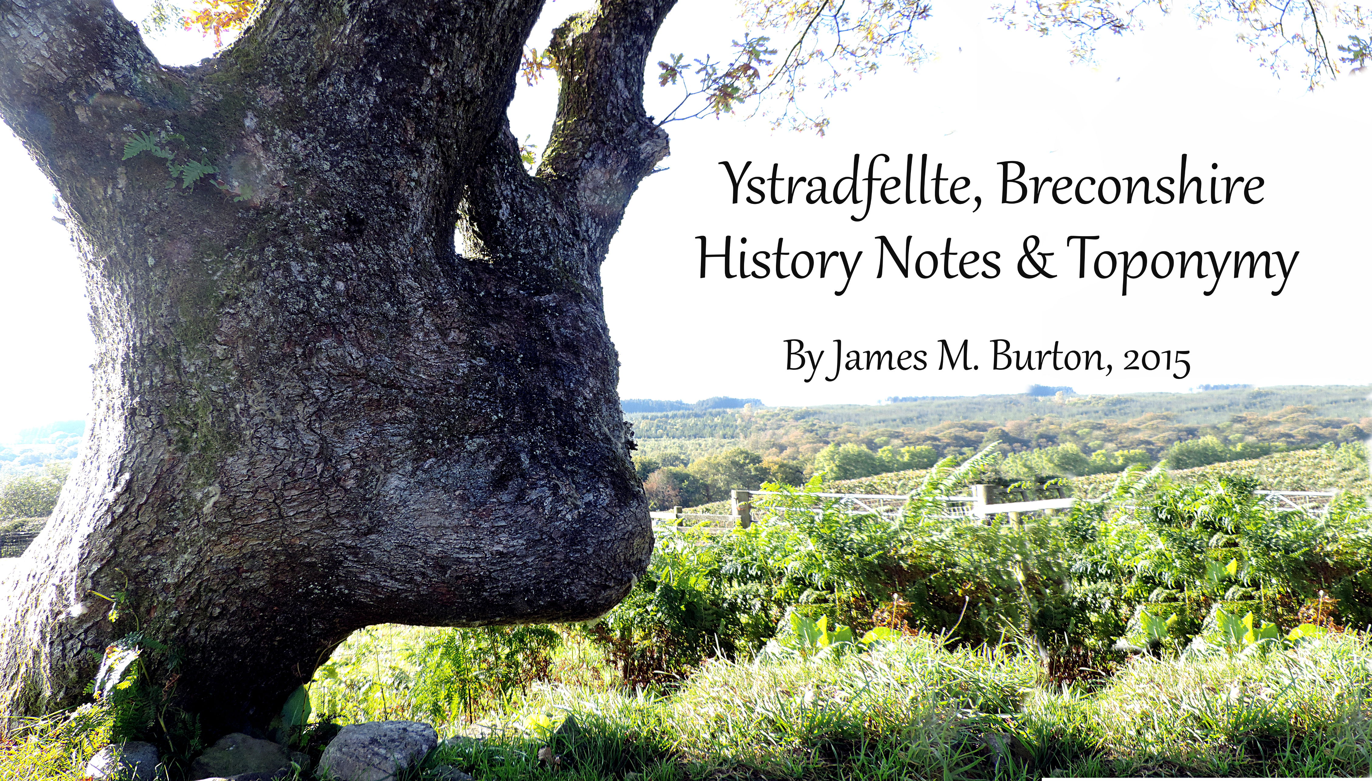
Ystradfellte -
Toponymical & History Notes
By James M Burton 2015
Preface
This is an unfinished thesis that was meant to encompass the whole of the history of Ystradfellte in Breconshire. For now it compiles of all the deeds, documents, wills and references to this parish from archives, libraries, books and online that I have found to date. It also gives some insight into the toponymy and history of the 100 or so farms that have existed in the parish since the earliest written mention of them, c.1500. I may come back to it in the future. Please bear in mind this is a public service and not a university funded project. Uploaded 12th July 2016.
Due to my extended research into the origins of Palleg manor in Ystradgynlais nearby (completed 2014), I found scores of documents scattered across 50 dimensions relating to Ystradfellte, and always keen to tidy, contain and categorise, as humans are apt to do, I decided to list every available MS, book and website pertainting to this ancient parish and give a chronological history from that factual data as best as I am able, being bereft of actual time travel skills. It really pains me to see that no one seems to have bothered to write a book on individual parishes within Brecon. It is supposed researchers like to give a general picture of the country as a whole rather than take the difficult task of poking into the minute and local details that might only interest a few, but surely from this microcosm we get a better overall picture of the macro.
Thus I take on this task to highlight any info that seems to have escaped the blurbs on the parish in local histories. This info will come from proven facts documented, steering clear of supposed and fanciful tales as told by the likes of Geoffery of Monmouth, Iolo Morgan, the Black Book of Llandaff, Brut y Tywysogion, the Mabinogion, Lives of the Saints etc, even Theophillus Jones is suspect as he quoted regularily from those former books, of course that does not preclude me from quoting their examples to enhance the story.
This is a desk based solo project by James M Burton professional-amateur in antiquary and history, and is free to be edited or added to by the public. I claim no copyright and is free to be distributed in the public domain as an enhancment to local history. The project involves glimpsing into the the reflective time-stream of history and therefore may contain conjecture, errors and misunderstanding, especially when combined with information from 3rd party professionals. I am fluent in Welsh and have tried to keep close to original meanings, spellings and etymology, but language is fast changing, even Victorian Welsh of the dialect particular to Ystradfellte might be a strain on the brain if I attempted to converse with a local at that time.
Introduction
An average sized parish on the very southern edge of Breconshire, rising in length acutely to the first peaks of the Beacons mountain range, frequently covered in mist. A very wet and dark poor agricultural district for this reason, but a favoured destination in this time for cavers, rock climbers and hikers. A purely self sustaining sheep rearing district for well over 6000 years there is little difference in this age, many of the descendants could claim a lineage stretching back to original pre Roman settlers. Those Italian invaders were thoughtfull enough to extend their conquest into Ystradfellte, building a single road through the district, stretching from Coelbren to Brecon forts, stopping here to supposedly subdue the natives and bury one of their commanders under and ancient standing stone. Brychan was the first king of of their legacy who maintained an extensive defensive system in Breconshire which included Ystradfellte and deflected all Pict, Jute Dane and Saxon alike until 1093 when the Normans got a foothold in Brecon castle. Not enamoured with a poor agricultural district on its bounds, it was left to the Welsh who paid tribute in corn and cattle to its overlords.
It is divided now into north (Ystradfellte) and south (Pontneathvaughan) hamlets. The north consists of upland sheep farms and moorland with some cattle and a large reservoir built in early 1900's to serve the Neath industries. The south also has extensive farmland but at a lower level, therefore less sheep, more crops and includes the former industries of gunpowder, sand and coal mines on the valley peripheries. Of the 100 or so named farms, at least 30 today are in ruins, some sealed timecapsules of the Victorian era, as if waiting for the right owner to reclaim his heritage. The natural landscape is rich in biodiversity, but within 50 years many of the upland grouse, curlew, lapwing, hares and bird of prey have mysteriously vanished due to, it is thought chemical use on farms. A thouroughly almost permanetly wet district in this age, it obviosuly claims 8 rivers and 40 named tributaries with ancient toponymy. These have carved deep cave systems in their most ferocious moments through the limestone and is a popular exploration era for that reason. As with the presence of deep underground kingdoms, comes myths of dragons, fairies and devil hounds that are still told by the natives, that despite 200 of negative opression by an English education system still tell those stories in a Welsh tongue.
Roman Era AD70-383AD
Map of Roman Roads
Running through this parish is the prominent and well documented, if not one of the best surviving examples of a Roman Road in Wales not tarmaced. It has been used continuously for 2000+ years mostly by sheep & cattle drovers, for this purpose parts of it, especially that in Ystradfellte were recobbled and deviates up to 10m from the original Roman road. The stones would had to have been quarried locally, I wouldn't like to suggest anything but Carnau Gwynion has a large outcrop of suitable rock. It runs directly from Coelbren fort 4 miles west to a 'marching camp' at Plasygors in Ystradfellte, a parallelogram, which is traceable. It continues then 10 miles to Y Gaer fort at Brecon.
The road is supposedly named Sarn Helen after Helen of Hosts from North Wales who married Macsen Wledig, documented Emperor of Britannia and Gaul, who built all the Roman roads in Wales on her advice and his love for her (this according to the myths of the Mabinogion), very doubtfull since when Macsen made a bid for 'Western Emperor' in 383AD the Romans abandoned Britain with him. Archaeologists consider it to be much eariler, built a few years after the final conquest in AD70, others disaggree and say 200AD. The original name was thought to be Sarn Lleon/Lleng, the "road of the legion" and built for administrative and military control. Although we shouldn't dismiss the ledgend so easily, Roman influence and teaching persisted for many generations and it's perfectly possible for the natives to have improved those roads with the authority of a 'native govenor'. Plas-y-Gors marching camp is intersected by this road and considered earlier, used as a temporary camp in their conquest, consisting of a ditch and turf built bank.
With three Roman forts in the district on the road I consider it completely plausible, with the evidence of iron age settlements in Ystradfellte that there was fierce conflict and later influence with the local pastoral tribes, including early teaching of Christianity. In local folklore a mass grave at Cors Y Beddau (Bog of the Graves) near Penyfathor farm is said to sit, a result of a battle in this period. Streams running from it are named Nant yr Esgyrn (stream of bones) & Nant y Clefid (stream of sickness) may give plausibility to this, but no artefacts are documented. Were there any Roman Villas established here? With lack of records reuse of houses and extensive agriculture I can but give a vision of the enobled Welshmen having received citizenship of wider Rome administering this district for the local Roman governor. Having thousands of Pagan Welsh hiding in the hills in mud huts continuously throwing rocks at the Romans passing by on the road for 500 years is a ridiculous cartoon image and does diservice to my civilised and cultured ancestors, although I recognise them as apt in the arts of war and quick to disperse any intransigence shown towards them.
The parish having been robbed of its treasures over many centuries it's not suprising to find that little or no artifacts have been documented from this period, or secreted away in Cardiff Museum. The only found objects so far are a gold coin of Emperor Vespasian (69-79) before 1777, a greyware pottery vessel at Plasygors and possibly a mill Quern, recently. Close by, a Samian bowl was found near Blaen Senni farm (N. of parish) and the finds at Coelbren fort, and Penwyllt caves. All these items are stored at Cardiff Museum.
Early Christian Era 400-1000AD
After the Romans left, the native inhabitants, now armed and trained were left to administer Wales, but very soon infighting began, with invasions by Vikings, Saxons, Norse, Picts etc. It seems the Irish were either invited or invaded, bringing with them a stronger Christian faith and an Ogham alphabet. Deemed to have founded the Kingdom of Brycheiniog, after namesake chieftan Brychan Brycheiniog, of which Ystradfellte was a part.
Early Monuments
It is therefore thought that at the adoption of Christianity in the post Roman period (c.4-600AD) the cairns of the old religion were usurped by marked graves, and thus it is that Maen Madoc an 11 foot stone, standing on Sarn Helen road is dated, with its crude carved markings, "DERVACUS FILIUS JUSTI (H)IC JACIT" - "Of Dervacus, Son of Justus. He lies here" ; indicating, possibly a 'roadside burial'. Some enthusiastic genealogists consider him 4x great gransdon of Emperor of Macsen Wledig, which I wouldn't like to comment on without seeing the evidence.
Thought to be an ancient megalith reused and moved here, it was on its side c.1800 and re-erected by Victorian amateurs c.1850, located next to a 'pit' or socket thought to be a grave, and moved again to its present position 5m away by the Ministry of Works in 1940, whom I presume were repairing the road. The MoW was however formed in 1943 for "requisitioning of property for wartime use". Recent excavations yielded no burial remains, because they dug in the wrong place, the Roman road deviates 10m from its original path here. My thoughts are that as it is given the name 'Madoc' but no reference to it known, that it was reused later in early mediaeval times to mark some occassion after a notable man named Madoc, the immediate area is known as Caer Madoc, Madoc's Fort. But, who knows, maybe there was a Iron Age carving on the front of the stone now worn away, explaining why the Roman inscription is on the side. The stone is so named Madoc evidenced in the earliest farm leases of 1500 onwards.
Also not 100 metres away a chance discovery in 1798 of a later marked burial stone was made, bearing a Christian cross and the inscription in Ogham; "Of Gluvoca", suggesting an Irish Christian burial, but with a name possibly of Serbian origin, now kept at Cyfartha Castle. These two stones, placed in the same vicinity close to an old Roman fort, might there be more here in a communal gravyeard?
Early Documentation
The first mention of the river Mellte comes from the 'Black Book of Llandaff' - Liber Landavensis compiled c.1129. It contains a description of Llandaff boundaries supposedly copied from an ancient document dated c. late 600AD within the life of Bishop St. Oudocei (Euddogwy). Most of these grants however are considered manipulations of older documents or completely false. But it is thought by experts that the particular passage below is in the vernacular language of the time, and contains the ancient name for the river which is the 'Melltou'.
|
"...cingleis ny hyt bet y blain, o blain cingleis y allun guernenn, o allun guernen hyt blain peurdin, o peurdin hyt pan dyscyn y ned, ned ivynyd hyt melltou, melltou ny hyt y vynyd hyt heptur y vynyd dy guyragon, Guyragon hyt y blayn hyt Gauanhauc. O Gauanhauc bet deri emeris, o deri emeris y cecin clysty, cecin clysty ny hyt bet blamfrut y guidon ary hyt bet taf maur, Taf maur y guairet hit cymer, o cymer ivynyd ar hyt taf bechan... "
...along the Cingleis to its source; from there to Allunguernen, from there to the source of the Peurdin, from there to where it falls into the Ned, from there up to the Melltou, along there up to the Heptur, along there to the Guyragon, to its source, from there to Gauanhauc, from there to Deri Emeris, from there to Cecin Clysty, from there to the source of Frut y Guidon, along there to the Taf Maur downwards to Cymer, from there up along Taf Bechan... |
| Liber Landevensis 1129 1
|
The boundaries are mostly denoted by rivers, some of which still have the same names now. The modern county boundaries are assumed to be a mirror of mediaevel ones due to extensive surveying, research and debate including many lengthy court cases, even wars, and in most cases old documents describing them are extact to the modern, thus we apply this criteria to the former description.
- Cingleis: River Cynlais (Gyrlais) is in Ystradgynlais. Peurdin: river Pyrddin; Ned: river Nedd; Melltou: river Mellte are straightforward.
- Some debate arises over Allungwernen (Hal un Guernen : the Moor of one Alder) as extensive coal mining occured in the area. There is in Onllwyn a farm named Rhos-y-gelynen in 1878 OS, but this translates to moor-of-the-holly, but I can guarantee no hollies would be growing in that inhospitable location.
- Hepstur: this appears not to be the river Hepste as it would have been spelt Heps-tou, as Mell-tou, it is thought a derivation of Hesp-dwr, meaning a tributary of Hepste, therefore the Sychbant (J. B. Coe. & W. Rees). If we followed the course of the Hepste then we would exclude Penderyn which was always within the lordship of Brecon from at least 1372, and none of the below would make sense. However this is much earlier and boundaries can change, note Pendryn is within RCT in 2015.
- Guyragon / Gurangon: on the 1812 OS, a farm named Cwm Gwarangon is placed on a stream that appears to flow from the Sychbant. Brook Grangon & farm Blaen Gwarangon appears in a 1583 lease (Bute D 216 NLW). From 1812 onwards Hirwaun was subsumed by industrialisation, railways, roads and factories which changed the waterways considerably. Rhigos now appears where the farm used to be, a modern road named Gwrang-Fryn seems to reflect this.
- Gauanhawc / Gauanhawe is half way between Gurangon (above) and Deri (below), and within the new Hirwaun area (from 1757, predating maps), thus probably destroyed or name lost. It does not appear to be described as a river; but a mutation of river Cynon might have been possible (older spellings include Kenag & Canan). Dylan Stephens considers it to be Tre-bannog farm in Penderyn, I see no reason for this. My thoughts are that near Coelbren there is a farm named Cefn Gwenynawc on Nant Hir, which better matches phoneticaly than any other suggestion, and we know that placenames are often reused or repeated in every parish, so I suggest that a farm named after a ridge was placed thus in the Hirwaun area, but now lost in time. Cefn y Gungong, which is found further south is a close match as suggested by other experts, could this name have mutated? If it is Cefn y Gyngon, then that would bring the whole of Hirwaun within Breconshire, and it is with certainty that the village, built on Hirwaun Common was always part of Glamorgan, the land donated to Margam Abbey in the 1100s, the boundary always denoted by the river Cynon running through the town. My further suggestion is thereforefore that the farm named Gauanawc was suituiated on the confluence of the river Cynon & Nant Hir. Other similar sounding name contenders are the farms, Cendon, Gellitarw, Gelignor, Gelli, Castell, Carlwyn, Cwm ynys minton, (all 1812 OS). Comberhinog (1583 Bute D 216 NLW). Nant Y Cnapiau (1875 OS).
- Deri Emeris could be Derihir (1812 OS) Dderi-hir (2015 OS) a farm on Nant Hir, NW of Aberdare. Tir y ddery, Merthyr mentioned in 1699 grant (NLW Penlle'rgaer A/658).
- Cecin Clysty, literally translates as Clysty's Kitchen, so would appear at first glance to be the old name for Baverstock's Hotel, formerly the Dynefor Arms (1812 OS), formerly The Giant's Inn (W.Price), a stop off point for the stagecoaches, which one might consider to have been a drover's route in older times, but with no authority of proof so far, other than William Rees places it exactly on that spot. But the inn does not feature on the 1812 OS. Cegin is also an extinct term for a ridge, and I would consider the Heads of the Valleys road to be on that ridge, it is also on the modern boundary, thus it is possibly in the location of Bryn Y Gwyddel (Hill of the Irishman).
- Frut y Guison / Guidon / Wyddon is now Nant Ffrwd which flows into the Taff, slightly up from Cefn Coed y Cymmer (Cymer) which fits with the modern boundary and the description. It is an earlier form for Gwyddel, its source is Bryn y Gwyddel (or Bwyddel), thus the former name of the stream (W.Price). Found here was a cairn & cross known locally as Bedd y Cawr, Giant's Grave, which gave its name to the inn nearby (W.Price. GGAT).
Toponymy
- Melltou 500 Black Book Llandaf
- Stradmelthin 1230 Crown
- Strathvelthly 1316 Crown
- Stradwellte 1510 Tredegar MS
- Stradvellte 1502 Grant Harley MS
- Ystrat vellte 1537 Land Grant Harley MS
- Estradvellte 1539 Deed Penpont MS
- Astradvelte 1540 Henry VIII Letters
- Astradvelthe 1547 Itinerary Earl Bucks
- Ystradveltye 1547 Itinerary Earl Bucks
- Istradveltie 1560 Sale Tredegar MS
- Estradvelltey 1579 Relief Tax Edward VI
- Istradwelthye 1580 Christopher Saxton map
- Estradvellte 1587 Tredegar MS
- Ystradvelltey 1611 Release Katherin verch Jevan
- Istradvelltey 1620 Will of Jevan Morgan
- Ystradcellty 1629 Sale Gwenlian verch Rytherch
- Astradveltey 1631 Grant Tredegar MS
- Istradvelte 1633 Penpont MS
- Istradvelty 1636 Lease William Morgan
- Istradveltye 1652 Deed Crown Leases
- Ystradveltey 1687 Legal Deposition
- Ystrodvelty 1687 Legal Deposition
- Ystrad Velhte 1698 Letter, Edward Lhuyd
- Estrodvelt 1716 Duchy of Cornwall Welsh Records
- Ysradfellte 1736 Fine, Castell Gorfod MS
- Ystrodvellty 1747 Lease Tredegar Estates
- Yestradveltey 1761 Land Tax
- Ystrodvelltey 1776 Lease Tredegar Estates
- Ystradvellty 1819 Great Forest Map
- Ysradfelty 1840 Tithe Awards
- Ystardfellty 1864 Inclosure Map
|
Ystrad Fellte & Hepste
Ystradfellte is composed of two conjoined words, Ystrad, which has the accepted meaning of flat valley bottom and Mellte the name of the river that flows through it, soft mutated to fellte after a posessive vowel making it the Valley of the River Mellte, which in modern Welsh translates as lightning, due to the nature of the river that can flash flood. The sister river Hepste is described as coming from the stem hesb: dried-up, barren, being as to its nature of drying up in summer, or dissapearing into underground caves. It could also derive from Heb-dwr: without water. Its tributary is of the same ilk, Sychbant: dry valley, not that I have ever seen that river unwetted!
Were it that simple I would hope. Welsh toponymy often is, referring to the nature of the river or its placment. But this parish has been inhabited from the Bronze Age, and I consider it reasonable from my studies that the rivers and escarpments were those features first named by settling Celts of the Brythonic tongue as waymarkers and boundaries, and the traditional deeply conservative Welsh helped preserve their continuation through millenia. And so I give some theses as to how the river may have otherwise received its name, to expand the dialogue and not be constrained by professional & complacent hypothesis.
-
The first problem is that the name given is Mell-te and not Mellt as for lightning. Further downstream we have the river Heps-te. It is often found that rivers are named as twins, as they did their oxen, i.e in Ystradgynlais nearby we have Cynlais and Dulais emerging from the same mountain. Taf fawr, Taf Fechan in Merthyr.
My first proposition is that Mell-te is the male river and Heps-te is the female conjoining with it to make further on their 'baby', the Nedd, such allusions are regularily seen in Welsh matrimonial prose. The suffix 'te' is described by scholars as a derivation of 'taf' from 'tam', alluding to the darkness of the river. Also named Mell-tou in c.1129, a similar suffix.
- My second is that it may have been named after a man named Mellt, detailed in the chronicles of the Mabinogion, 'Kilwch ac Olwen' oral story-myths from the 6th Century and before, but based loosely on facts. Most of the 20 or so towns in Wales with the suffix Ystrad have the name of a person now obscure attatched to it, (Ystradmeurig, Ystrad Rhondda, Ystradgynlais, Ystrad Owen etc) making it a mark of tribal ownership of land rather than Llanfellte, that would indicate land appropriated or donated to the church. However it is noted by scholars that the Mabinogion tales could have been formed around physical features already present to give familiarity, so it is a tenuous link.
|
"And after that Arthur went into Armorica, and with him Mabon the son of Mellt, and Gware Gwallt Euryn, to seek the two dogs of Glythmyr Ledewic. And when he had got them, he went to the West of Ireland, in search of Gwrgi Severi; and Odgar the son of Aedd king of Ireland went with him. And thence went Arthur into the North, and captured Kyledyr Wyllt; and he went after Yskithyrwyn Penbaedd. And Mabon the son of Mellt came with the two dogs of Glythmyr Ledewic in his hand, and Drudwyn, the cub of Greid the son of Eri". |
| The Mabinogion (c.600AD) trans by Lady Charlotte Guest 18771 |
- The 3rd is that is could be a stem of the many Welsh words for curse; melltigaid: accursed; melltigo: to curse; melltith: curse etc. Rivers were seen as homes of magical spirits in the Celtic era and often named in honor of the spirit of the river which also gave magical protection to its local inhabits. However a negative name or one associated with sorcery seems a little out of place for Welsh toponymy.
Considering these three facts above, I with artistic licence suggest that the real meaning of the name of the river is that of 'the dark river of Mellt' alluding to a chieftan of renoun named Mellt, whom by his character was named after either lightning or the nature of his 'dark druidic magic abilities'. Down through the ages, it seems as if the name is consistently given by inhabitants of the area as Ystradfellte. English enumerators, and phonetic spellings however have rendered the usual list of mangled spellings in an effort to give literary life to the double 'll' sound (see table, right).
River & Stream Names : Enwau Afonydd a Nentydd
The abundance of rivers in the parish each with their own character, fed by the high mountains can combine to a ferocious beast when provoked by the everchangable Beacon's weather. Unfortunately most of the tributaries have not been named, or have lost them, but may still be used by local farmers. The main river names we can trace to the year 500 AD and some tributaries from 1500. These names mutate over time as old words become extinct and language evolves, but on the whole keep the original meaning. When unsure of a name I will give many suggestions based on direct or indirect spellings and mutations, sometimes refering to Brythonic, Cornish or Latin, in order of preference.
Afon Llia & Afon Dringarth combine to make Afon Mellte. Afon Y Waun collects tributaries to form Afon Hepste, which flows into the Mellte. The Pyrddin, Mellte, Sgyryd & Nedd Fechan form Afon Nedd, which runs down to Swansea and into the sea. The water catchment area is from the high mountain moorland. (For abbrev see Farms).
Afon Pyrddin
Peurdin (500 AD Liber Land). Pewerdyn (1336 & 1468 Cartae Vol IV, Clark). Purddyn (1812 OS).
Lit. Trans.: pur: pure. ddyn: man. Pure man. Pur in Latin, Cornish, Welsh all mean pure or derivations of it.
Sugg. Trans: 1. Murddin is an old word for a fortification (Historia Gruffud Vab Kenan) ; stream flows directly from Colbren Roman fort.
Other Sugg.: 2. with reference to the Coelbren Roman fort from which it flows: pur dinas. Dinas is an old Welsh word for fort or refuge, Pur may come from the Old English pur: to pour, making it literally the fort's stream, however I seriously doubt English influence on river names, especially in the Pre Norman period. 3. The fort would have ejected a lot of waste, therefore literally, sewage stream, tenatively associated with tin: (man's) bottom and pur: pour.
4. dinau: to poor out. 5. dine: pale. 6. Din could be a 2nd syllable nasal mutation of tin: tail, it does taper off to a point. 7. Corruption of byddin: army, ref. to Roman camp. 8. Cerddin: mountain ash (tree). 9. Burddin: a hedge to keep out sheep, donating a boundary, the river is such. 10.Pyr in Latin is usually a suffix to words associated with fire.
Tributaries of Pyrddin:
- Nant Y Bryn: Lit. Trans.: Stream of the Hill.
- Nant Y Moel: Lit. Trans.: Stream of the bare (hill)
- Nant Y Fedwen: Lit. Trans.: Stream of the birch (tree).
- Nant Hir: Lit. Trans.: long stream, but it is not particularily so. My thoughts is that is may be the alternate hir: fresh or succulent, alluding to the purity of the water.
- Nant y Gwal: Lit. Trans.: 1. gwal: den or lair, maybe alluding to a local cave? Could it emerge from such? it is short. 2. derivation of gwael: poor, as in a trickle in summer? 3. gwal: chieftan.
Nedd Fechan
Lit. Trans.: Lesser Nedd.
Tributaries of Nedd Fechan:
- Nant Y Llechau: Lit. Trans.: stream of slates / stones. May refer to a quarry?
- Nant Cou: Lit. Trans.: unsure. Sugg Trans: 1. from gou: gouge, the stream has carved a deepish gorge on the morrland on its upper reaches. Other Sugg.:
2. from co: cof; memory. with suffix -u, makes memorising, alluding to the fact that it sits right on the parish border, to remind people the limits of the parish? Seems a little contrived.
- Nant Y Moch: Lit. Trans.: Stream of the Pigs.
- Nant Y Cwm: Lit. Trans.: Stream of the Valley. Possibly Fynnon Sevte in (1502, Harley [1021])
- Nant Bryn bach: Lit. Trans.: Stream of the Small Hill.
Afon Llia
Lit. Trans.: 1. Llia may come from a shortening of lliant, which means to flood. 2. In 1812 OS it has the name Llai, meaning lesser or the older, brown.
Tributaries of Llia:
- Nant Plas Y Gors: Lit. Trans.: mansion in the bog. This stream's catchment area includes the Roman camp at Plas Y Gors, but emerges from a now derilict mediaevel farmstead also called Plas Y Gors, which was a gentleman's house.
- Nant Llewelin Goch (1608, Tredegar 137/47): inferred name of stream from dated land grant for Aberllia farm. Has one mention only, and that a personal name, probably associated with a landowner. Depending on boundary of Aberllia farm, could be the stream that runs into Blaenllia farm.
- Nant yr Wydd (2015). Nant yr Owyth (1597, 122/46-7). Sugg.Trans: 1. May come from gwydd: rough / wild / forest. 2. The older Owyth, maybe from Gowythog : rough.
3. gowyth: vanquished.
Afon Dringarth
(1812 OS) Trumarth. Pre-Mellte. Lit. Trans.: 1. Mountain Ridge. Trum: mountain ; Garth: a ridge. 2. Trym comes from Trim: attractive.
Tributaries on the high moor
- Nant Y Gaseg: Lit. Trans.: stream of the mares, from caseg: mare, a female horse
- Nant Y Gwair: Lit. Trans.: stream of the grass
- Nant Mawr: Lit. Trans.: big stream
Tributaries flowing into the reservoir
- Nant Garlen-fawr: Lit. Trans.: 1. fawr: big. garleg: pile of stones. 3. garnen: wild sow. 4. carnen: small cairn. 5. Len could translate as veil; gar maybe from ger: near; stream near the veil.
- Nant Y Ddraenen: Lit. Trans.: stream of the thorns refering to hawthorn or blackthorn, from draen: thorn.
- Nant Cwm Porth: Lit. Trans.: from cwm: valley & porth: opening; opening of the glen. May refer to where the farmland ends and moorland begins.
- Nant Y Ffeldydd: Lit. Trans.: stream of the folds, sheep folds, plural of ffald. Two large ones nearby.
Tributaries below the reservoir
- Nant Yr Esgyrn: Lit. Trans.: stream of the bones, plural of asgwrn: bone. This is near Cors Y Beddau: bog of the graves, plural of bedd:grave. This might infer that there was a burial site here, or that bones might be found regularily washed out from the past ages. There have been suggestions from archaeologists of a battlesite or burial ground here but no evidence has come to light as yet, but there are cairns further to the south also Bedd Llywarch: Llywarch's grave, a supposed marker further west.
- Nant Ganol: Lit. Trans.: the middle stream. from canol.
- Nant Mawr: Lit. Trans.: the big stream. Named Nant y Cleafer in 1812 OS, unknown meaning. Close dictionary matches are clafr, leprosy or clafres: a leperous woman clefyd: sickness. As this also flows from Cors Y Beddau, might this also have an association with mass burials?
- Nant y Wenynen (2015 OS). Tyr Nant y Wernynen (1588, 122/42-3). Nantygwaunennyn (1812 OS). Name of stream infered from association with a nearby farm. Located near Castell Coch. Sugg Trans: Stream of the alder bog, bees, mare or cannonfield (see farm names).
Afon Mellte
Lit. Trans.: Meaning as above.
Tributaries of Mellte:
- Nant Y Groes. Lit. Trans.:Stream of the cross. Possibly refering to the fact that it is on the very boundary of the parish, thus crossing it, you exit.
- Nant Y Croen (2015 OS). Nant David Kroen (1543, 122/58). Nant y Kroen (1603, T.122/66). Inferred name of stream from association with farm nearby in dated leases. However there is no stream running past the farm in the modern day, only a pond, the stream lower down at Cwm Nant farm appears to be it. Sugg. Trans.: 1. David Kroen, a personal name. 2. Kroen is of German origin. 3. Croen: hide, there may have been a tannery here for produce of the hunt & farms, and that David was a tanner and named such. 4. Croen could also mean a lanky or contemptible person.
- Nant Y Gelly Game (1552, T.122/34). (1556, T.122/35). (1564, T.122/37). Mentioned in 3 early leases in association with Bwlch farm. I cannot discern where the stream is at present until the owners of land are found from those documents. It seems obvious from the descriptions to be on the Mellte and between nant Croen & Cared, and so may have dried up or rerouted. Sugg Trans: Hunting wood. Gam: giam: hunting birds. Gelli: wooded grove. Other: gam: crooked.
- Nant Y Carad. Name associated with Nant-y-Carred farm. 1812 OS, Nant Y Garreg on the farm. Sugg. Trans.: 1. Stream of the Deer. It is located near Bryn-bwch and Gwaun Bryn-bwch, which seems to be buck, a male roe deer. Could therefore cared be a mutation of carw or ceirw ; deer, ref to doe, aka female roe deer? 2. Cared is a form of caru: to love, seems a bit odd. 3. Caered/ cared also means walled enclosure. 4. Older name: stream of the stone, from carreg: stone.
Afon Y Waun
Sugg. Trans.: river of the heath, pre Hepste.
Tributaries of Y Waun:
- Nant yr Ychen: Lit. Trans.: stream of the oxen, plural of ych: ox. Ox were used on farms up to c.1840.
- Nant Iwrch: Lit. Trans.: stream of the roe. Referring to deer that inhabited the area pre 1700.
- Nant Llywarch (Llynllwch 1812 OS). Lit. Trans.: in association with Bedd Llywarch, Llyn Llywarch we can associate this with a man named Llywarch. However it is named llwch in 1812, making it dust/powder, maybe in association with cremation? Llywarch could be a pre-Christian chieftan or landowner.
- Nant Y Cwrier: (Cwriad 1812 OS). Lit. Trans.: stream of the border. From cwr: border or limit. This stream denotes the division bewtween Penderyn and Ystradfellte.
- Nant Hepste Fechan: stream that joins Afon Waun to make Hepste. Lit. Trans.: From bychan: small / little.
- Nant Llwch: Lit. Trans.: Stream of the dust / powder, possibly in assocation with cremation or the fact that it dries up in summer?
Afon Hepste
Lit. Trans.: meaning as above.
Tributaries of Hepste:
- Nant y Gwernlloyn: (1536, Harleian [1017]). Name infered from dated land grant. A short stream that appears from Garreg Llwyd, dissapers after a waterfall. Lit. Trans.: 1. Gwern: swamp. Lloyn: possibly llwyn: thicket. 2. Otherwise gwern from gwernen: alder; Alder Thicket.
- Nant Bryncil (1825, GCA DVL/264/1). Name infered from association with a farm named as such in dated land grant. Lit. Trans.: bend on the hill. Bryn: hill. cil: river bend.
Afon Sychryd
Lit. Trans.: Dry bed, apparently dries up in summer, but Ive never seen that occur. Previously known as Hespdwr (c.500AD).
Tributaries of Sychryd:
- Nant Gwinau: (Nant Y Gwyned 1812 OS). Lit. Trans.: Gwyn : white; suffix -au & -ed, suggests whitening. May allude to its fast flowing nature or the fact that it used to turn white from nearby lime quarries? However gwinau translates directly to reddish-brown suggesting there may be iron in the water, gwyn also has an alternative meaning of amber-coloured. Sugg Trans: Iron (Coloured) Stream
- Nant Gwrangon (2015 OS). Guyragon / Gurangon (500 AD Liber Land.). Gwarangon (1812 OS). . Sugg Trans: 1. Gwragen: wood bending, wood was often bent with steam to shape, maybe this was once the center of a small industry.
Other Sugg.: 2. Gwar may come from cwar: quarry & Angon a personal name, there used to be a lime quarry & works right on the stream (marked 1812 OS), that however seems to be too modern to match with this ancient name. 3. Gwr: man ; angon from angar/angr: vapour / smoke; might allude to its nature of drying up in summer? Man of the mist seems a little farfetched, unless they are alluding to the streams personality in human form or sugg. (1.) above. 4. Gwrang : part of a horses saddle. 5. Gwangen: sewin (fish).
- Nant Y Celyn: Infered name of stream from 2015 OS as farm named such, nearby. Lit. Trans.: stream of the Holly.
Farms Names - Enwau Ffermydd
Welsh farms have very simple names which are taken from the river or landscape features in the immediate vicinity. Being as we have concluded that some of the river names date to at least the Dark Ages, we may gather that many of the foundation of these farms may date from that period and probably before, with Roman activity in the area. The general consensus is that settlers were initially nomadic herdsmen, living in the uplands in summer and close to the valleys in winter. Over time and domestication upland houses, 'hafod' were abandoned in favour of the winter, 'hendre'. However the formal naming of farms did not become fixed, in documentation at least, until the abandonment of Welsh tribal laws and the need for legal documentation after c.1540. Before this lands owned could sometimes simply be described as i.e. Tir Morgan ap Jevan, the land of such and such a person. Indeed farms named in some 16th C deeds can hardly be traced on the first OS map of 1812, having been been given completely new names, but I must add the 1812 OS is frought with inacuracies and missing farms.
Population in the parish slowly grew up the 18th century and then rocketed due to the foundation of the silca works in 1822 & gunpowder factory in 1857 in Pontneddfechan and iron works elsewhere, but with the decline of farming, we see some of these farms abandoned by the 1870's. The construction of the dam in 1906 did not displace any farmsteads, and there are but a handfull of 'new' houses, most of these down in Pontneddfechan from the 1840s onward.
Many of the farm names start with a soft mutation, such as clyn for glyn; cors for gors; felin for melin; gwaen for waun etc as is particular to the dialect in the area, and they frequently drop letters in the second syllable. Welsh places do not translate well into English, the meaning becomes lost and long winded. For river name translation see chapter above.
Abbreviations: Lit. Trans: Literal Translation. Sug. Trans: Sugested Translation. Year will be given before document source.GCA: Glamorgan County Archives.HPO: History of Parliament Online. MTR: Middle Temple Records. NAS: Neath Antiquarian Society. NLW: National Lib. Wales. OS: Ordnance Survey. P: Penpont. PCA: Powys County Archive. PRO: Public Record Office, Kew. T: Tredegar. WGRO: West Glam Record Office.
A
- Aberllia (2015, OS). Prev. Names: Tir Aberlya (1590, T.122/8). Tir Aberllia (1608, T.137/47). Aberllia (1610, T.137/49). Aberllia (1747, NAS/Gw 5/7-8). Aberllia (1791, NAS/XL 1/4/1). Aberllia (1722, GCA DVL/242/1 Lanelay). Aberllia (1771, GCA DVL/242/1 Lanelay). Aberllai (1813, OS). Aberllia (1825, GCA DVL/264/1). Aber-llia (1878, OS). Aber-llia Farm (1929, WGA EA 180/256).
Lit. Trans.: mouth of the river Llai/Llia. reason: situated as such. (see also Nantycroen)
- Aber Mellte (1878, OS). Lit. Trans.: Mouth of the (river) Mellte.
- Aber Morlais (1812, OS). On the 1812 OS map Hepste Fawr is named as such. It is supposed on this map only, the surveyor made a mistake as the farm was always known as Hepste Fawr, unfortunately I havent seen any evidence as yet to support this. Sugg. Trans.: 1. Aber: river mouth ; Morlas: blue/green with refrerence to the landscape? 2. Mutation of bordais: burgess or member of parliament, an important chap, Jones d.1691 with plaque in Y'fellte church used to live here. 3. Mouth of the river Morlais, the nearest Morlais is in Merthyr 10Km and a River Morlais a tribute of the Loughour 30km away, the farm is nowhere near a river mouth, only close to the Hepste. The occupant may have moved from these areas? 4. Mor - lais is supposed to mean, voice of the sea. see Hepste Fawr
B
- Berthlwyd (2015, OS). Prev. Names: Berth Loyd (1662, P.1263). Berth Lloyd (1690, P.1300). Perthllwyd (1812, OS). Berth-lwyd (1878, OS). Lit. Trans: 1. Grey Copse: Perth: bush / hedge ; Llwyd: grey. Possibly refering to silver birch? 2. Blessed country : Lwyd: holy ; Perth: countryside. 3. Perthlwyn: a (wooded) thicket.
- Blaencwm (2015, OS, ruin). Blaencwm (1878, OS). Head of the valley. Not fond in any leases, may previously have been a sheperds cottage.
- Blaenhepste (Ruin, 2015, OS). Tyr Blaenhepste (1618, P.1254). Tir Blaen Hepstey (1653, P.1259). Tyr Blaen Hepstey (1667, P.1269). Tyr Blaen Hepstey (1690, P.1300). Tyr Blane Hebstea (1778, P.1299). Blaenhepste (1813, OS). Blaen-Hepste (1878, OS). Lit. Trans.: head of the river Hepste. Reason: situated as such.
- Blaenllia (Ruin, 2015, OS). Prev. Names: Tir Blaen Llya (1567, T.122/5). Kay Blaen Llya (1590, 122/8)
Blaenllia (1839, PCA R/D/BRA/2377/7). Blaenllai (1813, OS). Blaenllia (1878, OS). Lit. Trans.: Head of the river Llai/Llia. Reason: situated as such.
- Blaen Nant-hir (Ruin, 2015, OS). (1812, OS, Present, Unamed). Blaen-nant-hir (1878, OS). Lit. Trans.: head of the stream Hir. Blaen: head. nant:stream. Reason: situated as such. (see also Nant Hir)
- Blaen-Nedd-Ucha (Ruin, 2015, OS). Previous Names: Tir Carreg Hydrych (<1599, T.122/14). Blaen Neth Ycha (1566, T.122/4). Tyr Blayne Neathe (1573, T.122/41) Tir Blaen Neath (1594/5, T.122/10-11). Tyre Blaen Neathe (1595, T.122/12+13). Tir Blaen Neath Ycha (1599, T.122/14). Tir Blaen Neath (1602, T.122/17). Tir Blaen Neath (1628, T.122/83-4). Tir Blaen Neath ycha (1629, T.122/88). Blanneath (1722, T.124/542). Blaen Neath (1726, T.124/288). Blaen Heath (1760, William Hardy MS 18). Blaenneath (1812, OS). Blaen-nedd (1918, Gwilim MS 9).
Lit. Trans.: head of the river Nedd, upper. Upper, indicating this was the main farm to the lower. 1. Hydrych may be composed of two syllables ; hyd: along and rhych: a furrow in arable land (rhychdir). 2. Hyddrych: easily seen (refering to the carreg: rock). 3. Hydrwch: easily broken, maybe stone was quarried here?
The name of this farm prior to 1599 seems to have been Tir Carreg Hydrych and synonymous with its more modern name until at least 1628. There are no grants found alluding to the lower farm 'Blaen Nedd Isaf', so I wonder how strongly these two were connected, it seems they may have split before 1540. May have fallen into ruin after the first world war.
T. 122/17. 1602, Dec. 1. Grant of a m. commonly called tir blaen neath, otherwise tir Karreg hidrich, in Ystradvellte.
- Blaen-Nedd-Isaf (2015, OS). Previous names: Blaenneathisaf (1812, OS). Blaen-nedd-isaf (1878, OS).
Lit. Trans.: head of the river Nedd, lower. blaen: head Nedd:neath, isaf:lower; Indicates a farm of lesser importance than the main farm.
- Blaentringarth (2015, OS). Blaentringarth (c.1600 MTR & HPO). Blaentrumarth (1813, OS). Lit. Trans.: Head of the river Dringarth. Reason: situated as such. The 1812 spelling Trumarth, alludes to the very high mountain from trum: high ridge & arth: enclosure. Home of William Morgan JP MP c.1600.
- Blue Bell PH (1878). With two competing pubs in the small village, at the height of the temporal movement, I wonder how much trade they got. It it most notable in criminal reports of the Victorian era.
- Bronwydd (2015). Prev. Names: Bronwydd (1812, OS). Bronwydd (1878, OS). Bronwydd (1907, NLW Brec. 014). Bronwydd (1918, NLW Brec. 065). Lit. Trans.: Wooded Hillside.
- Bryn-chwyth (2015, OS). (present, 1812, OS, unamed). Bryn Chwyth (1864, NLW 7040 134/1/5). Bryn-Chwyth (1878, OS). Sugg. Trans.: Windy Hill ; bryn: hill ; chwyth is associated with wind.
- Bryn-cil (2015, OS). Prev names: Nant Bryncil (1825, GCA DVL/264/1). Bruncil (1812, OS). Bryn-Cul (1878, OS). Lit. Trans.: bend on the hill. bryn: hill. cil: corner. Reason: situated on a bend in the Hepste.
- Bryn-bwch (1812, 1878, 2015, OS). Lit. Trans.: Buckhill. Bryn: hill. Bwch: buck, is usually associated with male roe deer. Castell Coch is hinted at being a weekend gameing lodge and it being in the 'Great Forest hunting area'. This lower fertile land is named as a 'park' in early documents (1502, Harleian [1021]), therefore with these four hints I may suggest that deer were kept and bred here to be released later onto the moorland to be hunted.
- Bwlch (2015). Previous Names: Tyr Bolgh Rydedwidd (1522, T.122/31). Tyr Bolgh Rydedwidd (1524, T. 122/32). Tir Bwlch Ryd Ddedwydd (1552,'56 T.122/34 & 35). Tyr Bullich Riwr Ddedwedd (1564, T.122/37). Bulgh Ryde Dedwith (1568, T. 122/38-9). Tyr Bwlch Rydedwydd (1573, T.122/41). Tir Bullich Riwr Ddedwedd (1594, T.122/93). Tyr Bwlgh Y Vyd Ddedwydd (1594, T.122/9). Tyr Bulch Y Rhiw Ddedwith (1624, T.122/80). Tir Blwch Rhiw Ddedwydd (1648, 122/92). Bulch Rhue Dedwidd (1726, T.124/287). (present, 1812, OS, unamed). Bwlch (1878, OS).
Lit. Trans: Gap or pass. Rhyd Dedwydd refers to the fford nearby, which around 1560 changed to Rhiw, indicating a road had been built to the farm. Dedwydd: blessed or blissfull. (see also Nantycroen).
C
- Cae Hendre Ucha & Issa (1597, T.122/46-7). Kaer Hendre Ycha & Issa (1602, T. 122/48). Kay Ir Hendre Issa & Icha) (1613, T.122/52-3). Tyr Kayer Hendre (1627, T.122/82). Tyr Kay Yr Hendrey Icha & Issa (1628, T.122/85). Tyr Kay Yr Hendre Icha, & Issa (1631, T.122/91). Cae Hendre Ycha (1786, T.124/583). Early leases indicate that these are the ruined farms above Heol Rhedyn near Nant y Wydd.
- Carn-y-Crochan (2015, OS). Prev. Names: Tire Carn y Crochan (1561, T.122/36). Tyr Carne y Croghon or Glyn y Redyn (1610, T.122/74-5). Carn y Crochan (1614, T.122/78). Karne y Krochan (1627, T.122/98-9). Tir Karne y Crochan (1628, 122/100). Tyr Carne y Chroghon or Clyn y Redyn (1628, 122/86). Tyr Carne y Crochon (1631, 122/101). Carn-y-Crochon (1781, Tredegar Vol. 2 094/8/3). Carn-y-crochan (1918 PCA B/D/JPO/23/11-14). Carn-y-Crochan (1838, WGA Aberpengwm D/D Ab 219). Carn-y-crochan (1871, Tredegar Vol. 5 028/7/3). Carn-y-crochan (1878, OS). Carn-y-crochan (1915 Tredegar No. 11 Brec. 107). Carnycrachon (1812, OS).
Lit. Trans: Cairn of the Cauldron. This farm is near the raging 'cauldrons' of river pools nearby. Otherwise were some ancient cauldrons found here in the cairns? The old name prior to c.1560 appears to be Glyn y Redyn: Glen of the Ferns, but that may refer to the land pertaining to it.
- Castell Coch (Ruin, 2015, OS). Please see featured entry.
- Cefn d'rysgoed (2015, OS). Prev Names: Troscoed (1760, William Hardy MS 18) Cefntroscoed (1812, OS). Cefn Troscoed (1839, PCA R/D/BRA/2377/7). Cefn-drysgoed (1878, OS). Manor of Troscoed (1861, GCA DXGE74/5/1). Cefn Troscoed (c.1860, Hereford Pateshall A95/ET/150).
Lit. Trans: : Woodedridge ; cefn:ridge ; drysgoed: thicket. Might indicate an ancient route when the valley was more wooded. The 'Manor of Troscoed' may have included a number of farms in this area.
- Cefnucheldref (Ruin, 2015, OS). Prev. Names: Tyr Echel Dreff Yssa & Ychaff (1502, Harley [1021]).
Keven Ycheldre (1611, Penpont 361). Keaven ycheldre (1611, Penpont 242). Tir Keven Ycheldre (1622, 118/81).
Cefnycheldra (1812, OS). Cefn-ucheldref (1878, OS). Cefnucheldref (1907, Arch. Camb.). Cefn Ucheldra (1928, J. Ballinger).
Lit. Trans: 'Ridge Above The Village' ; Cefn: ridge, indicating an old path ; Uchel: high/ above. Located on the Roman Road before it climbs into the moorland.
From Harley docs. (1502, Harley [1021]) we learn there was an Upper farm and a Lower farm. Ceven ychell dreff ychaff (1502 Harley) is now possibly a ruin to the north (called by CPAT Pant Fawr). Here there is extensive ruins of a rabbit farm a legacy of the Normans, that may have gone into disuse after 1540. According to the deeds Isaf farm stretched from Carreg Lem to Nedd Fechan. Uchaf was in breadth between Pantt y forth (Pant Fawr?) and Fynnon Sevte (Nant y Cwm?), and in length from Neth vaghan (Nedd Fechan) to Bryn y merin.
- Cilhepsteyrcoed (1812, OS). Cilhepste Coed (1844, T.ROSCOE). Cilhepste Coed (1878, OS). Cilhepste Coed (1907, Harold D. Bowtell). Cilhepste Coed (John E. Williams, 1920) Cilhepste(1960, William Powell) (Unamed 2015, OS, Ruin). Lit. Trans: Hepste riverbend in the woods.
- Cilfach Bronwydd (Ruin, 2015 OS, unamed). Prev. Names: Tyr Cilfach Bronwydd (1842, GCA DLAH/1/50). Gilfach Bronwydd (1851, GCA DLAH/1/58). Clifach-bronwydd (1878, OS). Lit. Trans.: Wooded Hillside. Cilfach : secluded location. Formed from Bronwydd.
- Clyngwyn (1812, 1878, 2015, OS): Lit. Trans: White valley. from glyn: clun: valley ; gwyn; white. Reason: located near waterfalls?
- Coedcae nant y Cwm (2015, OS). Lit. trans.: Paddock of Nant Y Cwm (near dyffryn)
- Coed-y-Garreg (2015, OS). Coed-y-Garreg (1781, T. Vol. 2 094/8/3). Glanrhyd (1812, OS). Coed-y-gareg (1891, OS) Coed-y-garreg (1901, Arch. Camb). 2015 Lit Trans. Woods of the Rock. Coed: wood. Carreg: rock, located near a copse. 1812 Lit. Trans.: Bank of the ford. glan: bank. rhyd: ford. Located on the Roman ford to the North and the newer? ford to the south.
- Cwm (1812). Turycwm (1851, GCA DLAH/1/58, 59). Cwm (1878, OS). Cwm (1948, PRO MAF 112/606). (Ruin 2015, OS). Lit. Trans: valley. Rather unispiring name, placed as such.
- Cwmnant (2015, OS). Tyr Cwm y Nant (1652, Penpont 2201). Tyr Cwm y Nant (1764, Penpont 2201). Cwmnant (1849, NLW BR/1849/70). Cwmnant (1812, OS). Cwm-nant (1878, OS). Lit. Trans: stream in the valley. Situated as such.
- Cwm Nant-hir (2015, OS). (marked 1812, unnamed) Cwm-nant-hir (1878, OS). Lit. Trans: valley of stream Hir. cwm: vale. Situated as such. (see also Nant Hir).
- Cwmporth (1812, 1878, 2015, OS): Lit. Trans: valley of the (cave) portal. cwm: valley. porth: opening. Reason: near where Mellte has dissapeared underground.
Farm probably carved from Porth yr Ogof lands.
D
- Doledd (1878, OS). Lit. Trans:
- Dyffryn Nedd (2015, OS). Dyffryn-neath (1794, SD/1820/278). Dyffryn Neath (1812, OS). Dyffryn-nedd (1878, OS). Lit. Trans: Vale of the river Nedd. Dyffryn: vale. Reason: situated on in the Neath river valley.
- Dysgwylfa (2015, OS). Tir y Ddisgwylfa (1666, T.87/282 + 281). Tir y Ddisgwylfa (1666, GCA DVL/241/1 Lanelay). Ddisgwylfa (1812, OS). Ddisgwilfa (1832, BR/1832/57). Disgwylfa (1854, BR/1854/85).
Y Disgwylfa (1865, Westwood). Dysgwylfa (1878, OS). Dysgwylfa (1905, Maybery 6278).
Lit. Trans: Watchtower / Outlook. This farm is on the very edge of the parish, overlooking the Roman road and Colbren Fort. I wouldn't say it has a fair view but if ever there was a tower here, it may have served such a purpose against invading armies from the West for Castell Coch even into the medieval age. 'Old structures' have been found by archaeologists in the nearby woods dated 'post mediaeval'. Otherwise it might allude to the 'discrete' elavation.
F
- Felin Goytre (Ruin, 2015 OS). Felin Goytre (1812, OS). Felin Uchaf (Ruin, 1878, OS). : Lit. Trans: Mill in the woods. Felin (melin): mill. Goytre (from Coed tre): house in the woods. This mill is near the castle, location of the 'Queen's Mill' mentioned in Manor of Brecknock. (See featured section)
G
- Garn Fawr (Ruin, 2015, OS). Tyr Y Werne Fawr (1573, T.122/41 ). Tir Y Werne Vaur (1621, T.122/55). Gwern Fawr (1812, OS). Gyrn-fawr (1878, OS). Wern Fawr (1851, GCA DLAH/1/58, 59). Wern-Fawr (1878, OS). Lit Trans: Big Cairn. Garn is a derivation of gurn from 'curn, cyrn': heap, pyramid, thus a cairn. There certainly is an oval shaped large mound nearby east, archaeologists suggest a cairn in a field to the south. Older name: Gwern: alder wood. fawr: large
- Garnos (Ruin, 2015, OS). Garnos (1812, OS). (Ruin? 1878, OS). Lit. Trans.: Cairns. 1. possibly a derivation of Gurnos, from 'curn or cyrn': (heap, pyramid aka cairn) with the plural suffix -os. If there were cairns near this site, all are subsumed by forestry. Sugg. Trans.: 2. is gaer: fort. nos: night, indicating a night watchmans dwelling?
- Garreg Fawr (2015, OS). Carreg fawr (1812, OS). Garreg-fawr (1878, OS). Lit. Trans: : Big-rock. located opposite a large rocky mountain.
- Gelli Nedd (Ruin 2015, OS). Gelli Neath (1812, OS). Gelli Nedd (Ruin, 1878, OS). Gelli Nedd (1900, GCA DSA/20/822 Steph. & Alex.). Gelli-Nedd (1911, WGA D/D Ab 261-262). Gelli-nedd (1918, NLW Glam. 393.No.2).
(Ruin 2015, OS). Lit Trans: Nedd grove ; gelli: (wooded) grove ; Nedd: after the river.
- Glan-yr-Afon (1878, 2015, OS). Lit. Trans.: banks of the river. New farm post 1812?
- Glyn-mercher-uchaf (2015, OS). Clynmarch (1812, OS). Glyn-mercher-uchaf (1878, OS). Lit. Trans: 1. Glen of the stallion. The earlier march, makes it steed/stallion. 2. The later mercher is wednesday or mercury which might be a corruption, unless we can link it tenuously with the Roman God!
Notes: Here the clog maker was situate.
- Glyn-mercher-isaf (2015, OS). Clynmarch isaf (1812, OS). Glyn-mercher-isaf (1878, OS). see above.
- Goitre (2015, OS). Goytre (1812, OS). Goitre (1878, R. Llywelyn). Goetre Farm (1945, BD/WJP/3/16) Lit. Trans.: House in the woods. Coed: wood; Tre: House.
- Gorof Nedd (Ruin, 2015, OS). Gorof Neath (1812, OS). Tir Gorof Nedd (1676, T. Jones). Coredd Nedd (1878, OS). Cored Nedd (1891, CPAT). : Sugg. Trans.: 1. 'wooded precipice by a river' ; gorof: corf, corof. 2. Fishing Weir on the Nedd. In 1891 (CPAT) name it Cored: a weir accross a river for catching fish made with polion: poles. There is close by on the river a narrowing to an old ford, Rhyd-y-cnau then a widening after. Cnau translates as nuts, however it could be a mutation of cnaw: flesh or chew which seems implausible. 3. gorod: hiding place 4. goror: border. 5. Cor: stall for feeding cattle.
- Gors-wen (Ruin, 2015, OS). Tir y Gors-wen (1667, GCA DVL/241/1 Lanelay). Y Gorswen (1747, NAS/Gw 5/7-8). Corswen (1812, OS). Gorswen (1836 PRO BR/1836/66). Gors-wen (1878, OS). Gorswen Farm (1929, WGA EA 180/256). Sugg. Trans.: Blessed Marsh. gors: bog/marsh. wen (gwyn): white / blessed
- Gwaen-goch-dimai (2015, OS). (possibly on 1812 OS, unnamed). Gwaun-coch-dimai (1878, OS). Gwaen-goch-dimai (1990 CBHC): Lit. Trans.: Heath of the Red Halfpenny. gwaen: heath (from waun); goch: red; dimai: halfpenny. I'm sure there is a local story attatched to this site.
- Gwarshac (Ruin 2015, OS). Gwarshac (1812, OS). (Ruin 1878, OS). Sugg. Trans: 1. Quarryshack. gwar: from cwar: a quarry / nape of a road. Shac may be an anglisisation of shack, a simple structure. 2. Combine with gwair, and we get grasshut, how old cottages were often built?
- Gwaunmeirdy (Ruin, 2015, OS). Gwaunmeirdy (1812, OS). Gwaun-y-maerdy (1878, OS). : Sugg. Trans.: 1. summer house for tending cattle ; waun: moorland. 2. House of the Stewards ; meirdy: meirion: stewards. 3. moorland of the mayor (maer) known formerly as the reeve or bailiff.
- Gwernblaedda (2015, OS). Werry Blaeddied (1812, OS). Gwern-bleiddgi (1878, OS). Gwern Blaeddgi (1970). Sugg. Trans.: 1. Alderwood of the Wolfhound ; Gwern: alder wood ; Blaedda: from blaidd : wolf or bloedd: to cheer or yell, neither makes sense. Houses of Breconshire (1970) recognises the name as Blaeddgi, making it possibly a derivation of bleiddgi: wolfhound, a possible location of the local huntsman. 2. Corruption of baedda: wild boar. 3. Blaenied: head of the alderwood.
- Gwern-picoed (Ruin, 2015, OS). Gwernybicaid (1812, OS). Gwern-picoed (1878, OS). Sugg. Trans.: 1. Alderwood of the pickets ; maybe a carpenter's woods. 2. Pi-y-coed: magpie. 3. Scot's alderwood. Pictiaid: Picts, possibly reffering to a Scottish owner of land, this was not unknown. 4. plural of pica, sharp or pointed, possibly referring to stones.
H
- Hendre-bodlon (2015, OS). Tyr Hendreyrrebollion (1579, Penpont 1251). Hendre Polion (1812, OS). Hendre-Bolon (1878, OS). Sugg. Trans.: 1. Winterhouse of the Colts; Hendre: winter house; ebolion: colt or foals. 2. Winterhouse of the Fishermen ; polion: poles as we see from Cored Nedd (Gorof nedd) above, poles were used across a river to make a dam for catching fish, farm is located near the river. 3. Bodlon may indicate contentment, satisfaction, you might infer Welcoming Winter House from this.
Possibly Tir Hendrer Com (1611 Penpont)?.
- Hendreffydd (2015, OS). Hirdrefydd (1812, OS). Hendre-ffydd (1878, OS). Sugg. Trans.: Old Faith House. Hendre: winter house. Ffyd: faith, making it a winter lodging house for monks or more probably a farm in which services and preaching took place. Possibly Tir Hendrer Com (1611 Penpont)?
- Heol-fawr (2015, OS). Heol Fawr (1812, OS). Heol-fawr (1878, OS). Heol Fawr (1915, GCA DSA/6/398) Heol-fawr (1932, PCA B/D/WJP/3/201). Lit. Trans.: Big road. May infer it was built after the new road was built, on which it is situated. Possibly Tir Penn yr Heoil (Penpont 1252)? Tire Pen Yr Heol (Penpont MS 1261)?
- Heol-las (Ruin, 2015, OS). (present, unnamed on 1812 OS). Heol-las (1878, OS). Lit. Trans.: 1. Verdant Road. heol: road. glas: blue or green. Situated on the older road that leads up to the moor. 2. Glas has 20 other alternatives, one of which, 'level' makes some sense.
- Heolrhedyn (2015, OS). Tyr Lloyn Rhydin (1588, T.122/42-3). Tir Lloyne Rhidid (1610, T.122/76). Tyr Lloyn Rydill (1627, T.122/82). Heolridin (1812, OS). Heolrhedyn. (1868, NLW Vol. 5 028/7/3). Heol-rhedyn (1878, OS). Heol-rhedyn (1915, NLW Brec. 107).
Heolrhydings (1935, PCA B/D/WJP/3/345).
Lit. Trans.: 1. Fern Road. Heol: road. Rhedyn: bracken. 2. Deer Copse. Rhydain: deer, fawns ; lloyn: llwyn: (wooded) copse.
- Hepste Fawr (Ruin, 2015, OS). Hepsteavawr, (1805, P.2651). (1812, OS, present, unamed). Hepste-fawr (1851, BR/1851/66). Hepste Fawr (1887, B/D/BM/A60/1/50). Hepste-fawr (1878, OS). Lit. Trans: Big (House) on the Hepste. Fawr: big as in important. Reason: Situated near the river Hepste.
- Hepstefechan (Unoccupied, 2015, OS). Hepstey vechan (1757, P. 746). Hepstefechan (1812, OS). Hepste-fechan (1878, OS). Lit.Trans.: Small Hepste, reffering to the stream. Contempary and associated to Hepste Fawr house? Reason: located on the Hespte fechan stream.
- Hermon Chapel (1878, OS). Lit Trans: after Mount Hermon on the Libya-Syria border where the watcher angels descended to earth in book of Enoch, or where Jesus received his trasfiguration. (Welsh Calvanistic methodist)
L
- Lletty Hendreffydd (2015, OS). (Unmarked, unamed 1812, 1878 OS). Possibly a new house named in association with Hendreffydd. Lit.Trans.: Lletty: lodge. see Hendreffydd.
- Lluest (Ruin, 2015, OS). Lluest (1878, OS). Not found in any leases, maybe a shepherd's cottage, from inferance of name ; Lluest: temporary dwelling, cottage, cabin.
- Llwyncelyn (2015 OS). (Marked, 1812 OS, un-named). Tir-Shencyn-Llywelyn (1878, OS). Lit.Trans.: Holly Grove. Llwyn: grove. Celyn: Holy.
- Llwyn-onn (2015 OS). Llwynon (1812 OS). Llwynon (1883, PCA B/D/BM/A60/1/48). Llwyn-on (1878, OS). Llwyn-on (1908, NLW Brec. 013). Lit.Trans.: Ash grove
- Llwyn-y-fedwen (present 2015, OS, unamed). Llwyn y Fedwen (1536, Harleian [1017] 111 B 18 p.585). Llwyn-y-fedwen (1878, OS).
Lit.Trans.: Birch Copse. Bedwen: birch. Llwyn: copse.
M
- Maes-porth(2015, OS). Tyr Porth Gogove (1502, Harleian [1021]). Tir Porth Gogove (1653, Penpont 1258). Tyr Porth Gogove (1641, Penpont 1256). Maes y Porth (1812, OS). Maes-Porth (1878, OS). Lit.Trans.: Field of the (cave) Portal. Porth: (cave) portal. Maes: field / site. Situated near where the Mellte dissapears underground. Farm carved from Porth yr Ogof farm.
- Melin Glynmarch (Ruin, 2015, OS). Melin Glynmarch (1812, OS). Lower Mill (1781, P.2140). (Marked 1878, OS, unamed). : Lit.Trans.: Glynmarch mill. melin: a water mill, by name associated with the two farms of Glynmarch. see Glynmarch.
- Mellte Castle (2015, OS) Mellte Castle (1878, OS). This house appears to have arisen by the use of stones from the ruinous mill & castle opposite in the Victorian era.
- Methodist Chapel (Calvanistic)(1878, OS).
N
- Nant-hir (2015, OS). Tyr y Nant Hyre (1745, Gwilim 3). Nanthir (1812, OS). Nant-hir (1878, OS). Lit. Trans.: Fresh Stream. Reason: Situated as such. Could be mentioned in a 1745 lease as Tyr y Nant Hyre (Gwillim MS 3) but this could be one of the three farms on that stream with the same suffix.
- Nantllechau (2015, OS). (1812, OS, marked, unamed). Tir Nantllechau (1825, GCA, DVL/264/1 Lanelay). Nant-y-llechau (1878, OS). Nantllechau Farm (1929, B/D/WJP/3/244). Lit. Trans.: Slate Stream. Situated near such.
- Nant-y-Carred (2015, OS). Nant Y Garreg (1812, OS). Nant-y-Carad (1878, OS). (Nantycarred Farm, 1942, BD/WJP/3/54). Sugg. Trans.: Stream of the Deer. 1.located near Bryn-bwch and Gwaun Bryn-bwch, which seems to be buck, a male roe deer. Could therefore cared be a mutation of carw or ceirw ; deer, ref to doe, aka female roe deer? 2. cared if a form of caru to love, seems a bit odd. Older meaning: Stream of the rock.
- Nant Y Celyn (2015, OS). Llwyn-collen (1878, OS). Lit Trans: New: Stream of the Holly. Old: Hazelnut copse; llwyn: copse ; collen; hazelnut.
- Nantycroen (2015, OS). Prev. Names: ((No Name), 1510, T.122/1). Nant David Kroen (1543, 122/58). Tyr Nant David Croine (1571, T. 122/60). Tyr David Kroeyn (1572, T.122/61). Tyr Nant David Kroeyn (1572, T.122/62). Tir Nant y Kroen (1603, T.122/66). Tir David y Kroen (1606, T.122/67+ 68-9). Tyr Nant y Croyne (1631, 122/90). Nant yr Crone (1746, 124/315). Nant-y-croen (1868, Map 40 T. Vol. 5 028/7/3). Nantycroen (1812, OS). Nant-y-croen (1878, OS). Nantycroen (1890, Mayberry MS 6221). Nantycroen (1911, NLW SD/Deeds/490). Lit. Trans.: Croen's Stream. Nant: stream. Croen: hide or skin (or a personal name). Not exactly close but near to an unnamed stream. Reason: My thoughts are a tannery might have existed here, established by David Kroen, of German origin.
- Nantygwal (1812, OS). Gwylfa (1878, OS). (Forestry 2015, OS). Sugg. Trans.: 1. Stream of the lair. Nant: stream. Gwal: lair. Might the stream emerge from a cave? 2. gwal: chieftan. 3. cwal: holt: woods, this is a Norse word so suspect. 4. Cwar: quarry. 5. Gwar: road verge. Older name: Lit Trans: Gwylfa: lookout; in association with Disgwylfa nearby, another parish check point for invading troops?
- Nantywenynen (2015, OS). Tyr Nant y Wernynen (1588, 122/42-3). Nantygwaunennyn (1812 OS). Nant-y-Wenynen (1878, OS). Unamed stream nearby. Sugg. Trans: 1. Stream of the Alder-bog. Nant: stream. Gwern: alder. Other Sugg.: 2. Gwaun: waun: heath. Ennyn: has many derivations all around the theme of firing, fire or ignighting, or even awakening or provoking suggesting that cannons or armed men were stationed here for the castle? Or a training ground for troops? 3. Gwenynen: bee, as situated close to Castell Coch and a stream, could have been the location where monks propagated their honey? 4. Gwerynen: mare (horse). 5. Wynionyn: onion, maybe alluding to wild garlic in the woods? 6. Onnen: ash.
- Neuadd (2015, OS) (unmarked, unnamed 1812, OS). Neaudd (1878, OS). Lit. Trans.: Hall. Neuadd: hall. With such an auspicious name, one might associated it with an area of jurisdiction from times past, but missing from 1812.
- New Inn PH (1878, OS). (unnamed 1812, OS). 'New' might mean any time between the 1660 renaissance and 1800. To my eyes it appears Victorian in build.
P
- Pant-mawr (Ruin, 2015 OS). Pant-mawr (1878, OS). Ceven ychell dreff ychaff (1502, Harleian [1021]). Pant Fawr (1981, CPAT). a mediavel rabbit farm on the high moorland above Cefnucheldref. Pant: hollow. Fawr: large.
- Pant-y-llwyn (2015, OS). Y Lloyn (1527, T.122/33). Tir Pant Y Llwyne (1611, 122/77). Tye Pant Y Llwyn (1621, T.122/54). Tyr Pante yr Lloyne (1629 T.122/89). Tir Pant y Llwyn (1636 T. 118/87). Pant y Llywn (1726 T.124/311). Pant y Llwyn , (T.124/321. 1747/8). Pant y Llwyn (T.124/364. 1776). Pant y Llwyn (1781, Map 39. Vol. 2 094/8/3). Pantllwyn (1812, OS). Pant Y Llwyn (1842 Tithe Map). Pant y Llwyn (1868, Map 39 T. Vol. 5 028/7/3). Pant-llwyd (1878, OS). Pantlwyn (1901, Census). Pant Llwyn (1911, Census). Pant-y-llwyn (1921, OS). Pant-y-llwyn (1953, OS). Lit. Trans.: hollow in the (wooded) copse; pant: hollow; llwyn: copse.
- Pen Common (1878, OS). Lit Trans: head of the common. Possibly an anglisied name.
- Penllwyn Einon (2015, OS) Penllwynhinon (1812, OS). Pen-llwyn-Einon (1878, OS). Lit. Trans.: 1. Atop the Fair Weathered Grove; Pen: atop; llwyn: grove; hinon: fair weather. 2. Later: Einon possibly a personal name or corrupted, Einon Sais owned much land from Penpont c.1350.
- Penporth (1812, 2015 OS). Tyr yr Ynsaeth? (1502, Harleian [1021]). Pen-y-porth (1878, OS). Lit. Trans.: Atop of the (cave) portal, near where mellte dissapears underground.
- Pentrebach(Ruin 2015, OS). Pentrebach (1812, OS). (Ruin, 1878, OS) : Lit. Trans.: small village. Situated near the mill and castle. Known as Ynys Willie. Rows of houses in ruins near here seen on 1878 map, indicating workers houses for the mill & castle.
- Pentre Canol (1878, OS). Lit. Trans: Middle village/farmstead
- Pentre d'rysgoed (2015, OS). (Marked 1812 OS, unnamed). Pentretroscoed (1839, PCA R/D/BRA/2377/7).
Pentre-Troscoed (1861, GCA DXGE74/5/1). Pentre-Drysgoed (1878, OS) Pentre-truscoed (1907, Lot 3. Brec. 014). Pentretruscoed (1917, Cambrian Daily 18th Sept). Pentretroscoed (1920, Kellys)
Sugg Trans: Village in the Thicket; pentre: village; d'rysgoed: (wooded) thicket. The fact it is called pentre: village may indicate it was a lot busier or important in earlier years.
- Pentre Nedd (Ruin, 2015). Pentre Neth (1531, Harleian [1026] 111 B 27). Nedd House (2015, CPAT). Lit.Trans.: farmhouse above the (river) Nedd. Pentre: alluding to position, highest farm. Neth (Nedd): after the river nearby. Now ruins at very north edge of the parish.
- Pen-y-bont (Ruin, 2015, OS). Pen-y-bont (1878, OS). (Marked, unnamed 1812, OS). Lit. Trans: Above the bridge.
- Pen-y-ddeufryn (Ruin, 2015, OS). Penyddoufryn (1780, P.2137-8). Pen y ddoufryn (1781, P.2140). Pendaufruaen (1812, OS). Pen-y-ddeufryn (1878, OS). Penddeufryn, (1928, Ballinger). Lit. Trans.: 1. Atop the Two Hills; pen: top / head; ddou: dau: two; fryn: hill. 2. corruption of duffryn: valley? 3. daufran: two crows?
- Penyfathoruchaf (2015, OS). Penyvathor Ycha (1751, Y'fellte MI). Penyfathor Ychaf (1812, Y'fellte MI)
Penyfathoruchaf, (1812, OS). Penyfaltwr Uchaf (1849-1907, B/D/JGW/34/1). Penyfathor Uchaf (1850, BR/1850/6). Pen-fathor-uchaf (1878, OS).
Lit. Trans.: 1. Atop the Mathor, upper. Mathor is an obscure term, but farm is situated at the head of farmland close to a moor associated with burials. 2. The suffix
-or is used to denote a person in occupation, so maybe we have someone who is a 'mathor' w/e that may be! 3. A bathoriaeth or bathdy is were coins were minted. 4. A bathor is literally a fieldmouse. 5. A chieftan named Math is named in the Mabinogion as Math the son of Mathonwy lord of Gwynedd (6th C). 6.Also Ma'ath is a personal name in the geneaolgies of Jesus Christ. 7. Math has several literal meanings of such, kind of, sort of.
- Penyfathorisaf (2015, OS). Penyfathor isaf (1812, OS). Penyfathor Issa (1761, Y'fellte MI). Penyfathorisaf (1812, OS). Penyfaltwr Isaf (1849-1907, B/D/JGW/34/1). Pen-fathor-isaf (1878, OS). Lit. Trans.: Atop the Mathor, lower. (see above)
- Pen y Graig (1878, OS). Lit Trans: above the rock.
- Plas-derwen (Ruin 2015 OS). (Unmarked 1812 OS). Plas-derwen (1878, OS). . Lit. Trans: Oak Mansion; derwen: oak
- Plas-mount (2015, OS). Plasmount (1812, OS). Plas-mount (1878, OS). Plas-mount (1916, P/X/51/17). Lit. Trans.: 1.Manor on the mount? Possibly an English derivation? 2. Mwnt / munt: 100,000.
- Plas-y-Darren (2015, OS). Plasydaren (1812, OS). Plas-y-daren (1878, OS). Plas y Darren (1900, Gwilim MS 10). Plas-y-darren (1914, Brecon & Radnor Express, 19TH Mar). Plasydarren (1926, PCA BD/WJP/3/549). Plas-y-Daren (1950, Gwillim MS 12)
Lit. Trans.: Mansion (plas) on the Hillock (tarren). There is a conspicious mound of stones on a hillock behind this farm and a quarry nearby. Archaeologists have nothing to mention however.
- Plas Y Dinas(1878, OS). Lit trans.: Palace in the city.
- Plas Y Gors (Ruin, 2015, OS). Plas Y Gors (1841-1911, Census). Plas-y-gors (1878, OS). Plas-y-gors (1921, GCA GD/LA/15/153).
Lit. Trans.: Mansion on the Marsh. Gents house reputed an inn and mediaveal. It does not feature on the 1812 OS, there is no way such a big house would have been omitted from a detailed map of the area. It does feature as the abode of a Jones family in the 1841 census. Could they be descendant of the wealthy Jones, with a plaque dated 1691 in the church? Was in the hands of the mathews of Plasydarren, wealthy JPs, councillors until bankruptcy in 1914. Thursday 7th May 2009 auctioned by Mr. & Mrs. A. M.Lewis. I would suggest a build date of around 1820.
My amateur description: The house is c.40m long and 10m wide, of quarried stone & field rubble. Has a main two storey hall with large chimney. 2/4 bedrooms on the left and a coach house & barn on the right. A kitchen with a yard is at back of the hall. It is surrounded by a half acre walled garden with 100 year pine trees at the rear. A path leads up to the main door from the road and continues right, to the back of the coach house. There is a staired cellar to the left of the main hall, this could be were stairs to 2nd storey are, but there is a also a square hollow to the right of the main fireplace where wooden stairs may have sat. In the kitchen there is a smoke house/pantry/lavatory. Evidence of plastering, lime mortar, stoneware waterpipe and nailed slates. A cast iron flexible riveted beam extended from the main hall into the kitchen 10m long, evidence that the building was shored up due to instability, also a buttress at the back of the coach house. There are what appears to be smoke damage at the door entrances, but could be algae. I would like to suggest this was a poorly built house maybe bad foundations and began sinking but then burnt down. However in 1914 James Mathews the then owner was declared bankrupt, and the freehold farm of Plasygorse with pasture and underwood, 577 acres was sold by auction at Aberdare. Maybe the new owner forgot about the house and just used the pasture. Note: the 577 acres, if immediately surrounding the house seems as if it might include the while of the moorland Carnau Gwynion that from 1500 were associated with Bwlch in grants and leases.
- Porth yr Ogof (2015, OS). Forth Gogove (1502 Harleian [1021]). Porth gogove (1590, NLW P. 492).
Tyr Porth Gogove (1641, P. 1256). Tir Porth Gogove (1653, P. 1258). Porth y Gogove. (1662, P. 1263).
Porthgogo (1762, Gwilim MS 4). Porth (1812, OS). Pen-y-porth (1878, OS). Lit. Trans.: portal of the cave, near where Mellte dissapears underground. Kae Draw otherwise Y Nyssodd issa appears in many deeds, appear to be part of the farm (1690, P.1300).
T
- Tai-Canol (2015, OS) Ty-canol (1812, 1878 OS). Lit. Trans.: Midway house. Possibly as placed in middle of a field with no obvious features or between two associated farms.
- Tair heol(1878, OS). Lit. Trans.: Houses on the road. (near plasydaren )
- Tai-hirion (2015, OS). Tir y Nysodd Hirion (1619, P.1252). Tire ynyssodh hirion (1657 P. 1261). Ynyssodh Hirion (1662, P. 501). Ynyssoedd Hirrion (1690, P.1300). Tir yr Ynyssodde Hirion (1704, P.1306). Tyre Ynisodd Hireon (1724, P.1307). Tyr yr Yn Yssodde Hirion (1731, P.1308). Tirion (1812, OS). Tai-hirion (1878, OS).
Sugg. Trans.: 1. Long Islands, reference to untamed river lands ; hir: long. 2. Pleasent House. Tai: houses. Hirion: juicy/fresh. 3. Tirion: gentle / pleasent or 'grounds'.
- Tircanol (on Nant Hir, 1812, OS) (Ruin 1878, 2015, OS): Lit. Trans.: Middle farm.
- Tircanol (nr.Bronwydd, 2015, OS). Tircanol (1878, OS). Lit. Trans.: Middle farm.
- Tir Dyweunydd (2015, OS). (marked, 1812, OS, unnamed). Tir-y-duwinydd (1878, OS). Sugg. Trans.: 1. Servants House. Weinydd: servants, it is close to Ty-Mawr, which may indicate a house of importance in times past. 2. dywenydd: gladness. 3. diwynydd: theologian. 4. black moors. Dy:du: black ; weinydd: plural of waun.
- Tir Hendrer Com, Castell Eignon and Ynys y Byllva in Ystradvellte. Mentioned in Penpont MS 361. 242, 269 in 1611, boundaries are: length, river Neath to river Llech, breadth stream called nant y kwn (cwm?) to lands of Keven Ycheldre (Cefn Ucheldref). If refering to the rivers not streams then this is virtually half of Glynneath & half Ystradfellte. This is a huge area that I would imagine under Aberpengwm. However the lands were sold back to Sir John Games 2 days later, so I think this was a fictionional deed to raise funds in some way. Sir John was one of the chief landowners of his time so nothing unusual. (Needs Research)
- Tirllan (Ruin, 2015, OS). Tirllan (1812, OS). Tir-lan (1878, OS). Lit. Trans.: Sacred land. Tir: land. Llan (modern) church. May indicate land owned initially by a seer and later the church.
- Tirmawr (2015, OS). Rhydodyn (1812, OS). Tir-mawr (1878, OS). New Lit. Trans.: Big Land. Older: Odyn's Ford. Rhyd: ford. Odyn: personal name? Reason: placed near Hepste ford. Possibly Tyr Rhyd y Ddiolfa (1677 Penpont 481-482)? Tyr Rhoyd y Llwyth (1690, Penpont 1300)? Tyr Reyd Y Ddiolva (1573, T. 122/41)?
- Tir-yr-onen (Summer house, 2015, OS). (unmarked 1812). Tir-onen (1878, OS). Lit. Trans.: land of the ash (from onnen?).
- Tir y Wayn (1609, P.243). Tir Y Wayen (1610 P. 942). Tir Y Wayn (1611, P.79). Tyre Y Wayne (1618, P. 315).
Lit Trans: House on the Heath. There is no clue as to the location but we could infer upon the moorland from the name. Suggestion it may be Plas Y Gors with no clues. (Penpont 243 942 79 315. )
- Ton-yr-Efail (1878, OS). Lit. Trans.:
- Tref-garn (Ruin, 2015, OS). Trefcarn (1812 OS) Tref-garn (1878, OS). Lit. Trans.: 1. Town of the cairns. If there were any associated with this site they are all now subsumed by forestry. 2. Trefan: small dwelling.
- Tylau(1878, OS). Lit. Trans: (near bwlch)
- Tyle (1812, 2015, OS). Hen-dy (1878, OS). Lit Trans: a hill or ascent, also ancient name for house platform. (see also Nantycroen)
- Ty-mawr (Uninhabited, 2015, OS). Tirmawr (1812, OS). Ty-mawr (1878, OS). Lit. Trans.: big house or land. Mawr suggests importance, Tir dyweunydd : house of servants, nearby.
- Ty-newydd (1878, OS). (Marked, Unnamed 1812). (Ruin 2015 OS). Lit Trans: New House.
- Tyr-llyn (2015, OS) (unmakred unamed, 1812, 1878, OS). Lit. Trans.: Land of the Lake. Tyr (Tir): land or house. Llyn: (lake). This may be a new house built and named after the reservoir in 1906, there doesnt appear to be any lakes nearby, only a small spring. However tyr is an old spelling for land or house.
- Tyr Rees Bach (1703, 1763, 1816 NLW Gwillim MS 1, 5 & 8). Lit. Trans.: Land/House of Rees Bach. Only appears in 3 land grants, but could be traced from a will of William John Grifiith, probably a portion of another farm.
- Tyr Tan y Carne and Tir yr Hen Wayne (1723, NLW Gwilim MS 2) Only appears in one land grant, may be traceable from wills, probably land taken from older farms. May be associated with Tref Garn or Tir y garn and Tir yr Waun.
- Tyre Y Garn In Hepstey or Tyre y Garreg (1663, P.1265). Tyr y Garne in Hepstey or Tyr y Garreg (1690, P.1300). Tyr y Garne in Hepstey ( 1721, P. 1301). Tyr y Garn in Hepstey (1725, P.1303). I might associate this with Tre-garn above if it did not mention river Hepste, therefore appears to be an old name from one of the farms along that river yet to be deciphered.
Y
- Ynys Willy (1878, OS). Land below the castle. Lit Trans: William's island.
- Ysgubor-wen (1878, 2015 OS) (marked, 1812, OS, unnamed). Lit. Trans.: White barn, usual to associate this name with tithe barns for the church. (see also Nantycroen). Possibly Tyr Llowyn y Kynhayfdy (Grove of the harvesting) 1573, T 122/41.
Reference
AD: Anno Domini. Brit Lib: British Library. BC: Before Christ. c.: circa. C.: century CPAT: Clwyd-Powys Arcghive Trust. G.C.A.: Glamorgan County Archive. P.R.O.: Public Record Office. N.L.W.: National Library Wales. OS: Ordinance Survey. P.C.A.: Powys County Archive. WGCA: West Glamorgan County Archive.
=======================================================================================
Archaeology
GENERAL
- - Historic Wales Portal CPAT+CCM+CADW+NM
- - Archwilio Portal CPAT
- - Archaeology Finds Finds.org
- - History Y'fellte CPAT c.2000
- - Y'fellte Council
- - Ystradfellte Pages 438-446
A Topographical Dictionary of Wales. Originally published by S Lewis, London, 1849.
PREHISTORIC
- - Cairn Excavation, Cantrill 1898 Behaviour and belief in mortuary ritual:
3500BC-AD43 by Peter H. W. Bristow
- - An Inventory of the Ancient Monuments in Brecknock
By Royal Commission on the Ancient and Historical Monuments of Wales, 1986. (search: ystradfellte)
- - "Breconshire" Christopher J. Evans Cambridge University Press, (1912) republished 2012. (search Ystradfellte)
- - Celtic Remains 1878 by Lewis Morris, Daniel Silvan Evans
- - Hepste Valley CPAT Report No 1083
Hepste Valley Prehistoric Landscape, 2010.
- - Ystradfellte-Pontneddfechan
Trunk Main Powys CPAT Report No 106 1994
- - Waterfalls Cynllun Rheolaeth Bro'r Sgydau Waterfall Country Management Plan 2010
- - Dyffryn Hepste Historic Landscape Characterisation
East Fforest Fawr and Mynydd-y-glog: Dyffryn Hepste Ystradfellte CPAT (HLCA 1201)
- - Garreg-fawr Historic Landscape Characterisation
East Fforest Fawr and Mynydd-y-glog: Garreg-fawr Ystradfellte CPAT (HLCA 1200)
- - Mynydd y Garn East Fforest Fawr and Mynydd-y-glog: Mynydd y Garn
Ystradfellte. CPAT (HLCA 1198)
ROMAN
Artefacts
- - Historic Wales Portal Cardiff Museum Catalogue
- - Roman pottery vessel Roman grey ware 65.353/2
- - Roman samian bowl, decorated Roman samian 65.353/1
Sarn Helen
- - Sarn Helen "Discovering Roman Britain" Andrew McCloy, Andrew Midgley New Holland Publishers, 2008
- - Sarn Helen University College London
- - Bell, M, 2014. Sarn Helen, Ystradfellte, Powys (SAM Br 162); Archaeological Evaluation, CPAT Report 1304.
- - Sarn Helen: A Roman Road in Wales Morris MarplesWelsh Outlook Press, 1939
Plas Y Gors Camp
(Also known as Cefn perfedd)
- - Plas Y Gors Camp Cofelin - Royal Commission
- - Plas Y Gors Camp Cofelin - Royal Commission
- - Plas Y Gors Camp 'Roman Britain'
- - Plas Y Gors Camp An Inventory of the Ancient Monuments in Brecknock by Royal Commission on the Ancient and Historical Monuments in Wales,
1986 (search plas-y-gors).
- - Cefn Perfedd Marching Camp - Archaeoleg.org
- - Jones, G D B, 1965, 'Cefn Perfedd marching camp ..', The Bulletin of the Board of Celtic Studies 21, 174-178.
EARLY CHRISTIAN
Maen Madoc
- - Maen Madoc Cofelin
- - Maen Madoc Cofelin
- - Maen Madoc University College London
- - Maen Madoc Megalith Portal
- - Maen Madoc Meinhirion
- - Maen Madoc The Christian Celts: "Treasures of Late Celtic Wales" Mark Redknap National Museum Wales, 1 Jan 1991
- - Y'fellte Celtic Cross Uni College of London
- - Welsh Oghams "Ireland & Wales in the Middle Ages" by Karen Jankulak
- -Early Christian Wales CPAT
Mediaeval History
- - River Pewerdyn p.1204
Cartae et alia munimenta quae ad dominium de Glamorgancia pertinent Vol.4
by Clark, George Thomas, 1809-1898. Published 1910 (Confirmation of King John's Charter to Neath Abbey, 1336AD)
- - River Pewerdyn p.1677 "Cartae et alia munimenta quae ad dominium de Glamorgancia pertinent" Vol.5
by Clark, George Thomas, 1809-1898. Published 1910 (Inspeximus R.Nevill Earl Warwick of Charter to Neath Abbey, 1468AD)
- - Rabbit Warrens Glamorgan Walks
- - Waller, C M, 2000. Duffryn Nedd, Ystradfelte - E/10/680. Tir Gofal Historic Environment Report - HE2, CPAT Report 404.
- - Simons, E and Copleston, P J, 2000. Berthllwyd Farm, Ystradfellte: Tir Gofal historic environment report, CPAT Report 385.
- - Simons, E R, Silvester, R J and Copleston, P J, 2000. Blaenedd Isaf, Ystradfellte, Powys: Tir Gofal historic environment report, CPAT Report 386.
- - Berthllwyd Ystradfellte, South Wales, report by Emma Plunkett Dillon,October 1993, SMR 87001-87012. C608307. Royal Commission AM
=====================================================================
Genealogy
- - Gruffudd ap Cadwgon 1305 - 1383My Hertitage.com
- - (Llywarch)
Samuel Lewis, 'Carmarthen - Carmarthenshire', in A Topographical Dictionary of Wales (London, 1849), pp. 180-202
- - Dervacus, Son of Justus "The British Chronicles" Vol 2 by David Hughes. Heritage Books, 2007
- - Macsen Wledig Wikipedia
=====================================================================
Farm & Land Leases, Deeds, Rents
Individual Farms, Alphabetical
Aber Llia
- - Tredegar 137/47. 1608, Jan. 31. 1. Ieuan ap Meredith, Brecknock, Rees ap Ieuan, son, Ystradvelltey, Gwenllian, wife. 2. Thomas ap Ieuan ap Rees Ystradvelltey. Covenant, partition of a m. and lands called Tir Aberllia in Ystrad velltey, extending in length from a brook called Nant Llewelin goch to the highway called Rhiwgyvalva and in breadth from a river or brook called Llia to the lands of Morgan ap Richard in the occupation of Rees Llewelin David ap Rees, a moiety of which Thomas ap Ieuan had purchased by a deed of 20 Aug. 1599 from Rees ap Ieuan and Gwenllian, his wife, the other half being in the tenure of Ieuan ap Meredith for life, with reversion to Rees ap Ieuan and Gwenllian, his wife. The m. and lands were previously held by the parties in common. Under this agreement, Ieuan ap Meredith is to have for life, with the reversion as stated above, the part called ynys willy and all m's and lands upon the same, together with closes called Koet gae r ardd vawr, erw r maen lloyd, ynherer vagh, erw varged, erw r Tir marle, yr ardd galch, y Klwttyn bagh, erw wair mynydd, Kaer maen lloyd, bryn y gwenyn, y wayn vawr, y wayn vagh, Kem y pwll dwr, and the lower half of Kaer lloyn and the barn thereon, the woods growing on the said lower half of Kaer lloyn only excepted. Thomas ap Ieuan ap Rees is to have the capital m. wherein he dwells, an outhouse belonging called y Ty wrth y ffynnon, and closes called Kae r wrlodd, erw r gerddinen, yr erw, rhwng y ddwy garn, ynhererw ver, erw lle r hen ysgibor, erw wair mynydd, Kae r pant, ynys y bregeth, bryn y kynnyd, Kwm y nant vyghan, and all the lands from the way there leading towards the mountain and from the new wall there intended to be made to the river or brook called llia, a parcel of lands called Gwrlode r mynydd, and the lower half of a close called Koetgae r pwll dy.
- - W G A EA 180/256
Title/description:
Teitl/disgrifiad: Sales catalogue of the following freehold estate in Breconshire: Bryncul Farm; Aber-llia Farm; Pen-y-ddaufryn Farm; Gorswen Farm; Penybont Farm; Dole Bronwydd Farm; Nantllechau Farm; Gwaundwlly Farm; Planmount Farm; Tircanol Farm; Tirlan Farm. Includes plan.
Date:
Dyddiad: 25 Sep. 1929
- - GCA DVL/264/1 Lanelay Estate ... deeds of Tir Mawr ym Mronwydd, Tir Cenol, Tir Nantllechau, Nant Bryncil, Aberllia, 'Penddayfin', Pen-y-bont, and Nant-y-gwaun 1825, - all in Ystradfellte;
- - Tredegar 137/49. 1610, Aug. 15. 1. Ieuan Meredith of Estradvelltey, gent., and Rees ap Ieuan ap Meredith of Estradvelltey, gent. 2. Thomas ap Ieuan of Estradvelltey, gent. Bargain And Sale of a m. and lands called Aberllia within p. Estradvelltey, length from place called Kae y Coedkae yr ardd vawre to a common called come llia ; width from the lands of Morgan Llewelyn David to lands of Thomas ap Ieuan.
- - NAS/Gw 5/7-8 17 Feb. 1747 Marriage Settlement (i) Richard Powell of Neath, and Sarah his wife, to (ii) Richard Turberville of Ewenny, esq., and William Bell of Sandhurst, esq., with (iii) John Carne of Nash, esq. and Thomas Williams of Brecon, Houses and lands called Tyr Kenol yn Bronwidd, y Tir Mawr yn Bronwidd, Tir Nant Lleche, y Gorswen, Brynykeel and Aberllia, all in the parish of Ystradfellte... & land in Ystradgynlais; Bettws; Glyncorrwg, Neath.
- - NAS/XL 1/4/1 10 Aug 1791. Lease and release in consideration of £1,600, between i) William Lamb of Huntingdon Town, Huntingdonshire, gardener, and his wife Susannah; also John Kent of White Horse Court, St. Olave's parish, Southwark, Surrey, cordwainer and his wife Jemima (Susannah and Jemima both the surviving sisters and heirs of Ann Bassett formerly Evans dec'd); ii) William Bassett of Neath town, Glamorgan, esq. and Rev. Thomas Bassett of Lanelay, Glamorgan, clerk; Messuages, farms and lands called Tir kenol yn Bromvidd and Tir maur yn Bromwidd; also messuages and farms called Tir Nant Lleche or Tir Nant Hir, Y Gorse Wen, Bryn y keel, Aberllia, all in Ystradvelltey. Also farms in Ystradgunlais.
- -
GCA DVL/188/1-26 Lanelay Estate
Estate of William Bassett of Neath
Date / Dyddiad 1740-1814
Deeds of the Bell and other property in Brecon, 1740-1814; Tir Cenol, Tir Mawr, Tir Nant Llechau, Y Gorswen, Bryn-y-cil and Aberilla, in Ystradfellte; ...
- - GCA DVL/242/1 Lanelay Estate
Leases of Aberllia 1722, 1771, Gorswen 1749, Tir Nantyllechau 1755, Tir Mawr ym Mronwydd 1765, 1769, and Bryn-y-cil 1767 - all in Ystradfellte
Date / Dyddiad 1722-1771
Berth Lwyd
- - MS 1263. 1662, Aug. 30
1. Rees William Beavan of Ystradveltey, co. Brecknock gent.;
2. Morgan ap Rees of Penderin, gent.
GRANT to provide a jointure for Elizabeth, the grantor's wife, of Porth y Gogove and Kae Draw otherwise Y Nyssodd issa and Berth Loyd, parish of Ystradveltey. [Counterpart. Affected by damp.]
- - Penpont 1300. 1690, Sept. 6 1. William Lewis of Hepstey, parish of Ystradvelltey, co. Brecknock gent., and Alice, his wife; 2. John Havard of Devynnocke, gent., father of the said Alice; 3. Lewis Havard and Thomas Havard both of Devynnocke aforesaid, gentlemen. SETTLEMENT in consideration of the marriage of the said William Lewis and Alice, of Tyr y Garne in Hepstey otherwise Tyr y Garreg, parish of Ystradvelltey, Tyr blaen Hepstey and a close called yr anherer vach, parish of Cantreffe, Porth y Gogove kae vraw otherwise yr yssoedd yssa and berth Lloyd, parish of Ystradvelltey, and the moiety of Tyr Rhoyd y Llwyth, Pen yr heol, yr ynyssoedd hirrion, parishes of Ystradvelltey and Penderin.
Blaen-hepste
- http://www.penderynhistoricalsociety.org.uk/content/old-characters-translated-hanes-plwyf-penderyn
- - Penpont 1254. ?1618, April 16
1. Morgan ap Rees of Cantreffe, co. Brecknock, yeoman, and Ellinor, his wife;
2. Thomas Morgan ap Rees of the same, yeoman.
GRANT of Tyr Blaenhepstey ... Ystradvelltey.
- - Penpont 1259. 1653, Nov. 16
1. Morgan Thomas of Cantreffe, co. Brecknock gent.;
2. Lewis Williams of Merthirtydvill, co. Glamorgan, gent.;
3. Rees Williams of Ystradvellty, co. Brecknock and Henry Williams of Merthir aforesaid, gentlemen.
GRANT in consideration of the proposed marriage of Thomas Morgan, son and heir apparent of the said Morgan Thomas, and Elizabeth Lewis, one of the daughters of the said Lewys Williams, of Tir blaen Hepstey ...
- - Penpont 1269. 1667, Sept. 30
1. Thomas Morgan of the parish of Cantreffe, co. Brecknock yeoman, and Elizabeth, his wife;
2. Llewelin David of Ystradvelltey, yeoman.
MORTGAGE for £90 of Tyr Blaen hepstey ...
- -Tyr Blaen Hepstey (1690, P.1300) (see Berthlwyd)
- - Penpont 1299. 1778, Jan. 31
1. Penry Williams of Penpont, co. Brecknock esq.;
2. Morgan Evan of Hebstea, parish of Ystrodvelltey, yeoman.
LEASE for 19 years of a capital messuage called Hebstea Fawr and parcels of land called Tyr y Garn, Tyr yr heol laes, Tyr Blane Hebstea, and Tyr Hebstea Fechan parish of Ystrodvelltey.
- Author Thomas, Edward, fl. 1772-1797.
Blaen-hepste and Tir-yr-onnen farms [cartographic material] : in the parish of Ystradfellty & Cantreff / surveyed by E Thomas. estates of Charles Morgan Esq Map 19
Imprint 1780. Shelfmark Tredegar Vol. 2 094/8/3
Blaen Llia
- - Ref no. 122/5.1567, Sept. 11. Award of Lewys ap Hoell Havard of Devinock, and Jankyn ap Morgan ap Gwaltir of p. Devinock, arbitrators in a dispute between Andrewe ap John of Llanspyddit, and Meredythe ap Ieuan ap Meredythe of Estradvellte, concerning a m. and lands called Tir blaen llya in Estradvellte.
- -Ref no. 122/8.1590, Sept. 1. 1. Jevan ap Meredith of Estradvellte, yeoman, Margarett, his wife, and Nesta verch David Griffith, widow. 2. David ap Madock of Devinnock, yeoman, Morgan ap Meredith of Estradvellte, yeoman, David ap Owein of Estradvellte, yeoman, and David Llewelyn David of Estradvellte, gent. Settlement, in consideration of a proposed marriage between Rice ap Jevan, son and heir of Jevan ap Meredith, and Gwenllian verch Owein, one of the daughters of Owen John Willim of Estradvellte, of a m. and lands called tir aberlya and Kay blaen llya in p. Estradvellte to uses specified in the deed. Latin.
- -Ref R/D/BRA/2377/7 14 Sep 1839
1. Rev. Walter De Winton of Boatside House, p. Clirow,. Co. Radnor (formerly Walter Wilkins)
2. Jane Magdalen Williams, Duffryn near Neath, co. Glamorgan, spinster
3. Elizabeth Williams of same, spinster
4. Frederick Fredericks of same, esq.; Maria Catherine his wife (late Williams, spinster)
5. Cecil Parsons of t. Stapleton, p. Presteigne, co. Hereford, banker and attorney; Guy Parsons of Cheltenham, co. Gloucester, esq.
6. Frances Parsons the elder of Cheltenham, widow
7. Cecil Parsons and Guy Parsons (said); Rev. Frederick Parsons of Lausanne, Switzerland; Charles Octavius Parsons of Van Diemans land, gent; Thomas Emery of Doubleton House, p. ---, co. Somerset, esq.; Frances, his wife (late Parsons, spinster); Maria Parsons and Charlotte Parsons, both of Cheltenham, spinsters
8. Maria Williams of Duffryn, widow
Agreement for Partition Of estates late of Walter Jeffreys of Brecon
Lot 1 (to 6.): Wern Bicket; Quar Jack; Cefn Troscoed; Penllwyninon; Maesyporth and Blaenllia; Trewgarn and Carreggwreiddin; late R. Howells near the Church; lease-hold cottage with Plantation on the Hill Pontneddvaughan [Pontneddfechan], p. Ystradvelly [Ystradfellte]
Lot 2 (to 3): Penygraig, Llwynygollen and Ponty Ddinas; Black Lion and Cae Harry; Pentretroscoed Farm; Brynwyth; Castlemaen and Tyler hesk; Square and Compass; Dinas Cottage; late Hester Vaughan's leaseholds; 1/2a. and garden on the Hill etc., p. Ystradvelltey
Lot 3 (to 1): Blaen Nedd; Gelly Nedd, p. Ystradfelltey; land in p. Ystradgynlais; Llanfrynach
Recitals 1811-36 including:
Death of Walter Jeffreys of Brecon, banker, intestate and without issue leaving co-heirs at law viz. (a) Thomas Wilkins esq. (eldest son of Sybil Wilkins dec'd, 1 of 3 aunts of Walter Jeffreys) (b) Jane Magdalen Williams and Maria Catherine Fredericks (then Williams) (3 only children of John Williams esq., eldest son of Jane Williams dec'd., 1 of 3 aunts etc.) (c) Magdalen Morgan, Frances Parsons the elder and Maria Williams (3 dters. of Magdalen Morgan, widow, 1 of 3 aunts etc.)
Witnesses: Thomas Stanton, clerk to Mr Parsons; Charles James Heslop, Cheltenham; Edward Bowdler of Cowbridge, land agent; Edward Powell, land agent, of Hagley near Stourbridge.
Dorse: covenant by C.J. Parsons 1879 to produce deeds
Date / Dyddiad 14 Sep 1839
http://calmview.powys.gov.uk/CalmView/Record.aspx?src=CalmView.Catalog&id=RDBRA%2f2377%2f7&pos=1
Blaen Nedd Uchaf
- 122/4. 1566, July 6. 1. John ap Rice ap Griffith, junior of Glyn corrwk, gent. 2. Henry ap Rice of Glyn Tawe in Ystrad Gynleis, Jankin Thomas of Ystrade Vellte, Thomas ap Llywelyn of Klyn eithinog, and Lewis R' of Glyn corrwk, gent's. Settlement (post nuptial), in consideration of the marriage between John ap Rice ap Griffith, junior and Gwenllian verch David, his wife, of a m. called Blaen neth ycha to uses specified in the deed. Latin.
- Tyr Blayne Neathe (1573, T.122/41) (see Bwlch)
- 122/10 - 11. 1594/5, Feb. 18. 1. John ap Rees ap Griffith of Glinkorwge, co. Glam., gent. 2. William Llewelin of Istroedvelltey, co. Brec., yeoman. Lease (2 copies) for 17 years of tmt's and lands commonly called Tir blaen neath in Istroedvelltey.
- - 122/13. 1595, Aug. 20. 1. Rice John ap Rees of Glyn Corrwge, co. Glam., gent. 2. William Llewelyn. Bond for the quiet enjoyment during the residue of a term of 17 years of a lease of a tmt called tyr blaen neath in p. Istroedvellty
- 122/12. 1595, Aug. 10. 1. Rice ap John ap Rh' of p. Glyncorruck, co. Glam. 2. William Thomas ap Ieuan ap Owen of Dyvinnock, gent., and Thomas Llywelyn of Glyncorruck, gent. Settlement, in consideration of a proposed marriage between Rice ap John and Margaret verch Owen, one of the daughters of Owen Thomas ap Jenkin ap Owen of Istrodgwinleis, co. Brec., gent., of m's and lands called Tyre Blaen Neathe, Tyre y Tye lloyd, and Tir Glan Trafnen in p's Istradveltey and Glyncorruck to uses specified in the deed. Latin.
- - 122/14. 1599, Jan. 28. 1. Jenkin Johne ap R' of Ystradvellte, gent., and Gwilhelm Jenkin John of Ystradvellte. 2. Rice ap John of Ystradgynlais, gent. Release of lands Tir Blaen neath ycha, alias Tir Carreg hydrych, in p. Ystradvellte in length from river Neath up to a place called y panne and thence to the lands of Gwilhelm Llewelyn and in width from house Ty ymlaen neath to the places called maen madock and y ffos velen
- - 122/17+18+19. 1602, Dec. 1. 1. Rice ap John of Ystradginlais, gent., and Margaret, his wife. 2. Jenckin ap Ieuan of Ystradvellte, yeoman. Grant of a m. commonly called tir blaen neath, otherwise tir Karreg hidrich, in Ystradvellte. Latin.
- - 122/83-4. 1628, Jan. 29.1. William Jenkin ap Jevan of Ystradvelltey, yeoman, Margaret, his wife, and Gladys verch Ieuan, widow. 2. Morgan Llewelin of Ystradvelltey and William Morga of the Middle Temple, esq. Bargain And Sale (2 copies) of a m. called Tir Blaen Neath, alias Tir Blaen Neath ycha or Tir Karreg hydrych in Ystradvelltey
- -122/88. 1629, May 31. 1. William Jenkin ap Jevan of Istradveltey, gent., Margeret, his wife, and Gladiss verch Jevan of Istradveltey, widow. 2. Morgan Llewelin of Istradveltey and William Morgan of the Middle Temple, London, esq. Release of a m. called Tir Blaen Neath, alias Tir Blaen Neath ycha or Tir Karreg hydrych, in Ystradvelltey.
- - 124/542.1722, Nov. 27. 1. Richard Hughes of the town of Brecon, esq., on behalf of William Morgan, esq. 2. Thomas Morgan of Ystrodvelly, yeoman. Lease (counterpart) for 21 years of land called Blanneath.
- - 124/288. 1726, Sept. 20. 1. Sir William Morgan of Tredegar. 2. John Jenkin Prees of Yestrodvelty, yeoman. Lease (counterpart) for 21 years of a m. and lands called Tyr Kerrig Hutrich in the ht of Blaen Neath within p. Yestrodvelty, together with closes called Cae Vunach, Cae Yssa Ynis, Cae Garrow, Cae Candrell, Coed ga Newidd, Coed Cae Coed, Cae draw, Cae Gorse, Cwm Candrell bach, Cae Nant, and a lane belonging called Wern Gwain Ton Suchnant, all in Yestrodvelty, but reserving timber and minerals.
- - NLW William Le Hardy- MS 18.
1 William Owsley, Brecon, mercer, Jane, wife, only surviving sister, heir of Walter Jeffreys of same, dec. 2 John Wilkins, same. Lease To Vest Possession ... m's, tmt's and lands called Blaen Heath, Troscoed, with cottages, gardens, lands and water corn grist mill, all in p. Ystradfellte, co. Brec. 1760, Sept. 26.
- - Gwilim MS 9.: Sale of Fedwhir estate, ... Blaen-nedd and Gelli-nedd, Ystradfellte, three cottages and land Pencommon, Penygraig Farm, smallholding Llwyngollen, all at Pontneddfechan [Pontneathvaughan], Glyn-nedd [Glyn Neath], co. Brec., 1918, Sept. 11.
- - Title Plan No. 2, Blaen-nedd Farm [cartographic material].
In The Fedwhir Estate. (WlAbNL)003328343
Imprint 1918.
Notes Lot 3.
Shelfmark Glam. 393 Filing Cabinets also WGRO D/D Ab 261-262
see aberllia also above
- - Cofelin
- - Cofelin
Blaen Tringarth
- - Morgan William History of Parliament
- Thomas Powell, Farmer
Reference: BR/1851/65
Parish: Ystradfellte
Township: Blaentringarth
BRONWYDD
- - Brec. 014 Title Plan of freehold farm called Bronwydd
In Plans, particulars and conditions of an important sale of valuable freehold properties.
Imprint 1907.Shelfmark NLW
- - Brec. 065 Filing Cabinets. Author John M. Leeder and Son. Bronwydd (Ystradfellte, Wales : Farm),
Title Particulars and conditions of sale of valuable freehold properties and minerals / John M. Leeder and Son.
Imprint Swansea : John M. Leeder and Son, 1918.
Other authors Jeffreys and Powell.
Notes Actual day of sale: 25/9/1918.
Notes Solicitor: Jeffreys and Powell.
Notes Vendor: James Benjamin Garsed Price and Rice Vaughan Price.
- - GCA DLAH/1/50 Lake and Horley, Solicitors Bargain and Sale, 1842 Thos Jones and w Gwenllian (as above) to Morgan Jones of Courtcarne [Cwrtcarnau, in Llandeilo Taly-y-bont].
To bar entail on mess Tyr Cilfach Bronwydd (formerly in tenure of Wm Llewellyn, yeo afterwards---) in Ystradvelltey co Brecon
- - GCA DLAH/1/58, 59 Lake and Horley, Solicitors Settlement to Uses 15 Oct 1851
Thos Jones and w Gwenllian (as above) to Hen Jones of Neath, gent and Ben Morgan Davies of Aberavon, druggist.
Confirming to Jones and Davies and heirs mess, etc 2 messuages Wern fawr and Turycwm (112a), in Ystradfellte, ; mess, etc. Gilfach Bronwydd (149a) in Ystradfellte (tenants named).
BRYN CHWITH
- - NLW MAP 7040 134/1/5
Plan of freehold estate in the county of Brecknock for sale by Messrs E. & H. Lumley, land agents & auctioneers ...
Author(s): Kell, F.
Subject(s): Farms, Dinas Rock brick works (Ystradfellte, Wales), Glyn Neath Mills (Ystradfellte, Wales), Wales, Ystradfellte, Pontneddfechan (Wales), Pentre Canol (Ystradfellte, Wales : Farm), Pentre Uchaf (Ystradfellte, Wales : Farm), Pen Common (Ystradfellte, Wales : Farm), Pen-y-graig (Ystradfellte, Wales : Farm), Llwyn-collen (Ystradfellte, Wales : Farm), Bryn Chwyth (Ystradfellte, Wales : Farm), Pentre D'Rysgoed (Ystradfellte, Wales : Farm), Gwaen Goch Ddinai (Ystradfellte, Wales : Farm), Maps. Publisher: Messrs E. & H. Lumley. Year: 1864. Annotation: Divided into 18 lots. Probably the property assigned to John Iestyn Williams Fredricks in the 1864 partition.
BRYNCIL
- - GCA DVL/264/1 Deeds and papers relating to Bassett and Vaughan property in co. Brecon 1796-1826
Including attornment of tenants of late William Bassett 1796; deeds of deeds of Tir Mawr ym Mronwydd, Tir Cenol, Tir Nantllechau, Nant Bryncil, Aberllia, 'Penddayfin', Pen-y-bont, and Nant-y-gwaun 1825, - all in Ystradfellte; lease of way from highway to Ynysyrallor, in Glyncorrwg, 1740 (copy),
- 180 - Sales catalogues West Glamorgan Archives EA 180/256
Sales catalogue of the following freehold estate in Breconshire: Bryncul Farm; Aber-llia Farm; Pen-y-ddaufryn Farm; Gorswen Farm; Penybont Farm; Dole Bronwydd Farm; Nantllechau Farm; Gwaundwlly Farm; Planmount Farm; Tircanol Farm; Tirlan Farm. 25 Sep. 1929
Bwlch
- - 122/1. 1510, Nov. 20. 1. Rees ap David ap Rees ap Hoell. 2. Ieuan ap Meredydd ap Ieuan Gwyn. Grant land in p. Stradwellte, width between the well fynnon David Owen and stream lleya length from the ford Ryde y gavaellaen on river Melte to stream nant y gros.
- - 122/31. 1522, Jan. 12. 1. Rees ap David ap Rees ap Hoell and John ap Rees, his son. 2. David ap Hedd ap Ieuan gwyn. Grant lands called tyr bolgh rydedwidd in p. Stradvellte width the lands late of Gwilym ap Heoll ap Gwilym and the lands late of Hoell vechan; length from the lands late of Hoel vechan called tyr yr istrad to a stone called bonmaen madoc at the other.
- - 122/32. 1524, Jan. 12. 1. Rees ap David ap Rees ap Hoell and John ap Rees ap David ap Rees, his son. 2. David ap Meredydd ap Ieuan gwyn. Release of lands called tyr bolgh rydedwidd in p. Stradvellte, width lands late of Gwilym ap Hoell ap Gwilym, to lands late of Hoell vechan ; length from the lands late of Hoel vechan called tyr yr istrad to a stone there called bonmaen madoc.
- - 122/34. 1552, Nov. 20. 1. Ievan David ap Meredith of Estradvelltey, yeoman, and Joneta verch Thomas, his wife. 2. Rees ap John ychan. Grant of a tmt called tir bwlch Ryd ddedwydd in Estradvelltey, extending in length from gwairglodd y llyn to bon maen madock and in width from the land of Philip dew to nant y gelly game. Latin.
- - 122/35. 1556, May 31. 1. Ieuan David ap Mredith and Jenet verch Thomas, his wife. 2. Rees ap John yechan of Estradvelltey, gent. Release of a tmt called tir boullgh Rew dedwethe in Estradvellteye, length from the land of Phelip Tewe up to a place called bone maen vadock width from lands tir Phelippe tew to a stream nant y gelly game. Latin.
- - 122/37. 1564, Nov. 1. 1. Richard ap Rees ap John of Istradvellte, gent. 2. Rees ap Hoell ap Gwilym of Istradvellte, gent. Grant of a m. called tyr bullich Riwr ddedwedd in p. Istradvellte, extending in length from the ash tree called Onnen in Godre lloyne Philippe tewe to a certain stone called maen Madok and in width from the land called tyr y Gelly Game up to the land of Gwilym John Owen
- -122/38-9. 1568, Oct. 6. 1. Rice ap Hoell ap Gwillym of Estradvelltey, co. Brec., gent. 2. Griffith ap Morgan ap Rethergh of Estradvelltey, gent. Grant and Release of a m. commonly called Bulgh Ryde dedwith in p. Estradvelltey. Latin.
- - 122/41. 1573, Jan. 12. 1. Griffith ap Morgan ap Rydderche of Istradvelltey. 2. Roderic ap Morgan ap Rydderch of Istradvelltey. Lwelin David ap Gwillym of Istradvelltey, William Morgan ap Gwallter of Devinnoke, and John David ap Gwallter of Devinnoke. Grant of five parcels of land in Ystradvelltey called tyr bwlch rydedwydd, tyr blayne neathe, tyr reyd y ddiolva, tyr llowyn y kynhayfdy, and tyr y werne fawr to hold the first four parcels to the use of Griffith ap Morgan and Gladis verch David, his wife, for their lives, then to their heirs legitimate, and the fifth to the use of the heirs of the said Griffith and Gladis. Latin.
- - 122/93. 1594, Sept. 7. 1. Richard ap Rees ap John of Istradvellte. 2. Rees Hoell ap Gwilym of Istradvellte. Release of a m. called tir bullich Riwr ddedwedd in Istradvellte. Latin.
- 122/9. 1594, Sept. 20. 1. William John ap Rees of Istradveltye, gent. 2. Morgan Llewelin of Istradveltye, gent., Gladisse, his wife, and Morgan Griffith of Istradveltye, gent. Release of a m. and lands called tyr Bwlgh y vyd ddedwydd in p. Istradvelteye. Latin.
- - 122/80., 1624, Sept. 1. Thomas Morgan of Istradvelltey, gent. 2. Morgan Llewelin of Istradvelltey, gent., and William Morgan of the Middle Temple, London, gent. Bargain And Sale of a m. and lands in Istradvelltey called Tyr bulch y rhiw ddedwith.
- - 122/92. 1648, Oct. 19. 1. Thomas Morgan Griffith of Ystradvelltey, gent. 2. William Morgan of Therrow, esq. Release of an estate in a m. called Tir Blwch Rhiw ddedwydd in Ystradvelltey, the reversion of which Thomas Morgan Griffith expected on the death of his grandmother.
- - 124/283 +124 . 1716, Dec. 8. 1. John Morgan of Tredegar, esq. 2. John William Beavan of Ystrodvelltey, yeoman. Lease for 21 years of a m. and lands called Tyr bwlch y Rhiw Thedwith in Ystrodvelltey, but reserving timber and minerals.
- - 124/287. 1726, Sept. 20. 1. William Morgan of Tredegar, esq. 2. John William Bevan of Ystradvellty. Lease (unsigned) for 21 years of the m. and lands called Bulch Rhue Dedwidd in Ystradvellty, but reserving timber and minerals.
Cae Hendre
- -. 122/46-7. 1597, Nov. 24 & 26. 1. Rhydderch Morgan of Istroedvellty, gent. 2. David Lewellin of Istroedvellty. Grant and Release of a m. commonly called Tir Kay yr hendre in Istroedvellty extending in length from a stream called nant yr owyth to a place on a mountain called Karne yr Gwas bagh and in width from the land of Lewellin William to a river called llya. Latin.
- - 122/48 (+122/49 - 50). 1602, Jan. 10. 1. Morgan ap Rudderch of Ystrodvellte, Rudderch ap Morgan of Ystrodvellte, gent., and Morgan Griffith ap Morgan of Ystrodvellte, 2. Llewelin William. Bond to ensure that Rudderch ap Morgan and Margaret, his wife, and Morgan ap Rudderch and Cicilia, his wife, would confirm to Llewelin William the two parcels of land called Kaer hendre ycha and Kae r hendre Issa in p. Estrodvellte. Latin.
- -122/52-3.1613, Aug. 7. 1. Lewellin William of Istrod Velltey, yeoman. 2. John Lewellin and Phillipp John. Settlement (2 copies), in consideration of a marriage already solemnized between William Lewellin, one of the sons of Lewellin William, and Anna verch John, one of the daughters of John Phelip of Llanstephen, co. Rad., gent., of two closes of land called Kay ir hendre issa and Kay ir hendre icha in p. Istredvelltey to uses contained in the deed. Latin.
- - 122/85. 1628, April 1. 1. William Llewelyn of Istravelltey and Anne, his wife. 2. Morgan Llewelyn of Istravelltey, gent., and William Morgan, esq., of the Middle Temple, London. Bargain And Sale of m's and lands called tyr Kay yr hendrey icha and tir Kay yr hendrey issa in Istravelltey.
- - 122/91. 1631/2, March 20. 1. Morgan Llewelyn of Istradvelty, gent. 2. William Morgan of Therrowe, esq. Release of m's called tyr Kay yr hendre icha, tyr Kay yr hendre issa, tyr Lloyne riddill, tyr blaen neath isha, and tyr Carreg hidrich, three a. of land late in the possession of John Llewelyn William, and of lands called tyr bulch rhyw disodwith, all in Ystradvelty.
- - 124/583. 1786, Oct. 4. 1. Charles Morgan of Tredegar, co. Mon., esq. 2. John James of Ystradvelltey, farmer. Lease for three lives of a parcel of meadow ground called Cae hendre ycha in p. Ystradvelltey, but reserving timber and minerals.
Carn Y Crochan
- - 122/36. 1561 Oct. 12. 1. David ap Gwilym John Owen of Estradvellte, gent., and Rees ap Hoell ap Gwilym, 2. Jevan ap Rees ap Griffith, alias Jevan ap Rees gouch, and Goleyddyd ach Davyd, his wife. Feoffment of tire Carn y Crochan and the meadow belonging called Gwayn bryn Kynllevaney in p. Estradvellte, from Carn y Crochan to pen ryw pren; width from a ditch called clavth James Thomas to another ditch called clavth and the Great Stone for the lives of the said Jevan and Goleyddyd, with the reversion, in the event of failure of heirs legitimate, to heirs of Jevan
- - 122/74-5. 1610, June 5 & 8. 1. William John Prees of Penyderyn, gent.,. and John William of Ystradvellte, son and heir of the said William. 2. Jenkin William of Neath, mercer, son of the said William. Grant and Release of a moiety of a tmt called tyr Carne y Croghon or Glyn y Redyn in Ystradvellte. Latin.
- - 122/78. 1614, Oct. 31. 1. Goleyddydd verch David Griffith of Ystradvelltey, widow, and William Bevan of Ystradvelltey, yeoman. 2. Lewelin Gwillims of Garreg Vawr in Ystradvelltey, esq. Release of a m. commonly called Carn y Crochan in Ystradvelltey.
- -. 122/98-9. 1627, Oct. 10. 1. Morgan Gwillims of Ystradvelltey, gent., and Maud, his wife. 2. Richard Games of Penderin, esq. Bargain And Sale of the m. and lands called Karne y Krochan and the parcels of land called y wayn goch and Kae newith in Ystradvelltey.
- - 122/96-7.1627, Sept. 20.1. Morgan Gwillims of Ystradvelltie, gent. 2. Richard Games of Penderyn, esq. Bargain And Sale (and counterpart) of two closes called yr Wayn goch and y Kay newydd in Ystradvelltie.
- - 122/100. 1628, Sept. 12. 1. Morgan Gwillims of Ystradvelltey, Maud, his wife, and Richard Games of Penderin, esq. 2. Sir Henry Williams of Gwernevett and William Morgan of the Middle Temple, London, esq. Bargain And Sale of the m. and lands called Tir Karne y Crochan, together with the closes called y wayne goch and y Kay Newidd in Istradveltey.
- - 122/86. 1628, Sept. 12. 1. Jenkin William of Istradvelltey, gent., and Elizabeth, his wife. 2. Sir Henry Williams of Gwernevett and William Morgan of the Middle Temple, esq. Bargain And Sale of a moiety of lands called tyr Carne y Chroghon or Clyn y Redyn in Ystradvelltey extending in length from a brook called Nant y Rody to the lands of Jevan ap Rees ap Griffith and in breadth from a ditch called y Clawdd traws to the river Mealty.
- - 122/101. 1631/2, March 20. 1. Sir Henry Williams of Gwernevett. 2. William Morgan of Therrowe, esq. Release of a m. and lands called Tyr Carne y crochon and Clyn y reddin in Ystrasdvelty.
- - PCA B/D/JPO/23/11-14 . BDJPO - Jeffreys and Powell,
Title / Teitl 4 plans from sale particulars of Tredegar Estate: No. 8 (Lots 98-101), No. 9 (Lots 102-110a), No. 10 (Lots 111-115), No. 11 (Lots 116-117: Brecon area, Blaen-camlais-fach, Ystradfellte and Carn-y-crochan.
- - WGA Aberpengwm D/D Ab 219
Papers relating to Addoldy Chapel, Glynneath, and Blaengwrach Unitarian Chapel, including: Lease for 999 years from 25 Mar. 1838 for 5s annual rent dated 27 June 1838; (i) William Williams of Aberpergwm, esq., to; ii) The Rev. Phillip Griffiths of Alltwen, the Rev. Daniel Griffiths of Tonna, John Thomas of Glynneath, grocer, Walter Jones of Carn-y-Crochan, Ystradfellte, gent., and Morgan Jones of Aberclwyd, yeoman; Piece of land,for the purpose of building a chapel called Addoldy, Glynnedd, forIndependent Calvinists; Dyddiad: 1934
- - Map 41 Tredegar Vol. 5 028/7/3 Map Carn-y-crochan (Ystradfellte, Wales : Farm), 1868.
Author Davies, Isaac.
Title Plan of Carn y Crochan Farm, Ystradfellty,
Imprint 1871.
Other authors Jones, Elias W., fl. 1871.
Shelfmark Tredegar 555 139/9/8
- - Tredegar No. 11 Brec. 107 Filing Cabinets Imprint 1915. Description 1 map
Notes Lots 116 and 117.
Subject Carn-y-crochan (Ystradfellte, Wales : Farm)
- - Tredegar Vol. 2 094/8/3, Author Thomas, Edward, fl. 1772-1797.
Title A map of Carn-y-Crochon : in the parish of Ystradfellty
Brecon Map 13. Imprint 1781. Carn-y-crochan (Ystradfellte, Wales : Farm)
CARREG FAWR
- - Morgannwg - Vol. 8 1964 Judge David Jenkins, 1582-1663
Welsh Journals
- - Brec. 013 Filing Cabinets. Title Lot 1, Gareg-Fawr [cartographic material].
In Pariculars and conditions of sale of valuable freehold property.
Imprint 1908. Gareg-fawr (Ystradfellte, Wales : Farm)
Subject Gwaun-cefn-y-garreg (Ystradfellte, Wales : Farm)
- - Aerial photograph of Carnau Gwynion Limekilns, Ystradfellte, 1990
Ref no. GTJ28656. NLW https://discover.llgc.org.uk/?itemid=%7clibrary/marc/vtls-wales%7cvtls003853301
- - PCA B/D/BM/A60/1/48 Brecon Museum Papers
Sale of farms, , Garregfawr, Gwaua-cefn-y-Garreg, Llwynon (Ystradfellte), at the Castle Hotel, Brecon
Date / Dyddiad 20 July 1883
-
- - 'Gleanings from a printer's file'
by Ballinger, John, Historical Society of West Wales 1928. "John
Evans, Garregfawr" p.60
Castell Coch
- - 118/80.1622, Oct. 6. 1. Sir Henrie Williams of Gwernevett. 2. William Morgan of the Middle Temple, London, gent. Lease for 30 years of a parcel of waste ground called Cae r Castell in Istradvelltey.
- 118/58. 1659, Nov. 19. Rees Griffith of Ystrodvelltie, yeoman. 2. Blainch Morgan of Therrow, spinster. Lease (counterpart) for 50 years of a cottage with garden belonging lying upon cae yr Castle in Ystrodvelty.
- - 122/81. 1626, Sept. 6. 1. John Llewelin of Istrodvellte, yeoman. 2. Morgan Llewelin of Istrodvellte, gent., and William Morgan of the Middle Temple, gent. Bargain And Sale of three a. of land in Istrodvellte called Grwn Kaye extending in length from the highway leading from Brecon by the Piscodlin or fishpond to a place called Rhid ar lia to the river of Trwmgarth and in breadth from the river of Llia to a place called pen goror y Castell, abutting on that side upon land called Cae ir Castel
Cefn Drysgoed
- - PCA R/D/BRA/2377/7 14 Sep 1839 1. Cefn Troscoed (see Blaenllia).
- - NLW William Le Hardy- MS 18. 1 William Owsley, Brecon, mercer, Jane, wife, only surviving sister, heir of Walter Jeffreys of same, dec. 2 John Wilkins, same. Lease To Vest Possession ... m's, tmt's and lands called Blaen Heath, Troscoed, with cottages, gardens, lands and water corn grist mill, all in p. Ystradfellte, co. Brec. 1760, Sept. 26.
- - GCA DXGE74/5/1 Deed of Covenants for securing £3,000 7 Oct 1861... manor of Troscoed
- - Hereford Pateshall- A95/ET/150 c.1860. Memorandum of an Agreement between Walter Jones of Carnancrochon and William Morgan of Faicenal re the cutting of underwood on Cefn Troscoed and Clynmerchyr
- - Welsh Jounral
- -
- - Welsh Journal
Brycheiniog - Vol. 16 1972 The houses of Breconshire
Cefn Ucheldref Uchaf & Issa
- - Harleian [1021] 111 B 22 p.587
- 5. Tyr echel dreff yssa (Cefnucheldref farm 2015, Owen) lying in breadth between the rivulet of Nethe vaghan (Nedd) and Karrec lem. (Carreg Lem, is up to the East on the moorland)
- 6. d Ceven ychell dreff ychaff (Cefnucheldref farm 2015, Owen) lying in breadth between Pantt y forth (Pant Fawr? or Pant y Ffordd?) and Fynnon Sevte, and in length from Neth
vaghan (Nedd Fechan) to Bryn y merin (Appears to be the rabbit farm now in ruins above Cefn Uchel Dref farm. Pant Forth could be Pant Fawr. The rabbit warrens or pillow mounds extend right up to a stream now named Nant Moch)
- - Penpont 361. 1611, ... Keven Ycheldre (see Tir Hendre'r Com).
- -Penpont 242. 1611, ... Keaven ycheldre (see Tir Hendre'r Com).
- - T.118/81. 1622, Oct. 6. 1. Sir Henry Williams of Gwernevett. 2. John Griffith Morgan of Istradvellte, yeoman. Lease for 21 years of a m. and lands called Tir Keven ycheldre in Istradvalltey.
- - 'Gleanings from a printer's file'
by Ballinger, John, Historical Society of West Wales 1928. "Prices of Cefn Ucheldra" p.60
CILHEPSTE'R COED
- - 'Wanderings and Excursions in South Wales' by THOMAS ROSCOE, C. TILT, AND SIMPKIN AND CO 1844.
"Passing the farmhouse of Cilhepste Coed I directed my steps again towards the Melte". p.255.
Wanderings
Mentions hendre-bolon, Cwm Porth, Nant y Gwal, Purthen.
- - reservoir was constructed between 1907 and 1914 puddle clay was excavated from the glacial till at nearby Cilhepste Coed
- - Wiki
- - Biog John Eaton Williams biog, c.1920 "The family owned an unoccupied farm at Cilhepste Coed in Ystradfellte at that time and John and his elder brother Glyn lived there for three years felling timber and transporting it by horse and cart to collieries in Hirwaun. The farm was eventually sold"
- -
"Moved 90 ewes to Cilhepste" 19 Feb 1960, William Powell, Tyle.
- - BD/WJP/3/185- W.J. Price & Co. Ltd. & G.W. Millichap & Partners,
'Penpentre': ... Cilhepste'rcoed, Ystradfellte; ... 1928; Ebenezer Bugby decd,
COED Y GARREG
- - Tredegar Vol. 2 094/8/3 Thomas, Edward, fl. 1772-1797.
Map 15 Imprint 1781. Subject Coed-y-Garreg (Ystradfellte, Wales : Farm)
Subject Blaen-nedd (Ystradfellte, Wales : Farm)
- -
- - Madoc
CWM
- Reference: PRO MAF 112/606 Description: Cwm, Ystradfellte Date: 1948-1950
Forestry Commission Acquisition of land
- - GCA DLAH/1/58, 59 Lake and Horley, ... and Turycwm (112a), (see Bronwyd).
CWMNANT
- - MS 2201. 1764, Jan. 16
BILL OF COMPLAINT in Chancery of John Lloyd of Penmachno, eldest son and heir at law of Ellis Lloyd of Festiniog, co. Merioneth, who was one of the sons of David Lloyd of Maentwrog co. Merioneth, the only son and heir at law of Francis Lloyd of Bettws co. Carmarthen, by Gladis, his wife, which Gladis was the eldest daughter of David William by Constance, his wife, and which Francis Lloyd was one of the sons of David Lloyd of Bettus aforesaid by Mauld, his wife, claiming against Penry Williams, esq., John Lloyd, Gwen Williams widow, James Gough Aubrey clerk, and Llewellin Powell, whom he claimed were illegally possessed of lands belonging to him, and which had been settled on his grandfather, David Lloyd and Mary his wife by deeds of 5 and 6 and 7 November 1693, ..., the moiety of the messuage called Tyr Cwm y nant in Ystradvellty ... co. Brecon, being lands mentioned in a deed of 30 November 1652.
- - BR/1849/70 Title: Howell Powell, Bachelor Reference: Parish: Ystradfellte Township: Cwmnant Date: 1849
- - BR/1849/68 Bond. Daniel Powell, Farmer Grant of administration. Parish: Ystradfellte Township: Cwmnant Date: 1849
DISGWYLFA
- - Tredegar 87/282 + 281 1666, March 30. 1. Phillip Rogers of Cadoxton-iuxta-Neath. 2. Llewelin Rogers of p. Lansamlett, uncle of the said Phillip. Release ... m. and tmt of lands called Tir y ddisgwylfa in p. Ystradvelty, two other m's and tmt's of lands in Brynwidd in p. Ystradvelty called Tir Mawr and Tir Kenoll, and two other m's and tmt's of land called Tir Nant Hire in p. Ystradvelty.
- - GCA DVL/241/1 Lanelay Estate ... deeds of Tir y Ddisgwylfa, 1666;
- -Maybery 6278. 1905. Feb. 8. Summary Particulars, including plan, of the sale by auction of a freehold pasture farm known as Dysgwylfa including the tenement called Cae Porth in Ystradfellte. Printed.
- - Arch
Dyffryn Nedd
- - Morgan Jones SD/1820/278 Will made 1794.St David's Ystradfellte. Dyffryn-neath 1820
GELLI NEDD
- -NLW Glam. 393. Plan No. 2, Blaen-nedd Farm [cartographic material].
Imprint 1918. Subject Gelli-nedd (Ystradfellte, Wales : Farm)
Subject Blaen-nedd (Ystradfellte, Wales : Farm) The Fedwhir Estate
- -WGA D/D Ab 261-262 Aberpergwm . Teitl/disgrifiad: Plans and particulars of sale of part of the Fedw-Hir Estate, sold by the executors of the late Mrs Annie Edwards, including farms called Blaen-Nedd and Gelli-Nedd (226a 24p), 11 Sept. 1911
- - GCA DSA/20/822 Stephenson & Alexander,
c1900Gelli Nedd, Pont Cwm pwll-y-rhyd and Blaen Nedd-isaf coloured pink and yellow; extending onto XXXVIII SE (DSA/20/813) .
GOITRE
- - Rees Llywelyn
- - BD/WJP/3/16 Goetre Farm, Ystradfellte. W.M.Llewellyn deceased. 1945
GOITRE CORN MILL
- - Cofelin
GOROF NEDD
- - 1676 Will of Morgan Griffiths. Tir Gorof Nedd charged £3 annually for the use of the parish. (T. Jones)
- - corf, corof W, masc. and fem. sing. n., 'wooded precipice by a river'. GPC. e.g. Gorof, Gorof Road, Gorove Cottages, Ystradgynlais. Gorof Nedd, Ystradfellte. Caia'r Gorof, Llanwynno. Yn Herar pen Goroff, Merthyr Tydfil. (RJT) Gorof, Brynprydydd, Penderyn.
GORSWEN
- - see NAS/Gw 5/7-8 Aberllia
- - GCA DVL/241/1 Lanelay Estate
Probate will of Rees Williams of Cilhepste 1664; deeds of Tir y Ddisgwylfa, Tir Mawr and Tir Cenol 1666; Tir Rhyd-llechach and Tir y Gors-wen, 1667-1706; with description of boundaries of Ton y Craflwr and the Great Forest 1816 - all Yswtradfellte, co. Brecon.
Date / Dyddiad 1664-1816
- - PRO BR/1836/66John Jones, Farmer. Will. Ystradfellte Gorswen Date: 1836
- 180 - Sales catalogues West Glamorgan Archives EA 180/256
Sales catalogue of the following freehold estate in Breconshire: Bryncul Farm; Aber-llia Farm; Pen-y-ddaufryn Farm; Gorswen Farm; Penybont Farm; Dole Bronwydd Farm; Nantllechau Farm; Gwaundwlly Farm; Planmount Farm; Tircanol Farm; Tirlan Farm. 25 Sep. 1929
Gwaun Goch Dimai
-
- - Cofelin
GWAUN MAERDY
- -
TUESDAY 18TH OF SEPTEMBER, 1917 auction The Farms known as BRONWYDD, PENTRETRUSCOED; PEN VOLE, and GWAUN MAERDY, in the Parish of Ystradfellte, Brecon. shire. particulars of Sale may be ob- tained of Messrs. Jeffreys and Powell, Solicitors, Brecon; the DyLais Estate Office,
Gwern Fawr
- -122/41. 1573, ... tyr y werne fawr (see Bwlch)
- - 122/55. 1621, Nov. 5. 1. Morgan Griffith of Istradvellte, gent., and Griffith ap Morgan, gent. 2. Rees ap Powell of Istradvellte, yeoman. Lease for 10 years of the m. and lands called Tir y werne vaur in p. Istradvellte, but excepting lands called Tir y Lletty win.
- - PCA BD/WJP/3/185 WJ Price and Co Ltd and GW Millichap 'Penpentre': Wernfawr, Ystradfellte, 1928;
- - GCA DLAH/1/58, 59 Lake and Horley, ... Wern fawr (see Bronwydd). 1851
- - (Suspect) PCA B/D/BM/A60/1/48 Sale of farms, Gwernfawr/Wernfawr (Penderyn), 20 July 1883
HENDRE BOLION
- - Penpont 1251. 1579, Oct. 31. 1. Ieuan ap Rees of the parish of Istradvelltey co. Brecknock, gent.;. 2. Lewis John Lloyd of the parish of Devynock, gent. Covenant in consideration of the proposed marriage of John ap Ieuan ap Rees, son and heir of the said Ieuan ap Rees, and Ellnor, one of the daughters of the said Lewis John Lloyd, for the settlement of Tir porthegogove and tyr hendreyrrebollion, parish of Istradvelltey.
- - Place names
HEOL FAWR
- - W.J. Price & Co. Ltd. & G.W. Millichap & Partners, PCA B/D/WJP/3/201
'Glynmeddig Valuation':
...Heol-fawr, p. Ystradfellte, 1932;...
- - Stephenson & Alexander, GCA DSA/6/398
John M. Leeder & Son, 46 Waterloo St., Swansea.
Date / Dyddiad 24 Nov 1915
Owner: David Jones Powell, Spring Vale, Mumbles. [See DSA/10/2/ Item 302]
Coed-cae-nant-y-cwm, Coed-cae-Ucha, a stable near Hermon Calvanistic Methodist Chapel, part of Heol Fawr, Clyn-gwyn, 7 enclosures of pasture and woodland lying alongside the parish road from Glynneath to Ystradfellte, Ton-yr-efail and a one half part or share in a farm known as Dolydd situate near Colbren, all in the p. of Ystradfellte in the co. of Brecon.
Heol Rhedyn
- - 122/42-3. 1588, Oct. 12. Meredith Llewelyn ap Meredydd of Istrodvellty. 2. Lewelin William John ap Rees of Istrodvellty. Grant and Release of a m. commonly called tyr lloyn Rhydin in length from river Tringarth to carne y Gwasbagh and in length from stream llya to land tyr nant y wernynen in p. Istrodvellty. Latin.
- - 122/76. 1610/11, March 7.Tir lloyne Rhidid 1. Llewelin William of Ystradvelltey, yeoman, Angharad, his wife, and John Llewelin of Ystradvelltey, yeoman, and Margarett, his wife. 2. Llewelin Gwillym of Brecknok, esq., and Madock ap John of Llansanffread, gent. Deed To Lead The Uses of a fine of a m. and lands called Tir lloyne Rhidid in Ystradvelltey.
- - 122/82. 1627, April 20.1. John Llewelin of Ystradvelltey, yeoman. 2. Morgan Llewelin of Ystradvelltey, gent., and William Morgan of the Middle Temple, London, son and heir apparent of the said Morgan Llewelin. Bargain And Sale of the m. and land called tyr lloyn Rydill in Ystradvelltey extending from Rhyd ar lya and a place called y pysgodlyn to a place called Carney y gwas bagh and lands called tyr kayer hendre and in breadth from a brook called llyn to lands called tyr nant y wernynen.
- - Map 40 Tredegar Vol. 5 028/7/3 Tredegar Vol. 11 094/8/3. 1868 Heolrhedyn Bwlch & Nant-y-croen [cartographic material] Ystradfellte.
- - Brec. 107 Filing Cabinets 1915. Heol-rhedyn (Ystradfellte, Wales : Farm), Tir-Arglwydd Holding (Defynnog, Wales : Farm), Nant-y-croen (Ystradfellte, Wales : Farm), Blaen-lleiaf (Ystradfellte, Wales : Farm), Bwlch Farm (Ystradfellte, Wales), Maps
- - PCA B/D/WJP/3/345
Title / Teitl Valuations and inventories:
Slwch House 1936 and Heolrhydings farm, Ystradfellte 1935
Hepste Fawr & Aber Morlais
- - MS 2651. [1805, April]
DEPOSITIONS (abstracts) of David Walter, Edmund Lewis, Jenkin Walter, and Jno. Walter, touching a right of way from the Hill through the beasthouse fold of Hepsteavawr, thence through the lower end of the fields of the adjacent farm and Tyr Callop Pwll du to the highway leading from Ystradvellty to Penderin co. Brecknock.
- B/D/BM/A60/1/50
Sale of farms, Hepste Fawr, Blaen Hepste (Ystradfellte), at the Castle Hotel, Brecon
Date / Dyddiad 27 May 1887
- 1851, John Walters, Farmer,Hepste-fawr BR/1851/66
- - Listed Building
- - Cofelin
- - Welsh Jounral
Hepste Fechan
- - MS 746.
1757, Sept. 29
1. William Morgan of Tredegar, esq.;
2. George Morgan of Brecon.
LEASE for three lives of a messuage and several pieces of land belonging containing about 3 acres in Ystrodvellty surrounded by certain wastelands, parcels of the manor of Brecon called Hepstey vechan, but reserving timber and minerals; at an annual rent of 6s. and 5s. heriot.
LLWYNON
- - Lot 1, Gareg-Fawr Gareg-fawr (Ystradfellte, Wales : Farm), Gwaun-cefn-y-garreg (Ystradfellte, Wales : Farm), Llwyn-on (Ystradfellte, Wales : Farm), Maps
Year: 1908 Lot 1 NLW Brec. 013 Filing Cabinets
- - PCA B/D/BM/A60/1/48 Title / Teitl Sale of farms, Gwernfawr/Wernfawr (Penderyn), Garregfawr, Gwaua-cefn-y-Garreg, Llwynon (Ystradfellte), Llawr Llanarch (Merthyr Cynog), Tirbach, Penywaen, Wern Fawr, Middle Cwmwysk (Defynock), Plough and Harrow Inn (Brecon), at the Castle Hotel, Brecon
Date / Dyddiad 20 July 1883
- - PCA B/D/JPO/15/15 jeffreys and Powell Sale particulars, marked 'Lot 4'. Lot 2: farms now let as 1 farm Garregfawr or Carregfawr, Gwaun-cefn-y-garreg and Llwynon (416a 02. 29p.). p. Ystrad-fellte.Date / Dyddiad 20 Jul 1883
- - GCA DSA/6/164 Stephenson & Alexander, Auctioneer: David Price, The Bulwark, Brecon
7 Aug 1908 Owner: Ellen Beatrice Davidson. Garregfawr (Carregfawr), Gwaun-cefn-y-Garreg and Llwynon in the p.of Ystradfellte;
LLWYN Y FEDWEN
- - Harleian [1017] 111 B 18 p.585
(1536 Llwyn y Fedwen Farm) Land grant, howell ap david ap gwilym to Rhys ap
Morgan ap Meredith, from the Hepstey to Karreg Gwernlloyn, (Carreg Lwyd) breadth
from Nant y Gwernlloyn to the lands of Llewelyn ap Hoell Duy. 30 Nov., 28 Hen. VIII [1536].
Nant Hir
- NLW Gwilim MS 3.: 1 Morgan Prees, late Glyncorrwg, now . Ystradfellte, yeoman. 2 Walter John, Ystradfellte, yeoman. Deed (Release) A Fine passed Aug. 1741 of one half part of the two m's and lands called Tyr y Nant Hyre, Ystradfellte aforesaid. [Reference to Tabith, wife of Morgan Prees]. ..., 1745, April 3.
Nant Y Cared
- - BD/WJP/3/54 Nantycarred Farm, Ystradfellte. Misses Walters. 1942
Nant Y Croen
- - (Tredgear 122/1). 1510, Nov. 20. 1. Rees ap David ap Rees ap Hoell. 2. Ieuan ap Meredydd ap Ieuan Gwyn. Grant of a parcel of land in p. Stradwellte, in width between the well called fynnon David Owen on one side and the stream called lleya on the other and in length from the ford called Ryde y gavaellaen on the river called Melte at one end to a stream called nant y gros at the other..
- - 122/58. 1543, June 22. 1. Meredyth ap Ieuan Meredyth and David ap Ieuan ap Meredyth. 2. Rees ap Ieuan ap Meredyth. Release of a parcel of land in Ystradvellte in length from Riw y gafelvaen to blaen nant y groes ; width from stream nant David Kroen to land of John Gwnt at the other, together with the house where R' Morgan ap Ieuan ap Richart dwelt. Latin.
- -122/60 1571, Dec. 7. John ychan ap Richard of Istradvelltey, gent., and Llewelin ap Gwilym of Istradvelltey, gent. 2. Richard ap Rees ap John. Bond to execute a release of a m. called tyr nant David croine in Istradvellteye. Latin
- 118/98. 1647, May 10. 1. Morgan Llewelyn of Ystradvelltey, gent., and William Morgan of Therrow, esq. 2. David William of Ystradvelltey, gent. Lease (counterpart) for 21 years of a m. and lands called Tir Nant y Croen in Ystradvelltey.
- -122/61.: Bond to make a sufficient estate in a m. called tyr David kroeyn in Istradvelltey, 1572, Jan. 27.
- -122/62.: Bond for the further assurance of tyr nant David Kroeyn in Istradvelltey, 1572, Jan. 28.
- -122/63-4.: 1572, June 30. 1. John ap Rees Lloyd of Istradvelltey, yeoman, John ychan ap Richard of Istradvelltey, gent., and Agnes verch Gwilym, his wife. 2. Richard ap Rees ap John. Grant and Release of a tmt in Istradvelltey in length from Ryw y gavalvaen to blaen nant y groes ; width from stream nant David Kroen up to land of Meredydd ap Ieuan ap Meredydd.
- - 122/66. 1603, July 1. Morgan ap Richard of Ystradvelltey, gent. 2. Morgan Llewelyn David of Ystradvelltey, gent. Deed to lead the uses of a recovery of a m. and certain parcels of land in Ystradvelltey extending in length from a place called Riwe gavelvaen to a place called blaen nant y groes and in breadth from a brook called nant David groen to a place called tir Meredith ap Ieuan Meredith and commonly called tir y lloyne bedowe, maes David gwyn, and tir nant y Kroen.
- - 122/67. 1606, Nov. 5. 1. Morgan ap Richard of Ystradvelltey, gent. 2. Morgan Llewelin David of Ystradvelltey, gent. Bargain And Sale of a m. called Tir David y Kroen in Ystradvelltey
- - 122/68-9. 1606, Nov. 7 & 9. 1. Morgan ap Richard of Ystradvelltey, gent. 2. Morgan Llewelin David of Ystradvelltey, gent. Grant and Release of a m. called Tir David y Kroen in Ystradvelltey. Latin.
- - 122/90. 1631/2, March 20. 1. Morgan Llewelyn of Istradvelty, co. Brec., gent. 2. William Morgan of Therrowe, esq. Bargain And Sale of m's called tyr Nant y croyne, tyr maes David Gwyn, Ynys Willy, tyr Lloyn bedowe, and tyr pilch y gelynen in Ystradvelty and one other m. called tyr dan graige in Vaynor.
- - 124/139. 1631/2, March 18..1. Morgan Llew' of Istradvelty, co. Brec., gent. 2. William Morgan of Therrowe, esq. Lease for a year of m's or tmt's of lands called tir nant y croyne, tyr maes David Gwyn, tir Inys Willy, tir Lloyne Bedowe, and tyr pilth y gelynen in p. Istradvelty, and a m. and lands called tir dan graige in Vaynor.
- - 124/315. 1746/7, Feb. 2. 1. William Morgan of Tredegar, esq. 2. William Thomas Morgan of Ystrodvellty, farmer. 3. Thomas Bryan of Bassalleg, co. Mon. Lease (counterpart) for three lives of the m. and lands called Nant yr Crone in p. Ystrodvellty, but reserving timber and minerals.
- - Map 40 Tredegar Vol. 5 028/7/3 Tredegar Vol. 11 094/8/3. 1868 Heolrhedyn Bwlch & Nant-y-croen [cartographic material] Ystradfellte.
- - (N.L.W.) Mayberry MS 6221. 1890 Summary Report of a perambulation made by John Lloyd, W. Miller of Forest Lodge, Anthony Miers of Llwyncyntefryn, Howell Phillips of Castell Dhu and David Powell of Nantycroen, Ystradfellte, of the Great Forest of Brecknock.
- - NLW St David SD/Deeds/490. 1911. Grant from David Powell of Nantycroen, parish of Ystradfellte, county of Brecon, of a piece of land forming a part of Tyle farm, in the parish of Ystradfellte, as an addition to the parish churchyard.
NANT Y LLECHAU
- - B/D/WJP/3/244 W.J. Price & Co. Ltd. & G.W. Millichap & Partners,
Nantllechau Farm, Ystradfellte. Arbitration, with plan 1929
- 180 - Sales catalogues West Glamorgan Archives EA 180/256
Sales catalogue of the following freehold estate in Breconshire: Bryncul Farm; Aber-llia Farm; Pen-y-ddaufryn Farm; Gorswen Farm; Penybont Farm; Dole Bronwydd Farm; Nantllechau Farm; Gwaundwlly Farm; Planmount Farm; Tircanol Farm; Tirlan Farm.
Dyddiad: 25 Sep. 1929
- - GCA DVL/264/1 Lanelay Estate ... deeds of Tir Mawr ym Mronwydd, Tir Cenol, Tir Nantllechau, Nant Bryncil, Aberllia, 'Penddayfin', Pen-y-bont, and Nant-y-gwaun 1825, - all in Ystradfellte;
Pant Y Llwyn
- - T.122/33. 1527, Nov. 9. 1. John ap Hoell goch. 2. Jevan ap Moragan ap Meredith and ffelicia verch William ap Jankyn, his wife. Grant land called y lloyn in p. Stradvellte between a place commonly called ffod (ffordd?) haloc and place called y llydiad glace (Llydiad Glas?; llydanedd: breadth & glas: green possibly refering to the extent of grassland on the other side of the heath?) length from a stream called nant kared (Nant Y Carred) to boyn maen madoc (Maen Madoc) for lives of Jevan and ffelicia and, after the death of the survivor, to their heirs.
- - Henry VIII: Addenda, Cromwell Period Papers', Letters and Papers, Foreign and Domestic, Henry VIII, Volume 15: 1540 (1896), pp. 510-568. Augmentation Book, 212, f. 1. 94." Wm. ap John Owen, of (Pant Y llwyn) Astradvelte in the lordship of Brecknock. Tithes in Astradvelte. Brecknock mon. 6 March."
- - PRO E 179/219/47 Edward VI, sheep relief granted to him in 1549 - Estradvelltey David Willm John Owen qr het viiii oves
- - T.122/77. 1611, May 12. 1. Katherin verch Jevan of Ystradvelltey, spinster. 2. Jevan ap Morgan of Ystradvelltey, yeoman. Release of a m. called Tir pant y llwyne in Ystradvellty extending in length from the land called Tir Eronnos(?) to the land called tir maese yr porth and in width from the stream called nant Carrel to the land of Rice ap Morgan. Latin.
- T.122/54 1621 Aug. 29 will, Jevan Morgan - Tye pant y llwyn . wife Gwenllian vz Rytherch. Jevan ap Jevan, son. Agness my daughter . Johan vz Jevan my daughter. Morgan ap Jevan my sonne. (proved 1662?)
- - T.122/89. 1629, Oct. 1. 1. Gwenlian Rytherch of Istradveltey, widow, and John ap Jevan of Istradveltey, yeoman. 2. William Morgan of the Middle Temple, London, esq. Bargain And Sale of the m. and lands called Tyr Pante yr Lloyne in p. Istradvelte. Sold for 100 Marks - £66 13s 4d in 2007 - £9,650.02.
- - T. 118/87. 1636, Sept. 1. 1. William Morgan of Therrowe, esq. 2. Ritherch ap Jevan of Istradvelty, yeoman. Lease (counterpart) for 21 years of a tmt and lands called Tir pant y Llwyn in Istradvelty.
- BR1678-136 Richard William Beavan : 1678
- - T.124/311. 1726, Sept. 20. 1. Sir William Morgan of Tredegar. 2. John Jones of Yestradvelty, yeoman. Lease (counterpart) for 21 years of a m. and lands called Pant y Llywn in Yestradvelty, but reserving timber and minerals.
- - T.124/321. 1747/8, Feb. 2. 1. William Morgan of Tredegar, esq. 2. Thomas Jones of Ystrodvellty, gent. Lease (counterpart) for 21 years of the m. and lands called Pant y Llwyn in Ystrodvellty, but reserving timber and minerals.
- - T.124/364. 1776, Jan. 8. 1. Charles Morgan of Tredegar, esq. 2. Thomas Jones of Ystrodvelltey, co.
Brec., gent. Lease for 21 years of the m. and lands called Pant y Llwyn in Ystradvelltey, also a sixth part of the tithes of corn, grain, and hay in Ystradvelltey, but reserving timber and minerals.
- - (N.L.W.) Tredegar Tredegar Vol. 2 094/8/3. Thomas, Edward, fl. 1772-1797. Pant y Llwyn Map 39. Imprint 1781.
- 1842 tithe map - Jones, William, fl. 1817-1847.- Pant Y Llwyn Tithe rent charge £270 (£90 Vicar; £90 Bishop of Gloucester and Bristol; £45 Sir Charles Morgan, Tredegar Park; £45 Jenkin Powell, Ystadfellte
- 1851-1861 Map. Pant Y Llwyn
Pant History
- 1868 Map Pant y Llwyn Tredegar Map 39 Pant History
Tredegar Vol. 5 028/7/3 & Tredegar Vol. 11 094/8/3
- - 1901 Census - Pantlwyn - John Jones
- - 1911 Census - Pant Llwyn - Ann Price
- 1921 - Pant-y-llwyn
- - Pant History
- 1953 Pant-y-llwyn
- - Pant History
Pentre Drysgoed
- -PCA R/D/BRA/2377/7 14 Sep 1839 Pentretroscoed Farm (see Blaen Llia)
- -GCA DXGE74/5/1 Deed of Covenants for securing £3,000 7 Oct 1861
John Jestyn Williams Fredericks of The Albany, St James (co. Middx), esq., to Rob. Frs. Lascelles Jenner of Wenvoe Castle, esq.
Properties including Pen-y-graig, Pentre-Troscoed, Peny Bank, Dinas Bridge Brick Works, Th White Horse, the Lamb Inn, the works of Glyn-neath Gunpowder Co. Ltd., the manor of Troscoed, and others; all in Ystradfellte (co. Brecon)
Endorsed: Deed of Charge subsituting Talwen fawr, Talwen ycha and Talwen yssaf, in the parishes of Garthbrengy and Talachddu (co. Brecon), for the dinas Powis Brdige Brick Works in the above, 6 Aug. 1862
- -Map Pentre-truscoed (Ystradfellte, Year: 1907 Lot 3. Brec. 014 Filing Cabinets
- - TUESDAY 18TH OF SEPTEMBER, 1917 auction The Farms known as BRONWYDD, PENTRETRUSCOED; PEN VOLE, and GWAUN MAERDY, in the Parish of Ystradfellte, Brecon. shire. particulars of Sale may be obtained of Messrs. Jeffreys and Powell, Solicitors, Brecon; the DyLais Estate Office,
- 1986
- - PENTRE TRUSCOED FARM The farm is very old being at least 450 years old
- Kellys 1920 Kellys Farmers, David Powell, Pentretroscoed.
Pentre Nedd
- - Harleian [1026] 111 B 27 1531
Grant John ap Hopkyn ap John to Rees ap Morgan ap Meredydd parcel of land in parish of Stradvellte, le Pentre Neth between streams Nant y moch (Nant Y Moch) and Nant tec (Nant Cou?), which lies in length between the spring Fynnon vach (Fynnon Bryn Bach 2015) and Pen y quar ynghodre ynys Twlke (Pen y Cwar yn Godre Ynys Twlch?), in breadth from stream of Neth (Nedd Fechan) to y ddraenen yn llether y llan. 20 Oct., 23 Hen. VIII [1531]. (This farm appears to be one in ruins to the very north on the edge of the parish, called Afon Nedd House by CPAT 2015)
Pen Y Dau Fryn
- - MS 2137-8. 1780 Aug. 8 & 9
1. Penry Williams of Penpont in Llanspithid, esq., and Phillip Williams of Llangattock Lower Court in Llangattock near Crickhowell, only son and heir apparent of the said Penry Williams;
2. Henry Williams of town of Crickhowell, gent.;
3. Thomas Evans of Parish of Llangattock Vibon-Avel in co. Monmouth, esq.
LEASE and RELEASE to make the said Henry Williams a tenant of the freehold in inheritance, so that a recovery may be suffered of the capital and other messuages and lands ... the messuages and lands called Penyddoufryn in Ystrad veltey,
- - MS 2140. 1781, Feb. 1
1. Richard Davies of Brecon, clerk, Elizabeth, his wife, John Williams of Abercamlais, clerk, Ann, his wife, Martha Williams, Charlotte Williams and Diana Williams of Penpont, spinsters, five daughters and younger children of Penry Williams of Penpont by Ann, his wife, late Ann Smith, spinster, both deceased;
2. Phillip Williams of Penpont, only son and heir of the said Penry Williams.
RELEASE of interests in several terms of 400 years, 500 years and 600 years so far as the same relate to messuages and lands mentioned in 2137-8, with the exception of messues and land called ... Pen y ddoufryn in Ystradveltey, Hepstey fawr and the water corn mill called Lower Mill in Ystradveltey, ...
- - 'Gleanings from a printer's file'
by Ballinger, John, Historical Society of West Wales 1928. "David Vaughan, Penddeufryn" p.60
Penyfathor Uchaf & Issa
- - Margaret Morgan of Penyvathor Ycha died 1751 (Y'fellte church)
- - Howell Howell of Penyfathor Issa died 1761 and Lervelin Howell died 1753
- - Jenkin Walters of Penyfathor Ychaf died 1812 and wife died 1823
- - NLW BR/1850/6 William Watkin Walters, Gent Parish: Ystradfellte Penyfathor Uchaf Date: 1850
- - Jenkin Walters of Penyfathor died 1837 and wife died 1867
- Miscellaneous B/D/JGW/34/1 (1849-1907) Draft abstract of title of Mrs E S Williams, Mrs Marie
Sybil de Gruchy and Miss M L Watkins to ms., etc. known as Penyfaltwr Uchaf and Penyfaltwr Isaf, p.
Ystradfellte
Plasmount
- P/X/51/17 5 Dec 1916 Stephenson & Alexander Sales particular for pitwood & hardwood timber trees on
land called Tir-Canol, Plas-mount, Nant-y-llechau, Pen-yddaufryn,
Pen-y-bont, all p. Ystradfellte
Plas Y Darren
- - Grade II listed (see also Plas y gors)http://www.britishlistedbuildings.co.uk/wa-85435-plas-y-darren-ystradfellte/comments
- MS 10-11.: Plans of Plas y Darren farm, p. Ystradfellte, co. Brec. [c.1900].
- -1914 24th Feb Receiving orders https://www.thegazette.co.uk/London/issue/28806/page/1611/data.pdf
- - Appointment of Trustees 13 march 1914. https://www.thegazette.co.uk/London/issue/28812/page/2324/data.pdf
- - BRECON & RADNOR EXPRESS THUR 19TH OF MARCH, 1914
Ystradfellte JPs Affairs James Matthews, of Plas-y-darren Farm,J.P. member of the Breconshire County Council, public examination in bankruptcy at Neath on Tuesday. liabilities £617 12s, deficiency £327 2s. "Paying heavy interest on borrowed moneys, loss through death of stock, and want of capital." 18 years of age commenced farming on the death of father, capital of £100 in stock. I lost 200 sheep in one year.
Newspaper
- BRECON COUNTY TIMES,THUR 23RD OF APRIL, 1914 By order of the mortgage re; james mathews in bankruptcy Plasygorse farm 577acres to auction April 29th at Boot Hotel, Aberdare.
- - Newspaper
- THE BRECON & RADNOR EXPRESS THUR 14TH OF MAY, 1914 YSTRADFELLTE. District Council Election. An election to fill the vacancy on the Neath Rural District Council, consequent on the resignation of Mr James Mathews, Newspaper
- - THE BANKRUPTCY ACTS NOTICES OF INTENDED DIVIDENDS Mathews, James Plasydarren Farm, Farmer Neath Court. no. 5 of 1914 Last Day for Receiving Proof July 22, 1914. name of Trustee, James Lamb Cunningham 19, Glebeland-street, Merthyr Tydfil July 7th 1914
- - Newspaper
- THE BRECON & RADNOR EXPRESS THUR 6TH OF AUGUST, 1914 Mr William John James, funeral which took place on Sunday, July 26, at "The Hare and Hounds," Aberithin, Cowbridge.The chief mourners were , Mr and Mrs James Mathews, Brecon (sister and brother-in-law), Newspaper
- BRECON & RADNOR EXPRESS THUR 1ST OF OCTOBER, 1914. BRECONSHIRE WAR FUND the following list includes the first amounts received
Mr James Mathews, Ystradfellte,
Newspaper
- - Appointment of Justices under the Lunacy Act, 1890 20th day of October, 1914, JAMES MATTHEWS, Esq., Plasydarren, Ystradfellte Newspaper
- - NLW Gwillim Collection MS 10-11.: Plans of Plas y Darren farm, p. Ystradfellte, co. Brec. [c.1900].
- - PCA BD/WJP/3/549 W.J. Price & Co. Ltd. & G.W. Millichap & Partners Plasydarren, Ystradfellte 1926 Occupied by Howell Jones
- - (N.L.W.) GB 0210 Gwillim Collection
MS 12.: Photograph of Plas-y-Daren, Ystradfellte, [?c.1950].
Plasygors
- GCA GD/LA/15/153 Glamorgan County Council Plas-y-gors farm, in Ystradfellte, co.Brecon 1921
-
- - Auction
- See also Plas Y darren
Porth Yr Ogof
- - Harleian [1021] 111 B 22 p.587. 7.Tyr forth gogove (Tyr porth yr ogof) lying between Forth gogove (Porth Ogof) and tir Gruffudd ap R. ap Gwilym, and in length from tir Gwilym hir to the land of the afore- said Gr. ap R. ap Gwilym.
Stradvellte, 8 Jan., 18 Hen. VII [1502]
BL Harleian [1021] 111 B 22 p.587
- 2. Tyr yr Ynsaeth between Mellte and [Y Maen] Yren (Carn Arian (Owen)), length between the lands of Griffith ap K. ap Gwilym and those of Gwilym ap Howell ap Gwilym. (Land near Porth yr Ogof) Stradvellte, 8 Jan., 18 Hen. VII [1502]
- - NLW Penpont 492. 1590, Aug. 22. 1. Mauld verch John of Estradvellte, co. Brecknock, widow of Ieuan ap Rees, lately deceased;. 2. John ap Ieuan of the same, gent., her son and heir apparent. Release of Porth gogove and yr ynyssoedd, parish of Estradvelltey. [Latin].
- - Entry in LLYFR BAGLAN 1600 and 1607 by John Williams
- - NLW T 123/33.
1608, Jan. 31. Summary 1. Thomas Ieuan ap Rees of Ystradvelltey, yeoman. 2. Ivan ap Meredith of Brecon, yeoman. Release of a parcel of land commonly called Ynys Willy and the separate parcels called Koet gae, r Ardd vawr, erw r maen lloyd, ynherer vagh, erw varged, erw Tir marle, yr ardd galch, y Klwttyn bagh, erw wair, mynydd Kae r maen lloyd, bryn y gwenyn, y wayn vawr, y wayn vagh, kwm y pwll dwr, the inferior part or half of a parcel called Kae r lloyn, together with a barn there, and the moiety of a parcel of land lying between two walls there, but excepting the wood growing uopn the last mentioned parcel and also upon all that parcel called Kae r lloyn, all of which lie in Ystrodvelltey. Latin.
- - Penpont 122/24 + 122/51+ 122/25. 1611, Aug. 1. 1. Jevan ap Mredith of Istradvelltie, yeoman, Sissely, his wife, and Rees ap Jevan of Istradvelltie, yeoman. 2. Morgan Llewelin David of Istradvelltie, gent. Covenant to levy a fine of one m. and parcels of land called Ynys Willie, with all appurtenances, in p. Istradvelltie extending in length from a place called Clwyd ycha yr ardd vawre to Rhiwr gyvalvaen and in breadth from the river velltie to a certain close called Maes David gwyn.
- - T. 122/90. 1631/2, March 20. 1. Morgan Llewelyn of Istradvelty, co. Brec., gent. 2. William Morgan of Therrowe, esq. Bargain And Sale of m's called tyr Nant y croyne, tyr maes David Gwyn, Ynys Willy, tyr Lloyn bedowe, and tyr pilch y gelynen in Ystradvelty and one other m. called tyr dan graige in Vaynor.
- - Penpont 1256. 1641, Sept. 10
1. Ellenor Lewys, widow of John ap Ieuan late of Ystrodvellty, co. Brecknock, and Rees ap John of the same, gent.;
2. Rees William Beavan of the same, gent.
MORTGAGE for £120 of Tyr Porth Gogove and a parcel of land called y kae drawe in Ystrodvellty.
- - Penpont 1257. 1641, Sept. 10
1. Rees ap John of Ystrodvelty and John ap John Llewellyn of Penderin, both of co. Breckncok, gentlemen;
2. Rees William Bevan.
BOND for the observance of covenants, and for the further assurance of the properties specified in No. 1256.
- - Penpont 1258. 1653, Sept. 21
1. Rees William Bevan f the parish of Ystradvelltey, co. Brecknock gent.;
2. Jenkin William Jenkin Morgan of the same, gent.
GRANT of tir Porth Gogove and a close of land called kae Draw parish of Ystradvelltey.
- - Penpont 1263. 1662, Aug. 30
1. Rees William Beavan of Ystradveltey, co. Brecknock gent.;
2. Morgan ap Rees of Penderin, gent.
GRANT to provide a jointure for Elizabeth, the grantor's wife, of Porth y Gogove and Kae Draw otherwise Y Nyssodd issa and Berth Loyd, parish of Ystradveltey.
- Gwilim MS 4.: 1 Morgan Jenkins, and Jenkin Morgan, only son by Elizabeth his wife, Ystradfellte, 2 John Hughes and John Phillips, Brecon, esq's. Lease lands called Porthgogo east the river Veltey, and containing one dwelling house, etc., and the fields called Cae'r Erw, Cae Crwn, Cae Penllwyn Teg, Cae Canol, Cae Glase, Y Wain y Porth and Coed Cae, ..., 1762, May 28.
Tai Hirion
- - Penpont MS 1252 [1619]
1. William Bevan and John William, his son, both of Ystradvelltey, co. Brecknock, gentlemen;
2. Gwillim Lewelin of... and John ap Ieuan of Ystradvelltey, gentlemen.
GRANT in consideration of the proposed marriage of the said John William and Jonet verch Lewelin, one of the daughters of Lewelin Gwillim of Garreg Vawr, of Tir Klwyd y Llwyth, Tir Penn yr He[oil], Tir y Nysodd hirion, Tir Penn yr Allt Dduy, and Tir Pwll y [Ddylluan], parishes of Ystradvelltey and Penderin. [Latin]
- - Penpont 1261. 1657, Nov. 2
1. John Williams of Ystradvelltey, co. Brecknock gent., Jonett, his wife, and William John of Cantreff, gent., their son and heir apparent;
2. Morgan Prise of Penderin,
3. Llewelin Gwillims and John ap Rees both of Ystradvelltey, gentlemen.
GRANT in consideration of the marriage of the aid William John and Maude Watkin, daughter of Watkin ap Rees, brother of the said Morgan Prise, of [Pwll] y Dhyllyan, pan yr allt dhy, Tire kloyd [y Llwyth], tire pen yr heol, and Tire ynyssodh hirion, in Ystradvelltey and Penderin. [Affected by damp.]
- - Penpont 501. 1662, Aug. 20
1. William John of Ystradvelltey, co. Brecknock gent., and Maud, his wife;
2. Lewis William of Merther Tydvill, co. Glamorgan, gent.;
3. Henry Williams of Merther aforesaid and Llewelin Jones of Ystradvelltey aforesaid, gentlemen.
GRANT in consideration of the marriage of Thomas Lewis, son and heir apparent of the said Lewis William, and Elizabeth William, one of the daughters of the said William John, of a moiety of Pwll y dhylluan, yr Allt dhuy, Tire klwyd y llwyth, Pen yr heol, and ynyssodh hirion, parishes of Ystradvelltey and Penderin, co. Brecknock.
- - Penpont 1300. 1690, Sept. 6
1. William Lewis of Hepstey, parish of Ystradvelltey, co. Brecknock gent., and Alice, his wife;
2. John Havard of Devynnocke, gent., father of the said Alice;
3. Lewis Havard and Thomas Havard both of Devynnocke aforesaid, gentlemen.
SETTLEMENT in consideration of the marriage of the said William Lewis and Alice, of Tyr y Garne in Hepstey otherwise Tyr y Garreg, parish of Ystradvelltey, Tyr blaen Hepstey and a close called yr anherer vach, parish of Cantreffe, Porth y Gogove kae vraw otherwise yr yssoedd yssa and berth Lloyd, parish of Ystradvelltey, and the moiety of Tyr Rhoyd y Llwyth, Pen yr heol, yr ynyssoedd hirrion, parishes of Ystradvelltey and Penderin.
- - Penpont 1306. 1704/5, March 1
1. William Lewis of Hepstey, co. Brecknock gent., and Alice, his wife;
2. John Havard of the parish of Devynnocke, gent.
GRANT of Tir yr ynyssodde hirion (Tai Hirion) in Blaen Hepstey, parish of Ystrodveltey.
- - Penpont 1307. 1724, July 25
1. Mary Havard of the town of Brecon, co. Brecknock widow;
2. Thomas Lewis of the parish of Yestradvelty, yeoman.
LEASE for 21 years of Tyre Ynisodd hireon (Tai Hirion), parish of Ystradvelty. Counterpart.
- - Penpont 1308. 1731, Sept. 24
1. Mary Havard of the town of Brecon, co. Brecknock widow of Lewis Havard late of the same, gent., deceased, and John Havard of the same, apothecary, only son and heir of the said Lewis and Mary;
2. Penry Williams of Penpont, parish of Llanspythitt, esq.
DEED to lead the uses of a fine of Tyr yr Yn Yssodde Hirion in Blane Hebstea, parish of Ystrodvelltey.
Tir Hendre Com, Tir Castell Einon and Tir Ynys y Bwllfa
- - MS 361. 1611, June 20
1. William George of parish of St. David of Llanvaes, smith and Jonet, his wife;
2. Sir John Games.
BARGAIN AND SALE for £30.6.8 of a third part of messuages called tir hendrer Com, Castell Eignon and Ynys y Byllva in Ystradvellte, extending in length from the river Neath up to the river Llech, and in breadth from the stream called nant y kwn up to land called Keven Ycheldre (Cefn Ucheldra).
- - MS 242. 1611, June 22
1. William George of parish of St. Davids of Llanvaes, smith and Jonet, his wife;
2. Sir John Games of Newton.
RELEASE in consideration of £30.6.8 of third part of three messuages in parish of Ystradvellte called hendre�r Com, tir Castell Eignon and tir ynys y Byllva, extending in length from the river Neath to the river Llech, and in breadth from the stream called Nant y Kwn up to the land called Keaven ycheldre.
- - MS 269. 1611, June 23
1. William George of St, Davids of Llanvaes, smith, and George ap Richard of Ystradgynleis, smith;
2. Sir John Games.
BOND in the penalty of £100 for the quiet enjoyment of the third part of messuages called tir hendref r com, tir Castell Eignon and tir ynys y Byllva in Ystradvelltey.
Tir yr Hen Wayne
- NLW Gwilim MS 2.: Walter Jones, Ystradfellte, 2 Jenkin Jones, Ystradfellte and Thomas Watkin, Penderyn, Elizabeth Jones, spinster, da of said Jenkin Jones. Pre-nup, Release of lands Tyr Tan y Carne and Tir yr Hen Wayne, Ystradfellte, in the tenure of Joan Llewelin alias Jones, widow, 1723, Dec. 27.
Tir Y Waun
- - Penpont 243. 1609/10, March 11 1. Lewis Prees of Ystradvelltey, gent., and Juhana, his wife; 2. Sir John Games of Newton.
GRANT of a moiety of a messuage called tir y wayn in Ystradvelltey.
- - Penpont 942. 1609/10, March 11 1. John Games of Newton; 2. Llewelyn David of Dyvinock, gent. LETTERS of ATTORNEY to receive seisin of a moiety of a tenement of land called tir y wayen held by Llewelyn Price of Ystrad velltey in right of his wife, Juhanna.
- - Penpont 79. 1611 June 20 1. Thomas Griffeth of Ystradgynleis, co. Brecon, gent., and Ursula, his wife; 2. Sir John Games of Newton.
BARGAIN AND SALE of a moiety of messuage called tir y wayn in parish of Ystredvellte.
- - Penpont 315. 1618 1. John Games of the Middle Temple, gent.; 2. Edward Games of Newton, esq.LETTERS OF ATTORNEY to sell... a messuage called Tyre y wayne in Ystrodvelty.
Tolvildre?
- - MS 1701. 1748/9, March 17
1. Llewelin Morgan of Cwmduy, co. Brecknock yeoman;
2. Rees Daniel of the parish of Glyn Korrwg, co. Glamorgan, yeoman.
AGREEMENT for the lease for 21 years of Tolvildre, parish of Ystrodvelltey, co. Brecknock. [See Nos. 1693-1700].
Tomen Y Beili
- - (1547, Harleian [1068] CC 11) Land voc. Tommen y Baili late of Jevan Dye, now held by Ll'n ap Meredith ... ... 10d
Tyr Morgan Watkin
- - Penpont MS 1099. 1748, June 9 1. Mary Morgan of the town of Brecon, widow, and Edward Morgan of the same, esq.; 2. Penry Williams of Penpont, esq. LEASE for a year of messuages ... the messuage called Tir Morgan Watkin in Cantreff and Ystradveltey,
- - Penpont MS 2267. 1748, June 10 1. Mary Morgan of Brecon, widow, late wife of William Morgan of same, esq., deceased, Edward Morgan of same, esq., her son and heir; 2. Penry Williams, esq., of Penpont, and Thomas James of same, esq.; 3. Jennett Williams, late of Penpont, widow, relict of Penry Williams, and Catherine Williams, spinster, one of the daughters of Jennett and Penry. SETTLEMENT, in consideration of the proposed marriage of Edward Morgan and Catherine Williams ... the messuage and lands called Tyr Morgan Watkin in parishes of Cantreff and Ystradveltey,
Tyr Rhyd y Ddiolfa - Tir Mawr?
- - MS 481-482. 1677, Sept. 6-7
1. Elizabeth Waters, widow, and William Bevan, gent., and Isabell, his wife, all of the parish of Ystrodvellty, co. Brecknock;
2. John Williams of Penpont, co. Brecknock.
LEASE AND RELEASE of Tyr Rhyd y ddiolfa, parish of Ystroadvellty.
Tyr Rhys Bach
- NLW Gwilim MS 1.: John Morgan, Ystradfellte, Margarett, wife, Morgan John, Ystradfellte, eldest son, heir, William Williams, Ystradfellte, Margaret, wife, da of John Morgan, and Rachell Morgan, Jonnet Morgan and Gwenllian Morgan, spins, dau of John Morgan. 2 Thomas Phillip of Brecon, joiner, Margarett, wife. Sale of lands called Tyr Rees Bach, p. Ystradfellte, purchased by William John Griffith, deceased, father of Margarett, wife of John Morgan, from John Thomas ap Ievan ..., 1703, Nov. 10.
- NLW Gwilim MS 5.: 1 John Lloyd Brecon, tanner, brother heir of Peter Lloyd jun., late Brecon, tanner, dec., who was a devisee of Margaret Lewis, late of Brecon, dec., widow of Thomas Phillip, late of Brecon, her former husband, dec. 2 John Walter of p. Ystradfellte, yeoman. Release of the m. and lands called Tyr Rees Bach, Ystradfellte. 1764, Oct. 28.
- NLW Gwilim MS 8.: 1 Walter Jones, Ystradfellte, Gladis, wife, and David Walter Jones, Ystradfellte, eldest son,heir 2 Timothy Thomas, Ystradfellte, carpenter. Lease for three lives of 71/2 perches, part of Tyr Rhys Bach, Ystradfellte, upon which Timothy Thomas of p. Ystradfellte has built a dwelling house. 1816, Dec 10.
Tyr Tan y Carne
- MS 2.: Walter Jones, Ystradfellte, 2 Jenkin Jones, Ystradfellte and Thomas Watkin, Penderyn, Elizabeth Jones, spinster, da of said Jenkin Jones. Pre-nup, Release of lands Tyr Tan y Carne and Tir yr Hen Wayne, Ystradfellte, in the tenure of Joan Llewelin alias Jones, widow, 1723, Dec. 27.
Tyre Y Garn in Hepstey
- - MS 1265. 1663, Oct. 1
1. William Jones of Ystradvelltey, co. Brecknock gent., and Maud, his wife;
2. Lewis William of Merther Tydvill, co. Glamorgan, gent.;
3. Henry Williams of Merther aforesaid and Llewelin Jones of Ystradvelltey aforesaid gentlemen.
GRANT in consideration of the marriage of Thomas Lewis son and heir apparent of the said Lewis William, and Elizabeth William, one of the daughters of the said William Jones, of Tyre y garn in hepstey otherwise Tyre y garreg, parish of Ystradvelltey aforesaid. [Counterpart. Affected by damp.]
- - MS 1301. 1721, April 1
1. William Lewis of Hepstey, parish of Ystradveltey, co. Brecknock gent.;
2. Katherine Games of Newton, spinster.
DECLARATION of the uses of a fine of Tyr y Garne in Hepstey, Tyr Clwyd y Llwyth, and Tyr Pen yr heol parish of Ystradveltey.
- - MS 1303. 1725, Nov. 29
1. Elizabeth Walker of Newton, widow, and William Lewis of Hepstey, parish of Ystraveltey [sic] gent., both of co. Brecknock;
2. Penry Williams of Penpont, esq.
LEASE for one year of Tyr y Garn in Hepstey, Tyr Clwyd y Llwch, and Tyr Pen yr Heol, parish of Ystradveltey.
- - MS 1304. 1725, Nov. 30
1. William Lewis, gent., Alice his wife, and Lewis Lewis, gent., their eldest son and heir apparent, all of Hepstey, parish of Ystradveltey, co. Brecknock;
2. Elizabeth Walker;
3. Penry Williams.
RELEASE of the properties specified in No. 1303.
Unspecified Lands 1400-1600
- T. 114/10. 1482, Nov. 10. 1. Gruffyth' ap Hoell' ap Ievan ap Llewellin ap Gwilim, William ap David ap Gwatkyn, and David ap Thomas ap Hoell' gethyn, guardians of the said Gruffyth' both on his father's and his mother's side. 2. Rees ap Llewellin ap Gwilim. Grant of a parcel of land in p. Penyderyn in the lordship of Brecon between a torrent called Mellte on the one side and the way leading from Rydvaen to a place called Pen lloyn Gruffyth' on the other side. Witnesses: Jankyn ap Llewellin ap Gwilim, Ievan ap Morgan ap David game, Gruffyth ap Rees ap Gwilim, Ieuan ap David Lloyd ap Jake, Ievan Lloyd ap Gruffyth. Dated at Penyderyn.
- - Penpont MS 1354. 1503, Sept. 24 1. Catherine verch Hoell; 2. Griffith ap Llywelyn ap David ap Morgan.
GRANT of a parcel of land in Dyffryn Hepste, parish of Stradvellte and lordship of Brecon. Latin.
- - Harleian [1018] 111 B 19 p.585
Bond Howell David ap Gwilym, Penderin & Rees Griffith Llywelyn David ap Morgan of Ystrad Vellte to Rees ap Morgan Meredydd 9 marks ; 18 April, 28 Hen. VIII [1537].
9 marks: 120 shillings: £6 = approx £1,845.36 (2005).
- - Harleian [1068] CC 11 Land in Astradvelthe leased to Ieuan Duye 10d 1547
Parish of Ystradveltye Land now held by Rice ap Morgan ap leuan ap Richard 6/8d
Land voc. Tommen y Baili late of Jevan Dye, now held by Ll'n ap Meredith ... ... 10d
Land late of William ap Jevan Lloyde, now held by Morgan ap Redderch...4s
- - 122/2. 1552, March 31.Summary Final Concord in a fine levied at the co. Brec. Great Sessions between Rees ap Gryffeth ap Ieuan melyn, plaintiff, and Hopkyn ap Rees, gent., and Gwenllian, his wife, deforciants, when the deforciants acknowledged four m's, 100 a. of land, 20 a. of meadow, 40 a. of pasture, 20 a. of wood, and 100 a. of furze and heath in Istrydgynles and Istrydvellte to be the right of the plaintiff.
- - 122/6 - 7.
1572, July 10. Final Concord (2 copies) in a fine levied at the co. Brec. Great Sessions between Richard Price, plaintiff, and John Vaughan ap Richarde, Agnes, his wife, John ap Rees Lloid, and Johanna, his wife, deforciants, when the deforciants acknowledged one m., one barn, one garden, 16 a. of land, 24 a. of meadow, 26 a. of pasture, 6 a. of wood, and 20 a. of furze and heath in Ystradvelte to be the right of the plaintiff. Latin.
- - Ref no. 122/44. 1594, July 15. 1. Lewellin David Willim of Ystroedvelltey, gent., Juhana, his wife, and John Llewelin David of Cantreff, gent. 2. David Llewelin of Istroedvelltey, gent., and John Jenkin Willim of Vaynor, gent. Settlement,
- - 122/15 (+122/20-21.) - 16.1600, Aug. 25.
Final Concord (2 copies) in a fine levied at the co. Brec. Great Sessions between Rice ap John, plaintiff, and Jenkin John and William Jenkin, deforciants, when the deforciants acknowledged one m., 20 a. of land, 10 a. of meadow, 10 a. of pasture, 2 a. of wood, and 40 a. of furze and heath in Estradvelte to be the right of the plaintiff. Latin.
Unspecified Lands 1600-1650
- -122/71. 1607, 1607, Jan. 31. 1. Thomas ap Ieuan ap Rees of Ystradvelltey, yeoman, and Rice Thomas of Ystradvelltey, yeoman. 2. Jevan ap Meredith of Brecon, yeoman. Bond for the observance of covenants in a pair of indentures dated Jan. 31 1607.
- - 122/70. 1607, Aug. 15. Exemplification of a recovery with double voucher whereby Morgan Llewelin David recovered from Vincent Parry one m., one barn, one garden, 15 a. of land, 20 a. of meadow, 15 a. of pasture, and 4 a. of wood in Ystradvelltey. Tenant to the precipe: Morgan ap Richard. Latin.
- - . 137/50 +51. 1611, Aug. 20. 1. Jevan ap Meredeth of Ystradvelltey, yeoman, and Rice ap Jevan of Ystradvelltey, yeoman. 2. Morgan Llewelin David of Ystradvelltey. Grant of a parcel of land called ynys withi in p. Ystradvelltey, extending in length from a place called Klwyd ycha yr Ardd vawr to the lands of Rice Prichard called Rhiw r Gyvalvaen and in width from a river called velltey up to a certain close called maes David Gwyn. Latin.
- - 122/26-7.1611, Aug. 26. Final Concord (2 copies) in a fine levied at the co. Brec. Great Sessions between Morgan Llewelyn David, plaintiff, and Jevan ap Meredith, Cecilia, his wife, and Rice ap Jevan, deforciants, when the deforciants acknowledged one m., one barn, one curtilage, 1 a. of land, 1 a. of pasture, and 1/2 a. of wood in Istradvelltie to be the right of the plaintiff. Latin.
- - Penpont MS 1373-1374. 1620, Sept. 4 FINAL CONCORD in a fine levied at the Great Sessions for co. Brecknock between Thomas ap Morgan, plaintiff, and Morgan ap Rees, Eleanor, his wife, and William Bevan, deforciants, when the deforciants acknowledged one messuage and 103 acres of land in Cantreff and Ystradvelltey to be the right of the plaintiffs. [Latin. Two copies. Affected by damp.]
- - Penpont MS 1388. 1620, Sept. 4 FINAL CONCORD in a fine levied at the Great Sessions for co. Brecknock between John William and Morgan Llywelyn David, plaintiffs, and John ap Ieuan and Eleanor, his wife, deforciants, when the deforciants acknowledged two messuages and ... acres of land in Ystradvelltey to be the right of the plaintiffs. [Latin. Affected by damp.]
- - 122/29. 1. Morgan Llewelin of Ystradvelltey, co. Brec., gent. 2. William Jenkin ap Jevan and Gladysse verch Jevan, widow. Bond for the observance of covenants in a pair of indentures dated Jan. 29 1627/8.
- - 137/171. 1628, July 19. Acknowledgement by Phillipp John Phelep of Llanstephen, co. Rad., yeoman, that he had received from Morgan Llewelyn David of Istradveltey the sum of £20.
- - 122/94-5. 1628, March 31. Final Concord (2 copies) in a fine levied at the co. Brec. Great Sessions between Richard Games, esq., plaintiff, and Morgan Gwillim, gent., and Maud, his wife, deforciants, when the deforciants acknowledged one m., one barn, one garden, 6 a. of land, 24 a. of meadow, 10 a. of pasture, and 1 a. of wood in Ystradvelltey to be the right of the plaintiff. Latin.
Unspecified 1650-1700
- - Penpont MS 692-3. 1649/50, March 1 1. Hoo Games of Newton, esq.; 2. Edward Williams of Llangattwck, esq., and Edward Lewis of the town of Brecon, gent.; Henry Powell of Brecon, gent. COVENANT to levy a fine of the manor of Peytine ddy, ... mills and lands in the parishes of ... Ystradvellty, ... so that the said Edward Williams and Edward Lewis should be made tenants by a precipe
- - Penpont MS 654. 1650, March 30 EXEMPLIFICATION OF RECOVERY, with double voucher, whereby Henry Powell recovered from Hoo Games, esq., the manor of Peyton duy, ... (land in)Ystradvelltey, Tenants to the precipe: Edward Williams, esq., and Edward Lewis, gent.
- - Penpont MS 1363-1364. 1653, Aug. 22 FINAL CONCORD in a fine levied at the Great Sessions for co. Brecknock between Rees William Beavan, gent., plaintiff and John Jones, gent., and Elinor, his wife, and John William, gent., and Maud, his wife, deforciants, when the deforciants acknowledged one messuage and 82 acres of land in Ystradvelltey to be the right of the plaintiffs.
- - Penpont MS 1379-1380. 1662, Sept. 1 FINAL CONCORD in a fine levied at the Great Sessions for co. Brecknock between Henry Williams and Llywelyn Jones, plaintiffs, and William John, Matilda, his wife, Lewis William, and Thomas Lewis, deforciants, when the deforciants acknowledged two messuages and 149 acres of land and the moiety of five messuages and ... acres of land in Ystradvellty, Penderin, and Vaynor to be the right of the plaintiffs. [Latin.
- - Penpont MS 658. 1693/4, March 6 1. Thomas Walker of Newton, co. Brecon, esq., and Elizabeth, his wife; 2. fflorence Lucey of town of Brecon, widow; 3. Catherine Games of Newton, spinster; 4. Edward Jones of Buckland, esq., Walter Vaughan of Trebarried, esq., and Thomas Price of Glyn, gent. ARTICLES OF AGREEMENT for the partition of lands which on the death of John Games of Newton, esq., descended to his siters the said Elizabeth,Florenee and Lucy and to John Williams, deceased, son to Daniel Williams of Penpont by Blanch, his late wife, also deceased, another sister of the said John Games; but the death of the said John Williams left the lands to be divided equally among the aforesaid three sisters at the arbitrament of the said Edward Jones, Walter Vaughan and Thomas Price; 1) Thomas Walker and Elizabeth, his wife, ... a messuage and lands in Ystradveltey in the possession of John Morgan, gent.,
- - Penpont MS 1731. [17th century] 'A LIST of wt. tenants are In my sister in Laws Joynture or rentcharge'.The List refers to properties in ... Ystrodveltey,
Unspecified Lands 1700-1750
- - Penpont MS 1352. 1703, Oct. 21 1. Daniell Williams of Penpont, Sybill, his wife, and Gwyn Williams, son heir apparent; 2. Thomas Johnes of Llanvaire Cledogey and Walter Lloyd of Olmarch, both of co. Cardigan, Sir Rowland Gwynne of King Street, Westminster, Middlesex, kt., Roger Maynwaring of Llandovery, Carmarthen, William Phillips of the town of Brecon, and Daniell Williams the younger of Penpont. LEASE for one year of messuages in the parishes of ... Ystradvelltey.
- - Penpont MS 913-14. 1704, April 10 FINAL CONCORD (2 copies) in a fine levied at the Breconshire Great Sessions between John Havard, gent, plaintiff, and William Lewis and Alice, his wife, deforciants when the deforciants acknowledged one messuage, one barn, one garden, 10 acres of land, 6 acres of wood, 6 acres of pasture, 3 acres of meadow and 15 acres of furze and heath in Ystradveltey to be the right of the plaintiff.
- - Penpont MS 1271. 1708, Oct. 12 1. Elizabeth Walker, widow, and Catherine Games and Catherine Walker, spinsters, all of Newton, co. Brecknock; 2. Sir John Awbrey of Llantrythitt, bart., and John Jones of Dyffryn, gent., both of co. Glamorgan. LEASE for six months ... messuages and lands in the parishes of Ystradveltey, ...
- - Penpont MS 673-4. 1708, Oct. 13 1. Elizabeth Walker of Newton, widow, relict of Thomas Walker, esq., Catherine Games of Newton, spinster, two of the daughters of Hoo Games, late of Newton, esq., and sisters and co-heirs of John Games of Newton, esq., deceased, son and heir of the said Hoo Games, and Catherine Walker of Newton, spinster, sole daughter and heir of the said Thomas Walker and Elizabeth, and heir apparent of the said Elizabeth Games; 2. Sir John Awbrey of Llantrythid, bart., and John Jones of Dyfrinn, co. Glam. gent.; 3. Sir Humphrey Mackworth of Neath and Henry Lloyd of the Inner Temple, London, sergeant at law; 4. Richard Jenkins of Hensoll, co. Glamorgan, esq. SETTLEMENT (and copy) in consideration of a proposed marriage between the said Richard Jenkins and the said Katherine Walker ... one other messuage in Ystradvelltey in the possession of John Morgan, gent.,
- - Penpont MS 800-1. 1716, April 6 FINAL CONCORD in a fine levied at the Glamorganshire Great Sessions between Penry Williams, esq., plaintiff, and Mary Havard, widow, and John Havard, esq., apothecary, deforciants, when the deforciants acknowledged one messuage, two gardens, 10 acres of land, 10 acres of meadow, 10 acres of pasture and 20 acres of furze and heath in Ystradvelty to be the right of the plaintiff.
- - 124/285. 1718, May 28. 1. John Morgan, esq., lord of the manor of Brecon. 2. David Lewis of Ystrodvelthey, sow gelder. Memorandum Of Agreement to lease a parcel of land out of a common called Hepstey vechan to build a house for the term of two lives.
- - Penpont MS 828-9. 1721, March 29 FINAL CONCORD (2 copies) in a fine levied at the Breconshire Great Sessions between Katherine Games, spinster, plaintiff and William Lewis, gent., and Alice, his wife, deforciants, when the deforciants acknowledged three messuages, 20 acres of land, 10 acres of meadow, 10 acres of pasture, 3 acres of wood and 20 acres of furze and heath in Ystradveltey to be the right of the plaintiff.
- - Penpont MS 1309-1335. 1722-1735 PAPERS (receipts for rent, account of timber felled, etc.) relating to the Hepstey Estate parish of Ystradvelltey, co. Brecknock specified in Nos. 1300-1308.
- - 124/286. 1725, Dec. 28.1. Richard Hughes, esq., on behalf of Sir William Morgan of Tredegar. 2. Jenkin John of Yistrodvelty, yeoman. Memorandum Of Agreement to lease for 11 years a m. and lands in Yistrodvelty.
- Castell Gorfod MS B 48. 1726/7, March 15. 1 Jenkin Powell, of p. Devynock; and Anne, his wife. 2 Howell Bearan, of the same. Lease for a year of a m. in p. Ystradvelltey, co. Brec.
- -117/321.: Account of chief rents and comortha payments collected in Ystrodgunlas, Ystrodvelty, Penderin, Cray, Senny, Maskar, Glynn, Devynock village, Llywel, Cantreff ..., 1727.
- -117/297.: Rental of comortha payments in Yestrodvelty, 1730.
- - Castell Gorfod MS B 52.: Final concord in a fine levied on a m. etc. in Ystradfellte, 1736, April 16.
- - Castell Gorfod MS B 53.: Deed declaring the uses of a fine levied on a m. in Ysradfellte, 1736/7, Jan. 10.
- - Penpont MS 1274. 1737, Dec. 12 1. Penry Williams the elder of Penpont, co. Brecknock esq., Anna Jane, his wife, and Penry Williams the younger, esq., his son and heir apparent; 2. George Karver of Upton, parish of Little Hereford, co. Hereford, esq., Francis Herbert of the town of Ludlow, co. Salop, esq., Thomas Sheppard of the city of London, merchant, and William Gwyn Vaughan of Trebarriott, co. Brecknock esq... messuages in the parishes of ... Ystrodvelltey,
- - Penpont MS 2266. 1737, Dec. 13 1. Penry Williams, the elder, of Penpont, esq., Anna Jane, his wife, and Penry Williams, the younger, their son and heir apparent; 2. George Karver of Upton in parish of Little Hereford, esq., ffrancis Herbert of Ludlow, esq., Thomas Sheppard of city of London, merchant, and William Gwyn Vaughan of Trebarriott, co. Brecon, esq.; 3. Thomas Smith of Stoke in parish of Burford, eo. Salop, esq., and Anne Smith, spinster, his only daughter; Phillip Sheppard of Minchinhampton, co. Gloucester, clerk, and John smith, esq., son and heir apparent of said Thomas Smith. SETTLEMENT, in consideration of a proposed marriage between Penry Williams, the younger and Anne Smith and of sum of £4000 to Penry Williams, the elder, and £1000 to Penry Williams, the younger, as the marriage portion of Anne Smith, and for the provision of a jointure in the event of her surviving her husband, ... messuages and lands in Ystrodveltey in the several possessions of Evan Morgan Rees ap Thomas, Thomas Prothroe, John Jones, Rees Morgan Rees, [blank] Miller and Thomas Lewis;
- - Penpont 1693-1699. 1738-1747 SCHEDULE of deeds (1668-1738) relating to lands in the parish of [Ystrodvelltey, co. Brecknock] mortgaged by Llewelin Morgan, gent., to Penry Williams, esq.; together with papers relating thereto. [See Nos. 1700-1702].
- - Penpont MS 2179. 1739, Oct. 5 LETTER of Benjamin Tanner of Brecon to John Howell at his Chambers at Lincolnts Inn, enclosing a certified copy of an exemplification of a recovery by double voucher, dated 4 April 1721, by which Rees Jones recovered from John Jones twelve messuages, 200 acres of land, 40 acres of meadow, 150 acres of pasture, 10 acres of wood and 200 acres of furze and heath in Ystradvelthey, Trallone, St. John Evangelist and the town of Brecon.
- - Penpont MS 1700. 1746, Sept. 27 ATTORNMENT of David Prees, Morgan Prees, William Morgan Thomas, and John Thomas John to Penry Williams [of Penpont, co. Brecknock] esq., in respect of lands in the parish of Ystrodvelltey specified in Nos. 1693-1699.
Unspecified 1750-1800
- - 124/322. 1750, Sept. 29. 1. William Morgan of Tredegar, esq. 2. Morgan Jones of Ystrodvellty, yeoman. Lease (counterpart) for 99 years, determinable on three lives, of a m. and lands in Ystrodvellty in as ample a manner as the same are now in the possession of Thomas Howell Harry, but reserving timber and minerals.
- - Penpont MS 2184-89. 1752-3. RENTALS of B. Tanner's estate in Devynnock, Ystradveltey, Brecon, Trallong and Garthbrengy.
- - Penpont MS 1421. 1753, Jan. 20-23 ATTORNMENT of William Tanner of the town of Brecon, co. Brecknock, gent., and others to Penry Williams of Penpont, esq., in respect of messuages and lands in the parishes of Ystrodvelltey, Penderin, Devynnock, Trallong, Garthbrengy, and Saint John the Evangelist, and in the town of Brecon.
- - Penpont MS 825. 1758, Sept. 29 1. [William Morgan of Tredegar, co. Monmouth, esq.]; 2. Penry Williams of Penpont, co. Brecknock esq. LEASE for 99 years of a messuage in [the parish of Ystradveltey], co. Brecknock. Mutilated.
- - Penpont MS 2190-6. 1759-60 RENTALS of Richard Davies's estate in Trallong, Devynnock, Glyn, Llanspithitt, Llywel, Bebulva, Ystrodvelty and Penderin, including dilapidated fragments.
- - Penpont MS 915-16. 1762, April 6 FINAL CONCORD (2 copies) in a fine levied at the Breconshire Great Sessions between Morgan Jenkins, gent., and Rees Williams, yeoman, plaintiffs, and Thomas Powell, gent., Anne, his wife, and Howell Powell, gent., deforciants when the deforciants acknowledged two messuages two barns, two beast houses, two stables, two outhouses, three gardens two orchards, 60 acres of land, 40 acres of meadow, 60 acres of pasture, 10 acres of wood and underwood, 100 acres of furze and heath and common of pasture for all manner of cattle in the parish of Ystradveltey to be the right of the plaintiffs.
- NLW Gwilim MS 6-7.: 1 John Walter, Ystradfellte,yeoman, (deforc.). 2 John Lloyd of Brecon, tanner (quer.). Final Concord of 1 m., 2 cottages, etc., (70 a.), p. Ystradfellte, L.H. and R.H. Indentures, 1765, April 9.
- - Penpont MS 381. 1768, Feb. 1 1. Catherine Morgan of the town of Brecon, co. Brecknock widow of Edward Morgan late of the same, esq., deceased; 2. The Reverend William Morgan of the same, clerk, brother and heir of the said Edward Morgan. ... and a messuage and parcel of land called ... parishes of Cantreff and Ystradvelty, Pontysticill [sic]
- - Penpont MS 2139. 1780, Sept. 4 EXEMPLIFICATION of a recovery whereby Thomas Evans, esq., recovered from Phillip Williams, esq., (land) ... in the parishes of ...Ystradvelltey, ... in co. Brecon. Tenant to the precipe: Penry Williams, esq.
- - Penpont MS 1976. 1795 - 1800 RENTAL (bound volume) with extracts from previous books, of the estates of Penry Williams, esq., a minor, under the guardianship of his mother, Mrs. Elizabeth Williams, Thomas Evans, esq., and Thomas Harcourt Powell esq., ...Ystradveltey,... Contains an account of receipts and disbursements in each year.
- - Penpont MS 1639. 1798, May SUMMARY of John Dixon's valuation of part of the Penpont Estate in ... Ystradv[elltey], ...co. Brecknock.
- - Penpont MS 1279. 1799, June 20 CERTIFICATE OF CONTRACT for the redemption of land tax made between James Williams, esq., and Robert Wynter, clerk, commissioners and the guardians of Penry Williams of Penpont, esq., for properties in the parishes of ... Ystrad velltey, ... in consideration of £2790.14.4, capital stock in the Consolidated 3% Bank Annuities.
Unspecified Lands 1800-1900
- - Penpont MS 1638. [circa 1804, April 27] RENTAL of estates in ...Ystradvelltey, proposed to be settled by Penry Williams, esq., on his marriage to Miss Yeats.
- - Penpont MS 1977. 1800-4. RENTAL (bound volume) of the estates of Penry Williams, esq., a minor, in ... Ystradvelltey, ... Contains an annual account of receipts and disbursements.
- -154/170.: List of names and farms, apparently those of the tenants of Sir Charles Morgan in Ystradfellty, 1812
- Ref no. 121/821.
Title Letter from Walter Price to Sir Charles Morgan concerning the payment of rent for land held by him in Ystradfelltey ..., 1818, March 3.
Reference No / Rhif Cyfeirnod R/D/BRA/2377/17 3 May 1876
1. Cecil Parsons (as in 2377/16), esq.
2. John Evans, William de Winton, Henry Jones Evans, David Evans and Thomas John Evans, bankers and co-partners, Brecon, as Wilkins and Co.
Mortgage of sums due to 2. from 1. and Parsons and Co.
On ms or tmts., farms etc. ... 1. in severalty, heretofore of 1., Thomas de Winton and J.J.W. Fredericks as tenants in common in ps. Ystradfellte and Cantreff, co. Brecon, described in Instrument of Partition by Inclosure Commissioners.
Witnesses: J.R. Cobb, solicitor, Brecon; Thomas Stanton, Bank, Presteigne.
15 May 1878
1. W. de Winton, H.J. Evans and T.J. Evans - Wilkins and Co.
2. David Evans and Rev. John James Evans of Cantreff Rectory, co. Brecon.
3. Cecil Joseph Parsons, Withington, co. Hereford, esq.
4. Duncan Mackenzie, 1 Delahay St., City of Westminster, solicitor.
Transfer of mortgage to 4.
Consideration: £16,467 14s.
Schedule of Deeds 1860-61
Witnesses: St. Barbe Sladen, 1 Delahay St., solicitor; John Tudor, solicitor, Brecon; John R. Rees, clerk to Wilkins and Co., Cardiff; Thomas D. Lims, clerk to Wilkins and Co., Carmarthen.
Tredegar Estates 1652-1946
- - Tredegar AMA 1
Early Tredegar rentals (main series) 1652-1799 Ystradfellte
- - Tredegar AMA 1/2
Tredegar rentals 1669-1683 Ystradfellte
- - Tredegar AMS /6
Title William Morgan's rental survey 1722 Ystradfellte
- - Tredegar ABA: Breconshire estate financial records 1758-1941
- - Tredegar AES 3/2
Title Schedule of papers, 1783
'Schedule of deeds in evidence room, Tredegar 1783'. Ystradfellte,
AES 3/13 Title Schedule of deeds 1783-1852
- - Tredegar AES 1/5
Title Rental survey 1896-1925
==========================================================================================
British Library - Harleian Collection 1500
- -http://scans.library.utoronto.ca/pdf/2/39/p3catalogueofman04brituoft/p3catalogueofman04brituoft.pdf
- - Harleian
- - Harleian
- - Harleian
- -MS in Brit Lib rel to Wales Cymmrodion Vol III Edward Owen
Harleian [1021] 111 B 22 p.587
(Much of this mistranscribed by Owen worth another look at original)
- - Grant John ap Gwilym Gwyn to Hopkyn (son?) Stradvellte, 8 Jan., 18 Hen. VII [1502]
- - 1. Tir Adam between lands of William ap Rees ap Gwilym and Jankyn Harvard. Length Mellte to Park y Dero (Plas y Darren?)(because it gives length from Mellte suggests lower down the valley where river turns, a 'Park' is usually associated with deer, and we have Bryn Bwch up north).
- - 2. Tyr yr Ynsaeth between Mellte and [Y Maen] Yren (Carn Arian), length between the lands of Griffith ap K. ap Gwilym and those of Gwilym ap Howell ap Gwilym. Possibly Pen y Porth farm.)
- - 3.Tyr y gare Kelly [beilly, gelli?] uchaf lying in breadth between ... and the lands late of John Gunter, length between aforementioned Gwilym ap Howell ap Gwilym to park y Deyro;. (Close to Porth yr Ogof (see 2.) could Park y Deyro be Plas y Darren possibly making it Nantycared farm?)
- - 4. Tyr bryn y beirhe lying between the lands of Meredydd ap Hoell ap leuan ap Ris and those of Owen ap Res, and in length from cae Grono to le fosse haland (or halaud: ffoes halawg?: polluted ditch Owen). These lands seem to be close together. My guess is that Bryn y beirhe is mistranslated for Bryn y Bwch.
- - 5. Tyr echel dreff yssa (Cefnucheldref farm 2015, Owen) lying in breadth between the rivulet of Nethe vaghan (Nedd) and Karrec lem. (Carreg Lem, is up to the East on the moorland)
- - 6. Ceven ychell dreff ychaff (Cefnucheldref farm 2015, Owen) lying in breadth between Pantt y forth (Pant Fawr or Pant y Ffordd?) and Fynnon Sevte, and in length from Neth vaghan (Nedd Fechan) to Bryn y Merin. (By inference Uchaf would suppose it to be above the lower farm, making it the rabbit farm now in ruins above Cefn Uchel Dref, named Pant Fawr by CPAT 2015. The rabbit warrens or pillow mounds extend right up to a stream now named Nant Moch.
- - 7.Tyr forth gogove (Tyr porth yr ogof) lying between Forth gogove (Porth Ogof) and tir Gruffudd ap R. ap Gwilym, and in length from tir Gwilym hir to the land of the afore- said Gr. ap R. ap Gwilym. (I infer from this that it may be Maes Y Porth farm)
Penpont Papers 1600-1700
- - MS 24. 1606, Aug. 6
1. Thomas Howell David of the parish of Devinock, yeoman, Elizabeth, his wife, and John Howell David of the parish of Ystradvelltey, yeoman, all of co. Brecknock;
2. William John William of the parish of Llanspithed, gent.
GRANT of Tir Blaen Gwrthyd, parish of Llanspithed; together with a COVENANT to levy a fine of the same.
- - MS 1253. 1614, Sept. 7
1. David ap Richard of Vaynor, co. Brecknock, gent., and Elnor, his wife;
2. William ap Ieuan of Ystradvelltey, gent.
RELEASE of Tir Kil Sanws, parish of Vaynor. Latin.
- - MS 536. 1626, Aug. 5
1. Morgan Gwillims of Ystrodvellty, gent.;
2. Edward Games of Newton, esq.
BOND in the penalty of £200 to levy a fine of messuages and lands in Dyvinnocke.
- - MS 316. 1626, Aug. 19
1. Morgan Gwillims of Ystradvellty and Maud his wife;
2. Edward Games of Newton, esq.
COVENANT to levy a fine of messuages and lands formerly belonging to Richard Thomas, gent., and Thomas ap Richard, his father in Devynnocke, lately purchased by Sir John Games of Newton deceased, by name of 13 messuages 80 acres of land, 32 acres of pasture, 20 acres of wood and 30 acres of furze and heath in Devynnocke, to be to the use of the said Edward Games for life and to his right heirs.
- - MS 316.1626, Aug. 19
1. Morgan Gwillims of Ystradvellty and Maud his wife;
2. Edward Games of Newton, esq.
COVENANT to levy a fine of messuages and lands formerly belonging to Richard Thomas, gent., and Thomas ap Richard, his father in Devynnocke, lately purchased by Sir John Games of Newton deceased, by name of 13 messuages 80 acres of land, 32 acres of pasture, 20 acres of wood and 30 acres of furze and heath in Devynnocke, to be to the use of the said Edward Games for life and to his right heirs.
- - MS 536. 1626, Aug. 5
1. Morgan Gwillims of Ystrodvellty, gent.;
2. Edward Games of Newton, esq.
BOND in the penalty of £200 to levy a fine of messuages and lands in Dyvinnocke.
- - MS 1260. 1656, Nov. 1
1. Richard David of Vainor, co. Brecknock gent.;
2. Rees William Bevan of Ystradvelltey, gent.
GRANT of Tir Bryn Rice and parcels of land called tyle bryn rice, Erwr ffynon ycha, dwy Erwr Carney, y Dhwy Erw wynnon, Erwr fynon issa, close dhiwynydh and y bryn taile parish of Vainor.
- - MS 1163. 1657, Oct. 29
1. William Williams of Devynock, and John Williams and Jeffrey Williams both of Ystradvelltey, all of co. Brecknock gentlemen;
2. Gwenllian Phillipps of Devynock, widow.
BOND touching the proposed marriage of the said William Williams and Margarett verch William, one of the daughters of William Phillipp of Devynock, late deceased.
- - MS 1262. 1659, June 2
1. William John of Cantreff, co. Brecknock gent., and Maud, his wife;
2. Margarett John and Maud John of Ystradvellty, spinsters.
RELEASE of Tire Tonn y Sychnant and two closes of land called y Kayey newydh, parish of Cantreffe.
- - MS 1264. 1662, Aug. 20
1. Lewis William and Thomas Lewis, his son, both of Merther Tydvill, co. Glamorgan, gentlemen;
2. William John of Ystradvelltey, co. Brecknock gent.
3. Henry Williams of Merther aforesaid Llewelin Jones of Ystradvelltey aforesaid, gentlemen.
GRANT in consideration of the marriage of the said Thomas Lewis and Elizabeth William, one of the daughters of the said William John, of Pen y gelli and Maes y Vaynor parish of Vaynor, co. Brecknock.
- - MS 1268. 164/5, Feb. 20
1. William Jones of Ystradvelltey, co. Brecknock gent.;
2. Thomas Lewis of the same, gent.;
3. Ieuan John of Cantreffe, gent.
GRANT of Tire Kilsannws parish of Vaynor. [Affected by damp.]
- - MS 1267. 1665, Dec. 4
1. William Jones of Ystradvelltey, co. Brecknock gent.;
2. Thomas Lewis of the same, gent.
BOND for the observance of covenants. [Affected by damp.]
- - MS 486. 1669, March 25
1. Elizabeth Waters, widow, and William Bevan, gent., her son and heir apparent, both of the parish of Ystrodvelty, co. Brecknock;
2. John Williams of Penpont, clerk.
GRANT of messuages and a parcel of land called y Pump Stang parish of Trallong.
- - MS 1270. 1673, Nov. 20
1. Thomas Lewis of Ystradvellte and Daniel Lewis of Vaynor, both of co. Brecknock gentlemen;
2. Myles Mathew of Lancayach, co. Glamorgan, gent.
GRANT in consideration of the proposed marriage of the said Daniel Lewis and Elizabeth Prichard, kinswoman of the said Myles Mathew, of Tire Bryn Rees otherwise Tire y koedkae duy otherwise Tire Rees ap Ieuan ap John, parish of Vaynor.
- - MS 1141. 1674, Nov. 11
RECEIPT from William Bevan, yeoman, and Elizabeth Waters, widow, both of Ystradvelty, co. Brecknock to John Williams, clerk, for the sum of £105, being the purchase money of properties in the parish of Trallong.
- - MS 1028. 1688, April 13
1. John Havard of Devynock, gent., William Jones of Ystradvelltey, gent., and Llewelyn David of same, gent.;
2. Jenkin Powell and Howell Evan of Devynock, gents.
BOND in the penalty of £40 to pay £20 on 29 September 1691.
Penpont Papers 1700-1800
- - MS 444. 1751, Aug. 20
1. Charles Morgan, son and heir of Thomas Morgan late of the parish of Penderin, co. Brecknock clerk, and John Beavan of the same, yeoman;
2. Howell Thomas Powell of the parish of Ystradveltey, yeoman.
LEASE for one year of Gwern y Paul parish of Penderin.
- - MS 1218. 1754, July 7
1. Howell Thomas Powell of the parish of Ystrodveltey, co. Brecknock gent.;
2. Hugh Penry and John Williams.
LEASE for one year of a moiety of Gwern y Pawl, parish of Penderin.
- - MS 1226. 1754, July 8
1. Howell Thomas Powell;
2. Jenkin Thomas, Anne, his wife, and Mary Beavan;
3. John Beavan of the parish of Penderin, yeoman, and Gwenllian, his wife;
4. Gwenllian Beavan of the parish of Penderin, widow;
5. Thomas Powell of the parish of Ystradveltey, gent.;
6. Penry Williams of Penpont, esq.;
7. Hugh Penry and John Williams.
RELEASE of the properties specified in Nos. 446 and 1218.
- - MS 1143. 1754, Oct. 1
1. Howell Thomas Powell of the parish of Ystradveltey, co. Brecknock gent.;
2. Pennoyre Watkins of the town of Brecon and John Beavan of the parish of Ystradveltey, gentlemen.
LEASE for one year of Gwern y Pawl parish of Penderin.
- - MS 449. 1754, Oct. 2
1. Howell Thomas Powell;
2. Thomas Powell of the parish of Ystradveltey, co. Brecknock gent.;
3. Mary Beavan of the parish of Penderin, spinster;
4. Pennoyre Watkins and John Beavan.
RELEASE in consideration of the proposed marriage of (2) and (3), of the property specified in No. 1143.
- - MS 1145. 1754, Oct. 5
PROMISSORY NOTE for the sum of £1. 1s from Thomas Powell of the parish of Ystradvelty, co. Brecknock yeoman, to Penry Williams of the parish of Llanspythitt, esq.
- - MS 1144. 1755, Dec. 4
1. Thomas Powell of the parish of Ystradveltey, co. Brecknock gent.;
2. Edward Davies of the town of Brecon, gent.
BOND for the payment of the sum of £20.
- - MS 1595. 1755, Dec. 21
1. Thomas Powell of the parish of Ystradveltey, co. Brecknock gent.;
2. Morgan John and David John both of the parish of Penderin, yeomen.
LEASE for 21 years of Gwern y Pawl parish of Penderin. Mutilated.
- - MS 1146. 1756, Aug. 27
WARRANT OF ATTORNEY to Robert Williams and Samuel Evans to confess judgement against Thomas Powell of the parish of Ystradveltey, co. Brecknock gent., in an action for debt brought by Penry Williams, esq.
- - MS 1148. 1757, April 5
1. Thomas Powell of the parish of Ystradveltey, co. Brecknock yeoman;
2. Penry Williams of Penpont, esq.
LEASE for one year of Gwern y pawl parish of Penderin.
- - MS 1350. 1775, -
1. Thomas Powell of the parish of Ystradveltuy, co. Brecknock yeoman;
2. Penry Williams of Penpont, esq.
SURRENDER of the equity of redemption of a moiety of Gwern y Pawl parish of Penderin. Not executed.
=======================================================================================
- - PCA B/D/JPO/18
Title / Teitl Records formerly placed with the Maespoeth Records (above) docketed 'Maespoeth Estate Bundle of Old Deeds?(2)': Sgethrog and related property in ... property in Brecon, Ystradfellte,...
- - Stephenson & Alexander, Auctioneers and Chartered Surveyors, Records
GCA DSA/6/398 Date / Dyddiad 24 Nov 1915
Owner: David Jones Powell, Spring Vale, Mumbles. [See DSA/10/2/ Item 302]
Coed-cae-nant-y-cwm, Coed-cae-Ucha, a stable near Hermon Calvanistic Methodist Chapel, part of Heol Fawr, Clyn-gwyn, 7 enclosures of pasture and woodland lying alongside the parish road from Glynneath to Ystradfellte, Ton-yr-efail and a one half part or share in a farm known as Dolydd situate near Colbren, all in the p. of Ystradfellte in the co. of Brecon
- - B/D/BRA/2509 Papers Re: Property in Ystradfellte
/1 Evidences of title, sales particulars, map and other papers,
relating to Abermellte House, Pontneathvaughan, in the
parish of Ystradfellte, Vale of Neath
(Parties inc. J.T.W. Fredericks, William Gregory, Edward
Richard Salvey and E. Cutler)
=======================================================================================
Brecon Lordship
- - qtr sessions http://pstatic.powys.gov.uk/fileadmin/Docs/archives/records_catalogue/B_QS_bi.pdf
- -
Commons
- - Tredegar Box 146.Year: (1336). Manor of Brecon in ... Ystradfellte, Ystradgynlais, Defynnog
- - Staffordshire County Record Office, Reference: D641/1/2/249 Description:
[? Brecon etc. estreats of arrears in receivers account for years ending Michaelmas 1518;1519].
The document is similar in format and content to 1/2/248 and contains accounts relating to the following:-
[? General Accounts] English Rents [only 3 lines left] Office of Sheriff includes rents Mill [s] Bailiff itinerant Tallages, Arrears Office of Sheriff Bailiff Itinerant Arrears in the Great and Little Forests
Comorth rents. Date: 1517-18, 1518-19, 1519-20
- - 124/123-4.
Title Account Books of rents and comorthas due in the manor of Brecon, 1642-6.
- - Tredegar 72/15. (1653), Aug. 27. a final concord between Roland Morgan, William Morgan, acknowledged ... Istradveltie and Tallamere, and the third part of the manor of Llyswen to be the right of the plaintiff. Latin. Related as similar: Tredegar. 138/32 - 38. 1653.
- - Tredegar. 124/147. (1657/8) March 1. 1. William Morgan of Therrow, esq. 2. Thomas Hughes of Moynes Court, esq., and Edmond Jones of the town of Brecon, esq. 3. William Herbert of Chappelhill, co. Mon., esq. Deed To Lead The Uses of a recovery of the manor of Brecon and m's and lands lying in p's ... Ystradvelltey, Devynog, co. Brec. Related: Tredegar. 99/83. 1658, April 17. Tredegar. 124/170-1. 1658, March 26 & 29.
- - Tredegar. 101/20. (1687) Sept. 12. 1. Thomas Morgan of Tredegar. 2. John Morgan of London, and Charles Williams of Convent Garden, Middlesex, 3. Sir Edward Mansell of Margam. Thomas Mansell, esq., his son and heir-apparent, John Williams of Langiby. Charles Van of Lanwerne. Settlement the castle and site of the castle of Brecon, ... properties in the ht's and p's of ...Ystradvellty. Related as similar: Tredegar. 101/22. 1697.
- - Penrice and Margam Estate 2781. (1687) Sept. final concord made in the King's Court of the Great Sessions for the county of Brecon, whereby John Morgan, esq., and Charles Williams, esq., recover against Thomas Morgan, Esq., the castle and site of the castle of Brecon, tithes in Istradvelty,
- -124/655-64. 1692-99. Accounts of Richard Hughes, esq., for rents, comortha payments, and chief rents co. Brec. estates of Thomas Morgan, esq., of Tredegar.
- -124/665-88. 1700-19.Accounts and Vouchers of Richard Hughes, esq., for rents, comortha payments, and chief rents cBrec. estates of John Morgan, esq.
- -124/689-93. 1719-30. Accounts of Richard Hughes, esq., for rents, comortha payments, and chief rents collected co. Brec. estates of Sir William Morgan.
- - Tredegar. 121/269. (1813) Sept. 10. Exemplification of a recovery with treble voucher, whereby George Burley recovered from Sir Charles Morgan the castle of Brecknock, the manors or lordships of Brecknock...common of pasture, common of turbary, common of estovers, free fishery in the water, free warren, liberty of foldage and fairs and markets, courts leet, courts baron, etc. in the town of Brecon and in several p's ... Ystradvelty, a the sixth part of all manner of tithes great and small arising out of lands ...in Ystradvelty. Tenant to the precipe: Hugh Bold. Charles Morgan Robinson Morgan is included as a vouchee.
=======================================================================================
Ystradfellte Corn Mill
1300
- - (P.R.O.) SC 6/1156/17. 45 to 46 Edw III (1372). Ministers' and Receivers' Accounts. Brecon Mills in the Forest.
1500
- - (N.L.W.)23719 Maybery vol III p3 6257. Date: (1561). note on herbage, with presentment (copy) rel to customs, crown mills, Brecon
- - (P.R.O.). E 315/151/9 22 Dec, 20 Eliz (1577) Seven Mills in co. Brecon. Letters Patent.
- - (N.L.W.) Tredegar 204/15 (16 May 1587) lesse William Herbert of Crickhowell, Mary wife Edward son late of Duke of Buckingham farm of mills in Lp of Brecon mills Devynnock, Lluell, Crey, Senny, Estradvellte, Glintawy, Pollgough, Leyrewites, astigment of pigs in forest, fishery water of nethe & Tawey. Demised to Edward. Also 204/27 17 Nov 1587.
- - (N.L.W.) Castell Gorfod Manuscripts, 1588-1911 / Joseph Joseph, James Buckley.
MS B 1. (1588, Oct. 12.): The customs of the Queen's mills within the lordship of Brecon,
- - (P.R.O.) E 310/1/27. p.1324 Court of Augmentations. (1580?) William Awbrey a millparcel of Lordship Brecknock.
- - (P.R.O.). LR 14/798 Date: 30 Eliz (1588). The Queen to William Awbrey the younger, Mary wife of William Harbert, esquire, and Edward Harbert their son. PLACE OR SUBJECT: Demise, for their lives, successively, of mills within the lordship of Brecon. COUNTY: Brecon. . LR 14 Office of the Auditors of Land Revenue: Ancient Deeds, Series E
- - (N.L.W.) Castell Gorfod Manuscripts, 1588-1911 / Joseph Joseph, James Buckley.
MS B 1. (1588), Oct. 12: The customs of the Queen's mills within the lordship of Brecon.
- - (P.R.O.).E 315/151/12 Court of Augmentations 10 Nov, 33 Eliz (1591)
Mills, co. Brecon. Letters Patent.
- - (P.R.O.). Henry VIII Exchequer Proceedings Concerning Wales. Uni of Wales Press Board 1939
58/11. 39 Eliz (1597) Compl. William Llywelyn of John David. Def Jenkin Thomas, Jenkin ap Ievan Meyrick, John ap Evan William , Ievan Morgan , Thomas Williams. Water grist mill called Melin y Pwll Goch in Penderrine in Lp of Brecon. Custom of inhabitants of said parish to do suit at said mill and to contribute towards the reparation thereof. Right of underfarmers of the mill to cut timber on lands owing suit thereto. Grant by Crown Eliz of all the mills in said Lp to William Aubrey Mary Herbert Edward Herbert for 3 lives. Mill parcel to compliant. Also 58/13
1600
- - (N.L.W.) Penpont Documents 1340. 1609/10, Feb. 2. 2. Sir Percival Harte of Lullingstone, co. Kent, kt. Assignment of the mills of Devinnocke, Llewell Crey, Senny, Ystradveltey, Glintawy, and Pollgogh in the lordship of Brecon, together with custom of hogs in the forest of Devinnocke and the fishing of the rivers of Neath and Tawye, held by lease of the late Queen Elizabeth and formerly parcel of the possessions of the late Duke of Buckingham.
- (N.L.W.) Penpont 1340 1609/10, Feb. 2
1. Edward Lord Stafforde, lord of the honours of Glocester, Hereforde, Thornebury, and Newnam, son and heir apparent and sole administrator of Edward Lord Stafforde, deceased; 2. Sir Percival Harte of Lullingstone, co. Kent, kt.
ASSIGNMENT of the mills of Devinnocke, Llewell Crey, Senny, Ystradveltey, Glintawy, and Pollgogh in the lordship of Brecon, together with custom of hogs in the forest of Devinnocke and the fishing of the rivers of Neath and Tawye, held by lease of the late Queen Elizabeth and formerly parcel of the possessions of the late Duke of Buckingham.
- - (P.R.O.). Records of the Court of Augmentations Relating to Wales. Ed.proff E.A.Lewis & J. Conway Davies. Uni of Wales press 1954. Brecon 11/82. Complainant Walter Herbert. Defendant Hoell Haverd of Devynnock and 3 others. Complainant farmer of all Kings mills in Lp of Brecnoke, by lease for many years yet to run, mills of Cray & Senny. Defendant ought to pay certain custom called lairwite being a bond service to pay certain money at the marriage of their daughters and all other duties as toll of their tilage, refused to pay for 3 years.
- - (P.R.O.). E 134/12Jas1/Mich23 Date: (1614) 12 Jas 1 Richard Lewis and Maria his wife. v. Thos. Lewis Powell, Andrew Jenkin.: "Suit and service" to the grist mills of Devynoke, Lluell Craye, Semny, Estradvellty, Glynlawe, and Pullgouche; whether such mills were granted by Queen Elizabeth, 13 Eliz., 22 Dec., to Wm. Aubrey, junr., to plaintiff Mary, by the name of Mary Herbert, then wife of Wm. Herbert, Esq., and to Edwd. Herbert their son.
- - (P.R.O.) Exchequer Proceedings Concerning Wales. James I T.I. Jeffreys Jones. Uni of Wales Press, 1955.
Brecknock E 112/144/37/ND (1614) Plantiff Richard Lewis of Llangattock Crickhowell gent and Marie his wife. Defendant Thomas lewis Powell, David Morgan William, Andrew Jenkin, Thomas Watkin, Richard David Howell of Devynnock. The grist mill of Devinnocke, Llywel, Crey, Estrodfellte, Clintewye, Pollgoch in the Lp of Brecknock sometime parcel of the possessions of Edward late Duke Buckingham, attained. Crown demise (Dec 22 30 Eliz I (1588) to William Awbrey, Marie (wife of Wiliam Herbert) and to Edward Herbert son for 3 lives at £43.6.8 per annum. Death of William Awbrey & Herbert, seizure by Richard Lewis, illegal retention of documents, refusal to perform suit, expelling plaintiffs, seizing issues.
- - (P.R.O.). Exchequer Proceedings Concerning Wales. James I T.I. Jeffreys Jones. Uni of Wales Press, 1955. Brecknock E 112/144/52/20 Jac I (1623). Plantiff Howell Gwyn of Trecastle. Defendant John Games Cray. Will Games & David Lauren and under tenants (Doc B.Rep. W. A. B). Kings, Devynnock, Laywell, Ystradvellte, Glyntawe & Penderyne in lp Brecon, suit & service of mill of customary tenants consist of carrying wood timber and stones for repairs, grinding all grist and corn. payment of 1/10 of grist.
- - (P.R.O.) E 134/5Chas1/East12 Date: 5 Chas 1 (1629) Sir Percival Hart, knight. v. Sir Wm. Awbrey, knight: Lordship of Brecon alias Brecknock, the mills of Devynnock, Crey Sennye, &c. Touching right and title to premises.: Brecon
- - (P.R.O.) E 134/6Chas1/Mich27 Date: 6 Chas 1 (1630)
Sir Percival Hart, knight. v. Edward Harbert, John Harbert.: Mills in the lordship of Brecon alias Brecknock, commonly called "The King's Mills." Touching right and title to premises.: Brecon
- - (N.L.W.) Tredegar. 124/650. (1631, Dec. 8). Granting to William Collins and Edward ffenne of London the lordship and manor of Brecon, alias Brecknock, in Brecon, Walton, Benney, Llanvyes, and Byfield, parcels of the lordship and manor of Brecon...excepting the forest called Le Great fforest of Brecon ... the town of Brecon ... the mill called Redcrew Mill ... manor of Mara and Mota... manor of Welsh Penkelley ... manor of Welsh Haya ... manor of Alexanderston... mills in Devynock, Crassedy, Llywell, Astradveltey, and Pulchaughe, with the fishings of Neath and Towy, The crown reserves from this grant knights' fees, wards and marriages, advowsons, free gifts and rights of patronage of rectories, churches, vicarages, chapels, and mines of gold and silver. Related as similar: Tredegar. 137/65, 1632/3. Tredegar, 124/419, 1631 (1687, Inspeximus). Tredegar 124/417-18, 1631-39 (Abstracts, 1691/2). Tredegar. P 2/3 8 Dec. 1631 (1687)
- - (N.L.W.) Penpont Documents 582. 1633, Sept. 10. Mortgage of the mills of Devinnock, Crey, Cenney [sic], Istradvelte, Lluel, Glyntawey, and Pollgough in the lordship of Brecon otherwise ..., 1. Edward Herbert of Langattogg Crekhowell, co. Brecknock, gent.;. 2. Sir Thomas Awbrey of Lantrithed, custom of hogs and avisage in the forest of Devinnock, fishing of the rivers Neath and Tawey, late parcel of the possessions of Edward late Duke of Buckingham, attained.
- - (P.R.O.) E 134/12and13Chas2/Hil2 Date:12 & 13 Chas 2 (1637). Rees David Meredith v. John Gwynn, Tho. Morgan, Wm. Bevan, Howell Thomas.: Lordship of Brecon. Custom of "suit and grist" to the ancient mills there (i.e., grinding corn, &c.).: Glamorgan; Brecon.
- - (N.L.W.) Tredegar. 137/58. (1638/9, Feb. 10.) 1. Phillipp, Earl of Pembroke and Montgomery, 2. Thomas Morgan of Machen, esq., Robert Williams of the Middle Temple, London, esq. Assignment of a lease ... the lordship and manor of Brecon and the foreign bailiwick of the lordship of Brecon, but reserving the Great Forest of Brecon, the agistment of the Great Forest of Brecon, the town of Brecknock ... manor of Mara and Mota ... the manor of Penkelly Wallenses ...the manor of Haya Wallenses ... the manor of Alexanderston... divers mills in Divinniock, Crasseney, Llewell, Istradvelty, and Pulchaugh with the fishing of Neth and Towy, ... excepting royal mines of gold and silver, the advowsons of churches and chapels, knights' fees, mizes, etc., Related as similar: Tredegar. 124/7 - 8. 1639, April 1.
- - (N.L.W.) Tredegar MS 124/7-8. 1639, April 1. Final Concord fine levied at Great Sessions between William Morgan, and Philip, Earl of Pembroke, the deforciant acknowledged the lordship and manor of Brecon ... seven water grist mills, ... free fisheries, tithes of grain, hay, wool, lambs, flax, hemp, all oblations, obventions, fruits and liberties, both temporal and spiritual, free warren and view of frank-pledge in ... Penderin, Istradveltie, Dyvinock, Lliwell, Glyntawy.
1650
- Penpont 1081. 1651, Oct. 29
PARLIAMENTARY SURVEY of the forest mills, previously owned by the Crown, known as Dyvinock Mill, Clyntawey Mill, Cray Mill, Pwllcocke Mill, Llewell Mill, Senny Mill and Ystrodvellty Mill, in the several parishes of Dyvinock, Llewell, Istrodvelltey Istrogynles and Penderrine.
- Penpont 1198. 1651, May 12
EXEMPLIFICATION of the survey of the customs of the mills of Devynock, Glyntawy, Krey, Pwll Coch, Llywell, Ystradvellty, and Senney in the parishes of Devynocke, Llywell, Ystrode Velty, and Ystrodginlais and in the honour of Brecon. [Seal wanting].
- - (P.R.O.) E 317/BREC/2 + 3. (1651). Court of Augmentations. Parliamentary Survey of Mills & Forest. "the forest or custom mills" within the honor.
- - (P.R.O.). E 134/1652/Mich15. (1652) Thomas Awbrey v. Rees Williams Jenkin, Phillip Howell, Price Lewis, William Phillips.: Honor, lordship, or manor of Brecon, and the seven ancient mills therein. Custom of "suit and service" to mills (i.e., grinding corn, &c., &c.).: Brecon Date: 1652. Exchequer: King's Remembrancer: Depositions taken by Commission Commonwealth
- - (P.R.O.). E 134/12and13Chas2/Hil3(Date: 12 & 13 Chas 2 (1660). Description: Blanch Morgan, spinster. v. Willm. Lewis, David Thomas, Howel Meredith, Howel Prees, Andw. Jenkin, David Havard, David Howell, David Lewellin, James Penry.: Lordship of Brecon. Custom of "suit and grist" to the ancient mills there (i.e., grinding corn, &c.).: Glamorgan; Brecon.
- - (P.R.O.). E 134/27Chas2/Mich38 Date: 27 Chas 2 (1675)
John Gwynn v. Willm. Jones, Howell Rees.: Lordship of Brecon and the seven mills there (belonging to the Crown) in the plaintiff's occupation, and particularly touching two of those mills called "Pullcoch Mill," in Penderin parish, and "Glenitawy Mill," in Ystradginlais parish. Alleged interference with custom to, and injury to the mills caused by defendants' mills. "Can any subject erect or keepe up any mill by ye custome [of the manor of Brecon] wthin three myles of the King's mills," is one of the interrogatories for the plaintiff, &c., &c.: Brecon
- - (P.R.O.). E 134/2Jas2/Mich31 + E 134/3Jas2/East25 + E 134/2and3Jas2/Hil15 Brecon Date: 2 Jas 2 (1687). Daniel Williams v. Rice Jones and his wife Isabel, Cecil Morgan.: Lordship or honour of Brecon, and mills therein called Devinoke Mill, Senny Mill, Cray Mill, Ystradveltey Mill, Glentawy Mill, Lywell Mill, and Pulcoch Mill. Touching the custom of "suit and service" to the mills (i.e., grinding corn, &c.) called also "King's Mills." [A lease by the Crown to Sir Thos. Awbrey, and Edward Herbert, of Llongattock Crickhowell, and Morgan Watkins, late of Devynock, are mentioned.]: . Exchequer: King's Remembrancer: Depositions taken by Commission James II
- - (P.R.O.). E 134/4WandM/East19 (1693) Daniel Williams v. Rees Griffith, Willm. Walter, John Walter.: Honor or lp of Brecon, in the parish of Ystrodvelty, in the county of Brecon. Touching the custom of "suit and service" (i.e. grinding corn, &c.). to a water corn grist mill called Mellin Ystrodvelty or the Great Mill in Ystrodvelty, &c., &c. [The names and possessions of Thomas Awbrey, Sir John Awbrey, Knt. and Bart., Wm. Bassett, and William Howard, are mentioned.]: Brecon Date: 4 W & M Exchequer: King's Remembrancer: Depositions taken by Commission William and Mary
- - (P.R.O.).E 134/9Wm3/Mich30 Date: 9 Wm 3 (1697)
Edward Morgan, Watkin Price. v. Llewellin Wm. Morgan: Seven mills situate within the honor and lordship of Brecon, called by the several names of Devynock, Senny, and Crag Mills, situate in the parish of Devynock, Ystradveltey Mill, situate in the parishof Ystradveltey, Glyntawy Mill, situate in the parish of Glyntawy, Lywell Mill, situate in the parish of Lywell, and Pullconagh Mill, situate in the parish of Penderin, &c., &c. Custom of "suit and service" (i.e., grinding corn, &c.) due from the tenants of said lordship to said mills.: Brecon
1700
- - (P.R.O.). E 134/12and13Wm3/Hil16. Date:12 & 13 Wm 3 (1701) John Havard, William Lewis. v. Phillip Meredith: "Seaven customary mills" lying within the lordship of Brecon. Touching defendant's refusal to pay customary toll.: Brecon
- - (N.L.W.) Duchy of Cornwall Welsh Records D32. (1716/7), Feb. 71. 1. H.R.H. George Prince of Wales. 2. Penry Williams. Lease 31 years mills of Dyvinnock, Lluell, Crey, Senney, Estrodvelt, Glintaway, and Pollgough, part of the lordship of Brecon, together with watercourses, mulctures, suits of tenants, the 'leyrewitt' of the feeding of swine within the forest of Dyvinnock and the fishing and water of the fishery of Neth and Tawey, all formerly parcel of the possessions of Edward, late Duke of Buckingham, and granted by Letters Patent in 1591 to Edward, lord Stafford for 61 years, commencing from the death of William Awbrey, Mary Herbert and Edward Herbert; covenants relating to repairs. Consideration: £89. Annual rent: £43-6-8.
- - (B.H.O.) Calendar of Treasury Books, Volume 29, 1714-1715 Warrant Books: December 1715, 16-31 Pages 852-872
p.857 Dec. 20 1715, http://www.british-history.ac.uk/cal-treasury-books/vol29/pp852-872
Treasury warrant to the Surveyor General of Crown Lands for a particular of the mills of Devynock, Cray, Thenny, Ystrodvelty, Llywith, Glyntawy and Poollkock and also the Leerwit and custom of hogs with a visage within the Forest of Devynock and the fishing of the rivers of Neath and Towy in Co. Brecknock: in order to a new lease thereof to Penry Williams, Esq., at the old rent of 43l. 6s. 8d.
Prefixing: report by said Surveyor General on the petition of said Penry Williams for a new lease. The premises were granted 10 Nov. 1591 to Edward, Lord Stafford, for 60 years in reversion of a former grant to William Awbrey, which former grant was for 99 years terminable on the lives of the said William Awbrey and Mary and Edward Harbert, the last of which, viz. said Edward Harbert, died in Feb. 1662-3. The premises have been let for many years past for 73l. per an., leaving a clear yearly value of 29l. 13s. 4d. after payment of the reserved rent. I rate a fine of 89l. for the renewal for 31 years. Warrants not Relating to Money XXIII, p. 307.
- - (N.L.W.) Penpont Documents 3894. (1746/7), Feb. 26. Letter: H. Howorth from London, to Penry Williams at Penpont. An inquiry by the King's Surveyor General regarding the yearly value of Mr Williams's mills in the lordship of Brecon.
- - (P.R.O) CRES 49/267 Crown estate Description: Brecon Mills: Lease to H. Williams: Survey: Sale to J. Powell Date: 1747-1799
- - (N.L.W.) Tredegar MS 119/209. (1777): Extracts from lease of mills.
- - (N.L.W.) Maybery Collection. 6027 . (1799), Certificate of the Surveyor-General on the purchase by John Powell for £1003.15.6 of the seven mills called the Forest Mills otherwise the custom mills known severally as Devynnock Mill, otherwise the Mother Mill in Devynnock, Llywell Mill near Trecastle in the parish of Llywell, Senny Mill in the valley of Senny, Cray Mill in the valley of Glancray, Glyntawe Mill in the parish of Ystradgunles, Ystradvellte Mill in Ystradvellte and Pwll Coch Mill in Penyderrin
=======================================================================================
Y'fellte Castle
=======================================================================================
CHURCH
- -Church Yews Ancient yet Group
- -
- - Merthyr History
- -
- - Cofelin
- - (N.L.W.) Tredegar MS 122/3. 1560, March 5. 1. Thomas Reve and Nicholaus Pynde of London, gent's. 2. William Awbrey, LlD. Bargain And Sale of a moiety of the tithes of the fraternity of Istradveltie formerly belonging to the priory of Brecknok in Istradveltie. Latin.
- - 122/22+23. 1610/11, Feb. 2. 1. Llewelin ap Rees of Llangattoge iuxta neath, son and heir apparent of Rice Llewelin, and Juhan, his wife. 2. Morgan Llewelin David. Bargain And Sale of the moiety of tithes belonging to the fraternity in Ystradvelltey. Latin.
- - 122/72.Title 1618, April 14. Summary 1. Lewelin David Willim of Ystradvelltey, gent. 2. Morgan Lewelin David. Bargain And Sale of tithes and profits of the church of Ystradvelltey
- - 124/320. 1747, Sept. 29. 1. William Morgan of Tredegar, esq. 2. Thomas Jones of Ystrodvellty, gent. Lease (counterpart) for 7 years of the tithes of grain, corn, and hay in Ystrodvellty
- - (N.L.W.) Tredegar ABT 1/4
Title Breconshire tithes [Watermark 1861]
Summary Extracts of the tithe apportionment schedules Ystradfellte.
- - (N.L.W.) Tredegar ABT 1/5
Title Ystradfellte tithes 1901
Summary Extract from the 1843 tithe apportionment schedule for the parish of Ystradfellte, signed by J. R. Moore of the Department of Agriculture, 26 April 1901.
- - (N.L.W.) MS - B 60.: Castell Gorfod Manuscripts
Lease of the great and small vicarial tithes of p. Ystradfellte and t. Glyn (p. Defynnog), 1774, Aug. 20.
- - (N.L.W.) Mayberry MS 5973.
Title The payment of Ystradfellte tithes in the Great Forest of Brecknock, [c.1815?].
Summary Memorandum concerning witnesses to be called as to the payment of tithes in Ystradfellte in the matter of the Great Forest of Brecknock Inclosure.
- - (NLW) MS 23155D
Title Ystradmeurig school library catalogue, 1727-1730, 1827-1829.
Summary A volume originally used as a parish register, 1727-30, of Ystradfellte, co. Brecon
- - (NLW) MS 20604E.
Title Hermon Congregational Church, Ystradfellte account book. English. 1/2 leather. Donated by W. G. Eckley, J.P., Ystradfellte, December 1970, 1892-1914.
- - Location: Parish (Church): Defynnog With Ystradfellte 1584-1845
http://db.theclergydatabase.org.uk/jsp/locations/index.jsp?locKey=234726
=================================
- (N.L.W.) SD: St David's Diocese Records
- - SD/CWB/50.
Title Parish: Ystradfellte, 1693.
Assessment Account.
- - SD/CCB/C(G)/1803.
Title Citees: Lewis Richard of Ystradfellte, yeoman, 1784 Oct. 9.
Arrangement File.
Summary Cause: To answer Anne John, spinster, for defamation.
- - SD/CCB/C(G)/1804.
Title Monished: Anne John, of Ystradfellte, spinster, 1786 Dec. 2.
Arrangement File.
Summary Cause: To pay costs to Lewis Richard for not proceeding in cause of defamation.
- - SD/CCB/C(G)/1805.
Title Description: Fiat for indictment against William Williams of Ystradfellte,
yeoman, for the murder of Catherine Thomas by choking and strangling ..., 1788 April 8.
- - SD/CCB/P(W)/31.
Title Deceased: Jenkin Walters of Ystradfellte, 1809 Dec. 4.
- - SD/NR/1089-1152.
Title Taf Fechan - Ystradfellte, 1807-1906.
Arrangement Sub-series.
- SD/PDM/70.
Title Parish/Town Ystradfellte, 13 Nov. 1812.
Arrangement File.
Summary Name and Description of Meeting House Dwelling house called Nant y Vedwen. Denomination Protestant Dissenters.
- - SD/P/2441.
Title Phillips, W. S, 1832.
Arrangement File.
Summary Benefice: Defynnog and Ystradfellte and Ystradgynlais. Documents: Presentation to a benefice, Commission to institute, etc.
- - SD/SC/1352.
Title Maybery, C, 1837.
Arrangement File.
Summary Benefice: Ystradfellte. Documents: Nomination, Commission to administer oaths, Testimonial, Declaration on swearing oath.
- - SD/DB/26.
Title Name: Davies, Timothy, 1848.
Arrangement File.
Summary Benefices: Defynnog with Ystradfellte and Coelbren. Documents: -.
- - SD/P/519.
Title Davies, Timothy, 1847.
Arrangement File.
Summary Benefice: Defynnog and Ystradfellte and Ystradgynlais. Documents: Presentation to a benefice.
- - SD/OC/65.
Title Subject: Patronage of Defynnog & Ystradfellte; Llangathen; Glasbury, 1861, 25 July.
- - SD/P/2327.
Title Parry, D, 1862.
Arrangement File.
Summary Benefice: Defynnog and Ystradfellte. Documents: Commission to institute, etc., Testimonial.
- - SD/RES/371.
Title Incumbent: Parry, D, 17 May 1876.
Summary Benefice: Ystradfellte.
- - SD/P/306.
Title Davies, David, 1876.
Arrangement File.
Summary Benefice: Ystradfellte. Documents: Testimonial.
- - SD/IEC/608.
Title Benefice: Ystradfellte, 18 Jan. 1877.
- - SD/D/1194.
Title Benefice: Ystradfellte, 1877.
- - SD/P/1443.
Title Jones, David, 1885.
Arrangement File.
Summary Benefice: Ystradfellte. Documents: Testimonial
- - SD/SR/55.
Title Benefices Concerned: Ystradfellte, 1874.
Summary Scheme: Separation of chapelry of Ystradfellte from Defynnog and forming it into separate benefice. Documents: (a-b) Drafts of representation and scheme with consent; (c) Copy Archbishop's enquiry; (d-f) Copies Archbishop's notice; (g) Close copy draft of deed of annexation by the Vicar of Defynnog to the vicarage of Ystradfellte of £90 tithe rent charge.
- - SD/MISC/1366.
Title A Letter relating to negotiations with the ecclesiastical commissioners concerning the endowment of Ystradfellte, 1874 Jan. 27.
Summary 1. David Parry from Devynnock Vicarage, co. Brecon;. 2. John Thirwall esq. A Letter relating to negotiations with the ecclesiastical commissioners concerning the endowment of Ystradfellte.
- - SD/NR/1150.
Title Benefice: Ystradfellte, 25 Aug. 1883.
Summary Incumbent: Davies, D. Documents: Petition for a licence of non-residence or for legalising a house of residence, Medical certificate re incumbent's health
- - SD/SC/1402.
Title Morgan, J. L, 1883.
Summary Benefice: Ystradfellte. Documents: Nomination.
- - SD/SC/1401.
Title Morgan, J. L, 1882.
Summary Benefice: Penderin and Ystradfellte. Documents: Nomination, Testimonial.
- - SD/SC/1652.
Title Richards, John, 1881.
Summary Benefice: Penderin and Ystradfellte. Documents: Commission to administer oaths (2), Testimonial, Nomination (2)
- - SD/IEC/609.
Title Benefice: Ystradfellte, 4 Aug. 1887.
Summary Subject: Annual grant of £3.13.4.
- - SD/D/1195.
Title Benefice: Ystradfellte, 1886.
Summary Documents: Bishop's order to surveyor to inspect, Surveyor's report, Surveyor's certificate that copies of the report had been sent to the interested parties, Bishop's final order as to the assessment of dilapidation charges, Miscellaneous.
- - SD/NR/1151.
Title Benefice: Ystradfellte, 25 Nov. 1895.
Summary Incumbent: Jones, D. Documents: Petition for a licence of non-residence or for legalising a house of residence, Certificate that no house is available or that the available house is unfit for residence, Miscellanea, (Bundle of letters).
- - SD/SC/1496.
Title Owen, W, 1898.
- - SD/MISC.B/102.
Title Bound Terriers and Inventories of parishes in the Archdeaconry of Brecon, arranged alphabetically, Llansantffread in Elvell - Ystradfellte, 1900-1901.
- - SD/P/1774.
Title Jones, William, 1900.
Summary Benefice: Ystradfellte. Documents: Notice of bishop's intention to collate, Testimonial.
- - SD/IEC/610.
Title Benefice: Ystradfellte, 17 July 1902.
.
Summary Subject: Capital grant of £700.
(NLW) ECE Welsh Church Commission Papers, 1283-1960
- - ECE/DEEDS/SD505-507.
Title County of Brecon: Parishes of Devynock, Ystradfellte and Ystradgynlais, 1731-1804.
Arrangement Series.
- - ECE/EL/SUPP/SD1-4.
Title Parishes of Devynock, Ystradfellte and Ystradgynlais, 1753-81.
Arrangement Sub-series.
- - ECE/EL/SUPP/SD1.
Title Counterpart lease of three lives from the Bishop of Gloucester to Morgan Davies of Coombe, Charles Phillips of Llandebie, and ..., 1753 July 28.
- - ECE/EL/SUPP/SD2.
Title Counterpart lease for three lives from the Bishop of Gloucester to Gwinne Davies of Coombe, Charles Phillips of Llandebie, both ..., 1766 Feb. 24.
- - ECE/SD9,628.: Parishes of Devynock and Ystradfellte, 1855.
- - ECE/SD9,628.: General survey of the Gloucester and Bristol Bishopric Estates, 1855.
=======================================================================================
Court Cases
- Cronicl 42 PROSECUTION FOR WITCHCRAFT IN 1789 at the Breconshire Quarter Sessions (from an old paper)
Thomas Daniel, of Ystradfellte, having noticed that the milk of his father's cows was in the course of last summer of a very extraordinary appearance, he believed it to be affected by witchcraft. Accordingly he went, by his father's orders, to the defendant, Daniel Jones, at Llanafan Fawr, who immediately said it was the effect of witchcraft, and that he would prevent it.
Witness then went to him again, and he promised he would be sure to put the milk right, and that he should see who did the mischief to it. Then he again looked into his book, and described the person of a woman, who, he said, was a witch. Defendant again directed the witness to use the same charm as before, and with the addition of two horse-shoes, having three nails in each of them. Witness then paid the defendant 2s 6d. This having failed in success, defendant said he must be on the spot before he could effect the cure; and fixed a time to be at his father's house, desiring witness to inform the neighbours of his coming, and that he could tell fortunes and recover lost and stolen goods.
Defendant afterwards came to his father's house, and remained there four days; during which he pretended, by various means - having generally a book before him - to find out the witch. He said there was a conjuring book of his at Glynllech, which he would give five guineas to have restored to him.
The result of the trial is not given in the old paper, but the jurors presented a True Bill.
from "Historical Memoranda of Breconshire" Vol II, John Lloyd, London 1904
Court of Chancery: Six Clerks Office: Pleadings, Series II, Elizabeth I to Interregnum
- - (P.R.O.) C 3/116/26 Richard Lewys vs Meredith Evan ap Meredythe
property in Ystradvelltev [Ystradfellte] pleadings 1558-1579
- - (P.R.O.) C 3/102/4 Andrew Jones.vs Meredith ap Ivan.
property in Ystradvellty [Ystradfellte] [pleadings]. 1558-1579
- - (P.R.O.) C 93/20/17 Ystradvellty Subject: Charity Date: 1650
- - (P.R.O.) C 6/51/88 Elizabeth Williams and Abigail Williams. vs
Eleanor Haneford widow, Mary Williams spinster and David Williams.
Subject: property in Penderyn, Ystradfellte, Bronllys, and Llandefalle, Breconshire.
Date: 1673
- - (P.R.O.) C 5/513/64 Plaintiffs: Thomas Lane, Dame Abigail Lane, his wife, and others. Defendants: Mary Williams.
Subject: rectories of Gwenddwr, Llandefailog and Bronllys, and property in Ystradvelltey etc, Breconshire and Radnorshire.
Date: 1674
- - (P.R.O.) C 5/83/66 Plaintiffs: Rice Edwards and Mary Edwards his wife.
Defendants: William Jones and others.
Subject: property in Ystradvelltey, Breconshire.
Date: 1676
- - (P.R.O.) C 5/492/91 Plaintiffs: John Gwyn. Defendants: Jeffery Prees.
Subject: property in Ystradvelltey, Breconshire. Date: 1676
- - (P.R.O.) C 6/335/30 Plaintiffs: Thomas Walker and Elizabeth Walker his wife.
Defendants: Florence Lucy widow, Gam Lucy infant and Katherine Games.
Subject: land and personal estates of the deceased John Games and John Williams, in Ystradvelltey, Glynn, Devynock, Llanspyddid, Llanfaes, Llandefaelog, Garthbrengy, Llanthew, Merthyr Cynog, Hay, Breconshire, and St John the Evangelist, Herefordshire.
Date: 1694
- - (P.R.O.) C 6/324/56 Plaintiffs: Thomas Walker. Defendants: Florence Lucy widow.
Subject: mortgage of lands in Brecon, St John, Brecon, St David, Llanfihangel Fechan, Garthbrengy, Ystradvelltey, Merthyr Cynog, and Devynock, Breconshire.
Date: 1701
- - (P.R.O.) C 93/48/20 Ystradvellty Subject: Charity Date: 3 Anne 1705
- - (P.R.O.) C 91/18/1 Ystradvellty Subject: Charity Date: 3 Anne 1705
- - (P.R.O.) C 11/1566/26 Plaintiffs: Howell John of Devynnock, Breconshire and Margaret John his wife (a daughter of Edward Jones of Ystradvelltey, Breconshire and Margaret Jones his wife, a daughter of Howell Thomas of Ystradvelltey and Margaret Thomas his wife, both deceased).
Defendants: Eleanor Thomas and Edward Jones. Date: 1740
E - Records of the Exchequer
- - (P.R.O.) E 367/1874
a parcel of land called Y Trescoyd in Istradveltye [Ystradfellte]. Date: 1652
- - (P.R.O.) Reference: E 179/335/42
Schedule of arrears (names) for one and a half years' collection of the hearth tax ending Michaelmas 1670.
Brecknockshire: Ystradfellte parish;
- - (P.R.O.) E 134/6Geo1/Mich18
Catherine Morgan, widow v. Anne Morgan, widow: Messuage, &c., situate in the parish of Llanwonno, and now in defendant's possession, "and which were formerly demised and sett to Wm. Williams by Sir Chas. Kemeys, Barront, in trust for the benefitt of the complt." Mortgage or sale. Assignment, &c., &c. [The names of Joshua Morgan, gent. (plaintiff's late husband), James Prichard, gent., and his wife Alice (plaintiff's late father and mother), Wm. Williams, late of Llanwonno, gent., Lewellin Jenkins, late of Ystradveltey (Brecon), gent., Evan Edwards, late of Lantrissent, gent., Thos. Morgan, late of Eglwisylan, gent. (defendant's late husband), Anne Prichard, daughter of Thos. Prichard, of Telcha, Evan Prichard, the son of Evan Prichard, of Dehewid, are mentioned.]: Glamorgan
Date: 6 Geo 1
Maybery Collection, 1345-1928
- - (N.L.W.)MS 6011.: Writ to summon David Powell of Ystradveltey, yeoman, and Lewis Richard of same, yeoman, to answer Leyson Morgan at the ..., 1704, April 9.
- manuscript - 5817.: Writ to Lewis Richard, William Jones and Walter John of Ystradveltey, yeomen, to appear at the next Breconshire Great Sessions ..., 1784, April 9.
- - (N.L.W.) MS 4259.: Libel (copy) brought in the Brecon Consistory Court by Henry Williams of Brecon, gent., against Anne Lewis of Crickhowell, widow ..., c. 1784.
- - (N.L.W.) MS 6728.: Letter from Lewis Thomas of Swansea to Middleton Powell. Intends canvassing Lord Jersey's tenants at Ystradveilty and Penderyn on behalf ..., 1818, June 15.
- - (N.L.W.) MS 5993.: Instructions for the examination of witnesses relating to the boundaries between Ystradgynlais and Ystradfellty and between Ystradfellty and Defynnock, [c. 1822?].
- - (N.L.W.) MS5991.: Description of the boundaries between the parishes of Ystradfellte and Devynnock, as marks out by John Walters of Hepste and ..., 1826, June 21.
- - (N.L.W.) MS 6079.: Schedule of sheep walks in the parishes of Llywell, Ystradgunlais and Ystradfelltey, [?c. 1835].
- - (N.L.W.) MS 6003.: Notice given by Joseph Claypon to the tithe owners of the parishes of Devynnock, Llywell, Ystradvellty and Ystradgynlais that he ..., [c. 1841].
- - (N.L.W.) MS 5788. Title Notice of an application for adjourning the hearing of the summons in bastardy against Mr Lewis William Vaughan of Aberllian ..., 1871, March 25. 1890, Sept. 9.
Tredgear Estates
- - 122/30. 1649, Dec. 16. Mandate signed Henry Makepeace, John Marryott, and Peter Price, commissioners for the sale of Crown lands, to Edward Prosser of Therrow and Robert Stratford, the executors of William Morgan, dec., to appear before them on 27 Dec. at the house of Mrs Jane Davies of Brecon and to bring with them all documents concerning the property of the Crown, Prince Charles Stewart, or the late Queen Henrietta Maria, which were in their actual possession or in trust for them on 1 April 1635 or at any time since, by which the persons summoned claim any estate therein, to the end that the same may be viewed and saved upon the sale of the premises.
- - (N.L.W.) Tredegar 6263.
Title Petition of owners and tenants in common with others of the commoners' allotment of the Great Forest of Brecknock against ..., 1902.
Tringarth in the parish of Ystradfellte. Printed.
- - (N.L.W.) Tredegar MB /2
Title Presentments to be petty constable 1789-1800
Summary Original bundle of lists of petty constables for the townships and divisions of the parishes of Cantraf, Defynnog, Llandyfaelog, Llanfihangel Nant Bran, Llansbyddyd, Llywel, Merthyr Cynog, Penderyn, Ystradfellte and Ystradgynlais.
- - (N.L.W.) Tredegar MB /4
Title Presentments to be petty constable 1822-1835
Arrangement File
Summary Original bundle of presentments to be petty constable in the parishes of Cantref, Defynnog, Llandeilo'r-fan, Llanfihangel Nant Bran, Llywel, Merthyr Cynog, Penderyn and Ystradfellte.
- - (N.L.W.) Tredegar MB /3
Title Miscellaneous Breconshire papers 1821-1838
a parish meeting at Ystradfellte calling for the present useless out of repair parish pound be rebuilt on a more convenient spot, 1837,
=======================================================================================
Taxation
- -
'Henry VIII: Addenda, Cromwell Period Papers' , in Letters and Papers, Foreign and Domestic, Henry VIII, Volume 15, 1540
94. Wm. ap John Owen, of Astradvelte in the lordship of Brecknock. Tithes in Astradvelte. Brecknock mon. 6 March.
- - British History
- - (N.L.W.) Penpont 2143-2157. 1743
ASSESSMENTS of land tax in the lower and upper divisions of the parishes of ... Ystradvelltey; co. Brecknock.
- - (N.L.W.) Penpont 908-924. 1744
ASSESSMENTS of land tax in the lower and upper divisions of the parishes of ... Ystradvelltey the [county] ... co. Brecknock.
- - (N.L.W.) Penpont 2158-2178. 1754
ASSESSMENTS of land tax in the lower and upper divisions of the parishes of ... Ystradvelltey; ... co. Brecknock.
- - (N.L.W.) Penpont 2179-2209. 1760
ASSESSMENTS of land tax in the lower and upper divisions of the parishes of ... Ystradveltey; ... co. Brecknock.
- - (N.L.W.) Penpont 1897-1926. 1761
ASSESSMENTS of window tax in the lower and upper divisions of the parishes of ... Ystradvelltey;... co. Brecknock.
- - (N.L.W.) Penpont 2226-2256. 1762
ASSESSMENTS of land tax in the lower and upper divisions of the parishes of ... and Ystradvelltey; ... co. Brecknock.
- - (N.L.W.) Penpont 1941-1970. 1763
ASSESSMENTS of window tax in the lower and upper divisions of the parishes of ... and Ystradvelltey; ..., co. Brecknock.
- - (N.L.W.) Penpont 2285-2299. 1771
ASSESSMENTS of land tax in the lower and upper divisions of the parishes of ... and Ystradvelltey;... co. Brecknock.
- - (N.L.W.) Penpont 1239, 1985-1999. 1771
ASSESSMENTS of window tax in the lower and upper divisions of the parishes of ... and Ystradvelltey; ... co. Brecknock.
- - (N.L.W.) Penpont 2300-2314. 1774
ASSESSMENTS of land tax in the lower and upper divisions of the parishes of ... Ystradvelltey; ... co. Brecknock.
- - (N.L.W.) Penpont 2315-2331. 1777
ASSESSMENTS of land tax in the lower and upper divisions of the parishes of ... and Ystradveltey; ... co. Brecknock.
- - (N.L.W.) Penpont 2106-2122. 1785
ASSESSMENTS of horse tax, etc., in the lower and upper divisions of the parishes of ... and Ystradvelltey; ... co. Brecknock.
- - (N.L.W.) Penpont 2359-2387. 1787
ASSESSMENTS of land tax in the lower and upper divisions of the parishes of ... Ystradvelltey;... co. Brecknock.
- - (N.L.W.) Penpont 2028-2096. 1787
ASSESSMENTS of window tax in the parish of St. David's; the lower and upper divisions of the parishes of ... and Ystradveltey; ... co. Brecknock.
- - (N.L.W.) David and David Valuation Records, 1846-1933
Valuation no. -. 'Neath Union Assessment - Valuation'. Contains bound volume of valuations, listed by parish.
MS DD170 Ystradfellte, [19 cent.].
MS DD175: Neath, Ystradfellte, 1912-15.
MS DD1: Cantref, Penderyn, Ystradfellte, 1911-12.
- - (N.L.W.) MS 11019E.
Clayton letters, &c., 1671-1691, 1736-1771.
Year: 1671
a covenant, 1 September, 1691, in respect of the tithes of Yestradvellty and hamlet of Glyntawy
- - T 122/102. 1628. Subsidy Roll giving particulars of the names of every person within the county of Brecon assessed towards the payment of one entire subsidy, being the third of the five granted to the King by parliament, together with the names of the chief collector for the county and of the petty collectors in the several parishes and townships.
- - (P.R.O.) IR 23/112/65
Description:
Folio 99 to 100. Ystradfellte Upper, Devynnock Hundred. Land Tax Assessment, 1798.
- - (P.R.O.) IR 23/112/66
Description:
Folio 100 to 101. Ystradfellte Lower, Devynnock Hundred. Land Tax Assessment, 1798.
Date: 1798
- - (P.R.O.) IR 26/405/508
Description: Abstract of Administration of John Thomas of Ystradfellte, Brecknockshire. Proved in the Court of Brecon.
Date: May 02 1801
- - (P.R.O.) IR 26/405/592
Description: Abstract of Administration of William Morgan of Ystradfellte, Brecknockshire. Proved in the Court of Brecon.
Date: 1807
- - (P.R.O.) IR 26/405/381
Description: Abstract of Will of Mandlen Harry, Widow of Ystradfellte, Brecknockshire. Proved in the Court of Brecon.
Date: December 02 1809
- - (P.R.O.) IR 26/405/627
Description: Abstract of Administration of Richard William of Ystradfellte, Brecknockshire. Proved in the Court of Brecon.
Date: July 18 1810
- - (P.R.O.) IR 29/45/81
Tithe apportionment of Ystradfelty [Ystradfellte] (district in the parish of Ystradfelty), Brecknockshire.
Valuation: William Jones, Mount Pleasant, Breconshire.
Date: 1840 June 24
- - (P.R.O.) IR 30/45/81
Description:
Tithe map of Ystradfelty [Ystradfellte] Breconshire By William Jones, Brecon
Date: 1842
- (P.C.A.) B/LVR/1 - Inland Revenue: Land Valuation Books
Title: Penderyn and Ystradfellte (Formerly Defynnog (Defynock) Division)
Reference: B/LVR/1/40
Date: 1910-1912
=======================================================================================
Toponymy
- - Melville Richards Archive
- -Cwm Elan Enwau Lleodd, CPAT
- -Montgomeryshire collections - Vol. 56 1959-60 Meifod, Lluest, Cynaeafdy and Hendre in Welsh place-names
- - Welsh Journal
- - Kimkat
- -- Kimkat
- - Beauuty of England
- - S Wales Place names
- - Cowley
- -Book
- -Welsh Journal
- - Uni Wales Dictionary & Thesaurus
- - NLW MS 1132B 'Enwau lleoedd Ystradfellte' Powell, Richard, fl. 1875-1899
- - NLW XBV812 P93 'Yr ordinhad o fedydd' gan Preswylydd y Gareg, Ystradfellte. Evans, John, fl. 1887.
Imprint Merthyr Tydfil : Joseph Williams, 1887.
Translation
- -Geiriadur Prifysgol Cymru l
https://translate.google.com/#cy/en/
- - Uni Wales Dictionary
Geiriadur mawr
- -Place names
- -
Brycheiniog - Vol. 11 1965 Some Breconshire place names
- -
Brycheiniog - Vol. 20 1982-1983 Two eighteenth century registers of St Mary's Ystradfellte
- -
Brycheiniog - Vol. 16 1972 The houses of Breconshire
- -
Brycheiniog - Vol. 23 1988-1989 The place-names of Devynock hundred
- -
Enwau
- - p.375
Liber Landevalis
- -
Penderyn
- -Book of Llandaff
- -Book of Llandaff
- -
A book of Glamorganshire's antiquities ... 1578, publ. by sir T. Phillipps
Rice Merrick
1825
- -Rhigos
- -British newspapers
- -Book
- -Another Book
--===================================================================================
Maps
- -1908 OS
- -1917 OS
- -1819 Great Forest Map
- -1842 Tithe Map
- -Shelfmark Tredegar 892 032/2 Partition Aberiskir, Battle, Cantreff, Garthbengy, Llandilofane. Llanfrynach, Lanfihangel Nantbrane, Llanwern, Llywell, Merthgyr Cynog, St Davids, Tallachddu, Trallong, Ystardfellty and Ystradgynlais, Brecon and Mothvey, Carmarthen [cartographic material] : in three parts.
Summary Interest in lands divided into 9 shares, viz.: Cecil Parsons (2), Thomas de Winton (3), John Iestyn Williams Fredericks (4). Reference table gives names of tenants, field names and acreages. Includes town plan of Brecon. Adjoining landowners named. Directional compass. Coat of arms. Imprint 1864.
Other titles Ystradfellty &c partition
Notes Certified copy (G. Ridley and G.W. Cooke, Inclosure Commissioners for Engalnd and Wales), 16 January 1864.
Subject Inclosures Wales Breconshire Maps, Manuscript.
- -
Llandovery 3. Budgen, Thomas. Date: 1813. Brit Lib.: OSD 191 PT. 2.
- -
Brecon. Budgen, Thomas. Date: 1813. Shelfmark: OSD 191 PT. 1.
- -
Aberdare. Budgen, Thomas. Date: 1814. Brit Lib: OSD 192.
- -
Powys Parish Map BFHS <1974
- -
1830 OS Union Map
- - Street Map
- - 1820
Ordnance Survey First Series Sheet 42 1832
- - (N.L.W.) Tredegar Tredegar Vol. 2 094/8/3. Thomas, Edward, fl. 1772-1797.
A map of Nant-y-crone, Bwlch, Castle grounds &c, Tir-heol-riddings, and Cae Hendra-uchaf : in the parish of Ystradfelty.
Map 14 and Map 15 (Blaen-Neath) farmand Map 19 (Blaen-hepste and Tir-yr-onnen farms) Map 13 (Carn-y-Crochon & Pant-y-Llwyn). Heolrhedyn Bwlch & Nant-y-croen Map 40. Hebste Fechan & Tir yr Onnen Map 42. Pant y Llwyn Map 39. Carnycrochan Map 41.
Imprint 1781.
- - (N.L.W.) Tredegar 892 032/2 Ystardfellty in three parts.
Imprint 1864.
Notes Certified copy (G. Ridley and G.W. Cooke, Inclosure Commissioners for England and Wales), 16 January 1864.
- - (N.L.W.) Tredegar 555 139/9/8 Davies, Isaac.
Title Plan of Carn y Crochan Farm, in the parish of Ystradfellty, Brecknockshire [cartographic material].
Imprint 1871.
- - (N.L.W.) Tredegar Vol. 13 028/7/8 Plans of the boundary of the Manor of Brecon
Imprint [ca. 1880] Maps 1-25
- - (N.L.W.) Tredegar 1169 140/1/5. Large, C. J. E., Surveyor.
[Tredegar lands in parish of Ystradfellte]
Imprint [ca. 1900]
- - (N.L.W.) OS Brecknockshire 38 SW, SE, 44 NW, NE. Copy of plan annexed to certificate of contract for the sale of the royalties, rights and interests of His Majesty of and in five allotments of land on Brecknock Forest [cartographic material] : dated 7[th] day of Feb. 1820.
- - (N.L.W.) Dolaucothi 33 131/6/47 The Great Forest of Brecknock, 1819
Coloured to show Tithe allotments, limestone quarries, sale allotments, Crown allotments, commoners allotment, conditional allotment and allotment in trust. Parish boundaries shown.
Imprint 1819. Lithographic version 1900 (Maybery 70).
- - (N.L.W.) WCC Tithe maps Great Forest of Brecon Row 134 & Surrogate Tithe maps Great Forest of Brecon South Reading Room. Sayce, Morris, fl. 1808-1848.
Map Great Forest of Brecon in the parishes of Devynnock, Llywel and Ystradfellte in the County of Brecon as allotted under an inclosure Act compiled by Morris Sayce.
13948 acres commuted. £8.10.0d Vicar of Ystradfellte;
Imprint 1843.
Morris Sayce, Kington, Herefordshire, valuer and surveyor.
Award. Commutation dated 27.03.1841.
- - (N.L.W.) MAP 7777 134/2/5 The Great Forest of Brecknock, 1819
Imprint 1895. Notes "John Lloyd, 15 Chepstow Place, London" annotated in ink above title.
Notes On OS Brecknockshire 31, 32, 33, 37, 38, 39, 43, 44, 45.
Shelfmark
- - (N.L.W.) 1 Shelfmark Surrogate Tithe maps Ystradfellte South Reading Room
2 Shelfmark WCC Tithe maps Ystradfellte Row 043. Jones, William, fl. 1817-1847.
Plan of Ystradfellte.
Borderless plan showing waterbodies, woods, plantations, building names, mill, chapel, common.
8,147 acres commuted. Apportionment by holding. Land use details and field-names given in apportionment schedule. Tithe rent charge £270 (£90 Vicar; £90 Bishop of Gloucester and Bristol; £45 Sir Charles Morgan, Tredegar Park; £45 Jenkin Powell, Ystadfellte).
Imprint 1842.
- - (N.L.W.) MAP 7040 134/1/5. Plan of freehold estate in the county of Brecknock for sale by Messrs E. & H. Lumley, land agents & auctioneers.
Imprint London : Messrs E. & H. Lumley, [1864] Other authors Kell, F.
- - (N.L.W.) MAP 7780 134/2/6 & MAP 7040 134/1/5. Crown Allotment [of the Great Forest of Brecknock].
Imprint [ca. 1895].
Notes "John Lloyd, 15 Chepstow Place, London".
- - (N.L.W.) MAP 7779 134/2/6 An eye map of the Great Forest of Brecon.
Imprint 1900.
- - (N.L.W.) Tredegar 835A 139/9/14 The Great Forest of Brecknock .
Imprint [ca, 1900].
- - (N.L.W.) MAP 7776 134/2/5 The Great Forest of Brecknock, 1819 [cartographic material].
Imprint [ca. 1900].
- - (N.L.W.) MAP 7778 134/2/5 Certain lands, part of The Great Forest of Brecon, parishes of Devynnock, Llywel and Ystradfellte : county of Brecon, as allotted under the Inclosure Act / Exd. JGR.
Imprint 1900.
Notes "Traced at the Board of Agriculture from the 2nd class tithe map [by] AJB".
- - (N.L.W.) OS 26/3986
Boundary remark book with: Ystradfellte.
Date: 1872
- - (N.L.W.) OS 26/349
Brecknockshire: Ystradfellte. Boundary remark book containing strip maps showing boundaries with:
Cantreff; Cray; Glyn; Modrydd; Penderyn; Senny.
Date: 1876
- - (N.L.W.) OS 27/185
Description:
Boundary sketch map, covering the following places:
Brecknockshire: Ystradfellte
Date: [? 1877]
- - (N.L.W.) OS 29/18
Description:
Journal of Inspection, covering the following places:
Brecknockshire: Cray; Glyntawe; Maescar; Penderyn; Traian Glas; Ystradfellte; Ystradgynlais Lower; Ystradgynlais Upper
Date: 1877
- - (N.L.W.) OS 23/1083
Description:
Parish name book: Ystradfellte, Brecknockshire. National Grid Reference: SN 9313. (Related OS six-inch County series sheet(s): Brecknockshire XXXVIII, XXXIX, XLIV, XLV, XLIX)
Date: 1879-1905
=======================================================================================
Ystradfellte Reservoir
- -
Title [Neath Water Supplies] [cartographic material] : Sheet 1 / Cwm Dringarth [Reservoir].
Imprint [s.n.], [ca 1910].
Shelfmark NLW Herbert 4 131/2/1 Fforest Fawr to Bryn-Chwyth 3 131/2/1
- - Author Shakesby, R. A.
Title Glacial activity and paraglacial landsliding in the Devonian Late glacial : evidence from Craig Cerrig-gleisiad and Fan Dringarth, Fforest Fawr (Brecon Beacons) South Wales / R.A. Shakesby.
In NLW Geological journal, 31 (1996), p. 143-157
- - Shelfmark ABB /1 (Bocs 633) Loose Breconshire conveyances 1817-1921
an extract from a conveyance by Lord Tredegar to the Neath RDC of land (85a.) in the parish of Ystradfellte and part of the Great Forest of Brecon in the valley of the Afon Tringarth for the purposes of a reservoir, 1906;
- - Author Williams, Mai. Electrification, Wales, Ystradfellte
Title Bydded goleuni : gyda theimladau cymysg y mae pensiynwraig o Cwm Nedd yn croesawu trydan i'w chartre' / Mai Williams.In Golwg. Cyf. 18, rhif 15 (8 Rhagfyr 2005), p.
- - Title: Local Act, 2 Edward VII, c. ccxxvii
Reference: PRO HL/PO/PB/1/1902/2E7n256
Description:
An Act to empower the Neath Rural District Council to obtain a supply of water from the River Tringarth in the parish of Ystradfellte in the county of Brecknock to acquire the Cwm Avon gas and water undertaking and for other purposes. (Ystradfellte Water.)
Date: 1902
- - Former railway near Goitre
A temporary railway was constructed from Penderyn to Ystradfellte Reservoir to transport the stone for the dam. Much of the route has now reverted to nature although this section has been adopted as a farm track. The notices reinforce the message that it is for private use only.
- - (N.L.W.) Davies's estate Shelfmark XCD1041 An act to enable certain persons to grant leases for building and mining purposes of the estates, in the parishes of Penderryn and Ystradfellte, in the County of Brecon : devised by the will of the Reverend Reynold Davies, clerk, deceased. (Royal assent, July 24th, 1854.).
Imprint [London : s.n.], 1854.
- - (N.L.W.) Henry Robertson Papers MS - 2/1.: Book Of Reference for Railway No. 1 in p's Aberdare and Ystradyfodwg, co. Glam., and Penderyn, Ystradfellte and Ystradgynlais, co ..., 1865, Nov.
- - (N.L.W.) Tredegar ABL 4/1
Title Railway leases, 1882-1906 (gap 1883-1898).
Leases and other papers relating to railways, including a statement of claim in the High Court by the Brecon & Merthyr Tydfil Junction Railway Co., 1882, the construction of a pathway in the parish of Ystradgynlais by the Midland Railway Co., 1904, and a draft lease by Neath RDC of a right to lay and use a railway or tramway in the parishes of Penderyn and Cantref in connection with their Ystradfellte waterworks, 1906.
- - (W.G.A.) D/D PRO/BT/193 No. 8874: Ystradfellte, water works, conduits, etc. Reference: Date: 1901
- - Parliamentary Archives Local Act, 2 Edward VII, c. ccxxvii
Reference: HL/PO/PB/1/1902/2E7n256 An Act to empower the Neath Rural District Council to obtain a supply of water from the River Tringarth in the parish of Ystradfellte in the county of Brecknock to acquire the Cwm Avon gas and water undertaking and for other purposes. (Ystradfellte Water.)
Date: 1902
- - (P.C.A.)
Reference: B/Q/RP/175. Ystradfellte Water. Date: 1902.
- - (N.L.W.) Tredegar ABC 2/2/5
Title Ystradfellte Water Bill 1902
Summary Letters and papers relating to the Ystradfellte Water Bill, 1912, by which Neath RDC sought power to obtain a water supply from the Afon Tringarth in the parish of Ystradfellte, and Lord Tredegar's opposition to the bill.
- - (N.L.W.) Mayberry MS 7206.
Title Bill to empower the Neath R.D.C. to obtain a supply of water from the River Tringarth in the parish of ..., 1902.
Ystradfellte Shelfmark 7206
- - (N.L.W.) Tredegar ABB /1
Title Loose Breconshire conveyances 1817-1921
an extract from a conveyance by Lord Tredegar to the Neath RDC of land (85a.) in the parish of Ystradfellte and part of the Great Forest of Brecon in the valley of the Afon Tringarth for the purposes of a reservoir, 1906;
- - (P.R.O) RAIL 1057/2268
Description:
Maesmarchog Branch - Ystradfellte Water. Easements for line of pipes requested by Neath Rural District Council. Plans enclosed
Date: 1907
- - (P.C.A) B/Q/RP/198 Ystradfellte Water. Date: 1911
Held by: B/QS - Breconshire Quarter Sessions
- -Reservoir
Maybery Collection, 7212.
Title Letter (copy) from John Lloyd to D. T. Jeffreys, solicitor and secretary of the committee of the Great Forest of ..., 1907, Dec. 28.
Arrangement File.
Summary Letter (copy) from John Lloyd to D. T. Jeffreys, solicitor and secretary of the committee of the Great Forest of Brecon Allotment Holders, concerning the Pontypridd Water Scheme; thinks that £20,000 should be asked for the land to be covered by water plus the easement in a lump sum; a return should be made monthly of the number of gallons of water taken from the reservoir, which would be useful in case further powers were sought by the company; believes that the Hepste brook would be taken, next followed by the streams of Senny and Trewern, the remainder of Crai, Hydfer, Usk, the Trecastle branch of the Llywel (Gwydderig) brook, Clydach, Cilieni, Bran, Yskir Fawr and Fechan and Houdden within the neat 50 years, probably for London supply. Typescript
- - Gazette
- - Title Pontypridd Waterworks (Amendment) Session 1909. Railway work no. 4 [cartographic material].
Summary Shows line of railway through Bwlch and Nant-y-croen, Ystradfellte.
Notes Note: Signed plan referred to in clause of [Pontypridd Water Bill, 1909] whereof the marginal note is "For protection of Viscount Tredegar".
Subject Railroads Wales Ystradfellte.
Subject Bwlch (Ystradfellte, Wales : Farm)
Subject Nant-y-croen (Ystradfellte, Wales : Farm).
Shelfmark Tredegar 1172 140/1/5
- - Subject(s): Farms, Wales, Defynnog, Ystradfellte, Heol-rhedyn (Ystradfellte, Wales : Farm), Tir-Arglwydd Holding (Defynnog, Wales : Farm), Nant-y-croen (Ystradfellte, Wales : Farm), Blaen-lleiaf (Ystradfellte, Wales : Farm), Bwlch Farm (Ystradfellte, Wales), Maps
Language: English
Year: 1915
Annotation:
Lots 111 to 115
Brec. 107 Filing Cabinets
=======================================================================================
Charity
- - (NLW) MS 22641A Llewelyn's Charity, Ystradfellte 1838-1894
Account book of Llewelyn's Charity in the parish of Ystradfellte, co. Brecon, 1838-1894.
Description i, 117 ff. (mostly blank from f. 86v; many leaves torn out) 155 x 100 mm.
===========================================================================================
Schools
- - (NLW) MS 23155D
Title Ystradmeurig school library catalogue, 1727-1730, 1827-1829.
Arrangement File
Summary A volume originally used as a parish register, 1727-30, of Ystradfellte, co. Brecon
-
- (PRO) ED 21/21535
Ystradfellte Council School
Date: 1875-1914
- - (PRO) ED 49/9569
Description: Elementary Education Endowment Files
Ystradfellte and Penderyn: David Walter
Date: 1879-1930
- - (PRO) B/E/PS/85
Description: attendance registers
Date: 1895-1966 Ystradfellte School
- - (PRO) ED 2/567
Description: Elementary education, parish files
Ystradvelltey
Date: 1871 - 1902
=======================================================================================
Wills
(P.R.O.) PROB - Records of the Prerogative Court of Canterbury
(N.L.W.) BR - Brecon Probate Records, 1660-1858
1600-50
Ref no. 122/28.
Jenkin Ieuan of Estradvellte 1613, Sept. 1.
Ref no. 122/54. 1621, Aug. 29. 1621 Will Jevan Morgan, Pant-y-Llwyn http://www.pant.org.uk/Base-World/history.php?document=1621_Will_Front .
122/56.: Morgan Griffith 1622, June 25.
06 March 1624, John ap Owen, PROB 11/143/271.
20 October 1627, Morgan John, Gent, PROB 11/152/495.
122/87.: David William 17 July 1629, grant to Morgan Llewelyn 1629, Sept. 12.
08 June 1637, Llewellin Gwillims, PROB 11/174/280.
1642, Gwenllian vch Rythergh, BR1642-36.
122/57. 1646, Nov. 9. goods of John Powell of Ystradvelltie granted to Morgan Llewelin, gent.,
1650-1700
19 May 1652, Morgan Llewellyn, PROB 11/222/112.
138/6. 1652, May 15.Order of the Prerogative Court revoking admin of goods of Morgan Llewellin of Ystradvelltey, which had been granted to William Morgan, alias Wayte, who falsely represented himself to be the grandson of the dec.
1660, Griffith William, Gent, BR/1660/210.
1662 Thomas John, Yeoman, BR/1662/220.
1663, Jenkin William, Gent, BR/1663/179.
1664, Llewelin Pheelipp, BR/1664/188, Will made in 1649.
1664, Evan Preese, Yeoman, BR/1664/189.
1664 John Thomas, Gent, BR/1664/190.
1664, Rees Williams (Kilhepstey), BR/1664/191.
1665, Thomas Bowen, BR/1665/148.
1665, Morgan John Griffith, Gent, BR/1665/149.
1665, Owen John, BR/1665/150.
1666, Griffith John Griffith, BR/1666/150.
1666, John Griffith Morgan, BR/1666/151, Will made in 1649.
1669, Evan Griffith, Yeoman, BR/1669/190.
1669, Morgan David Griffith, Yeoman, BR/1669/189.
1670, John William, Yeoman, BR/1670/202.
1670, Thomas Morgan Griffith, BR/1670/201.
1671, Gladisse vch Morgan, BR/1671/178.
1672, William Prydderch, BR/1672/149.
1674, Elizabeth Williams, Widow, BR/1674/140.
1674, George William, Blacksmith, BR/1674/139.
1676, Gwalter John, BR/1676/152.
1678, Richard William Beavan, Yeoman, BR/1678/136.
1678, Griffith Morgan, BR/1678/137.
1679, Jenkin John Griffith, BR/1679/158.
1680, John ap John, Gent, BR/1680/145.
1680, William Prichard, Gent, BR/1680/146.
1681, Rees Thomas, BR/1681/149.
1681, Evan Thomas, Gent, BR/1681/148, Trawsgoed.
1682, Luce vch Jenkin, Widow, BR/1682/162.
1682, Llewelin Jenkins, Gent, BR/1682/161.
1682, Llewelin Johnes, Gent, BR/1682/163.
1684, Elizabeth Rees, Widow, BR/1684/193.
1685, John William Jenkin, Yeoman, BR/1685/169.
1685, David Rees, BR/1685/170
1687, Lewellin Jenkin, Yeoman, BR/1687/131.
1688, Rees Thomas, Yeoman, BR/1688/114.
1688, Llewelin David Beavan, Yeoman, BR/1688/113.
1688, David William, Gent, BR/1688/115.
1691, Howell Thomas Parry, BR/1691/96, Will made in 1678.
1692, Lewellyn Howell, Yeoman, BR/1692/111.
1692, David John William, Yeoman, BR/1692/112.
1693, Llewelyn David, Yeoman, BR/1693/126.
1694, Rees Griffith, Yeoman, BR/1694/123.
1697 Richard William, Yeoman, BR/1697/144.
1697, Thomas John, Carpenter, BR/1697/143.
1698, Lleyky Evans, Widow, BR/1698/121.
1698, William John Griffith, Gent, BR/1698/122.
1699, Jenkin Beavan, BR/1699/138.
1700-1750
1701, Arthur Mitchell, BR/1701/100
.
1703, John Walter, Yeoman, BR/1703/95.
1706, Jenkin Beavan, Tailor, BR/1706/79.
1710, Morgan Thomas, Yeoman,
BR/1710/129.
1711, Jenkin Griffith, Yeoman,
BR/1711/129.
1711, Reece William, Yeoman,
BR/1711/130.
1712, John Jenkin, Yeoman,
BR/1712/121.
1714, John Griffith, Yeoman,
BR/1714/115.
1714, Margarett Jones, Spinster,
BR/1714/116.
1714, Joan Phillip,
BR/1714/117.
1714, Morgan Richard, Yeoman,
BR/1714/118.
1715, Rees Llewellin, Yeoman,
BR/1715/78.
1716, Anne Evan, Widow,
BR/1716/103.
1717, Morgan Price, Yeoman,
BR/1717/100.
1718, Maudlen William, Widow,
BR/1718/114.
1719, John Meredith, Yeoman,
BR/1719/121.
1721, Jenkin Richard, Yeoman,
BR/1721/169.
1721, Lewis David, Yeoman,
BR/1721/168.
1722, Giles Llewellin, Bachelor,
BR/1722/123.
1723, John Howell,
BR/1723/117.
1723, Evan John, Yeoman,
BR/1723/119.
1723 Rice Llewelin, Yeoman
BR/1723/121.
1723, William Howell, Yeoman,
BR/1723/118.
1723, William John, Yeoman,
BR/1723/120.
1724, Jenkin Jones, Gent,
BR/1724/113.
1724, Philip Rees, Yeoman,
BR/1724/114.
1727 Howell Thomas, Clerk
BR/1727/111.
1728, Morgan Meredith, Yeoman,
BR/1728/166.
1729, Evan Prees, Yeoman,
BR/1729/184.
1729 Morgan Evan, Yeoman
BR/1729/183.
1730, Rees Morgan, Yeoman,
BR/1730/217.
1730, Morgan John, Yeoman,
BR/1730/216.
1730, Margarett Thomas, Widow,
BR/1730/218.
1731, Gwenllian Jenkin, Widow,
BR/1731/167.
1733, Thomas Griffith, Yeoman,
BR/1733/115.
1733, Marmaduke Lloyd, Yeoman,
BR/1733/108.
1733, Morgan Thomas, Yeoman,
BR/1733/109
.
1736, Thomas Michael, Yeoman,
BR/1736/99.
1736, Margaret Rees, Widow,
BR/1736/100.
1736, Morgan Rees, Gent,
BR/1736/101.
1737, Lewis Jones, Cobbler/Yeoman,
BR/1737/96.
1737, David Llewelin, Yeoman,
BR/1737/97.
1737, Thomas Richard, Yeoman,
BR/1737/98.
1737, Evan William, Yeoman,
BR/1737/99.
1737, Jenkin William,
BR/1737/100.
1738, Rees Howell, Yeoman,
BR/1738/124.
1740, John Jones, Gent,
BR/1740/122.
1740, Morgan Jones, Bachelor,
BR/1740/123.
1741, Thomas Morgan William, Yeoman,
BR/1741/131.
1741, Thomas Llewelin, Yeoman,
BR/1741/130.
1742, Jenkin Morgan William, Yeoman,
BR/1742/153.
1742, David Thomas,
BR/1742/152.
1742, Scissill Morgan, Widow,
BR/1742/151.
1742, Thomas William, Yeoman,
BR/1742/154.
1743, Jenkin John, Alehouse keeper/Yeoman,
BR/1743/128.
1744, Jenkin Morgan, Yeoman,
BR/1744/119.
1745, Thomas Rees, Yeoman,
BR/1745/97.
1745, David Morgan, Yeoman,
BR/1745/95.
1745, Thomas Morgan, Yeoman,
BR/1745/96.
1746, David Meredith, Yeoman,
BR/1746/109.
1747, Richard Jenkin, Yeoman,
BR/1747/120.
1747, Jeffrey Prees,
BR/1747/121.
1749, Rees William, Yeoman,
BR/1749/103.
1750-1800
1751, Lewis Thomas, Yeoman,
BR/1751/79 Will made in 1743.
.
1755, Thomas Prutheroe, Yeoman,
BR/1755/78.
1755, Gladis Harry,
BR/1755/76.
1755, Llewelin Howell, Yeoman,
BR/1755/77.
1758, John Howell, Yeoman,
BR/1758/78.
1758, Elizabeth Jones, Widow,
BR/1758/79.
1758, Rees Thomas, Weaver,
BR/1758/81.
1758, Evan Morgan, Bachelor,
BR/1758/80.
1758, Thomas William, Yeoman,
BR/1758/82.
1759, Catherine Owen, Spinster,
BR/1759/85.
1759, Jenkin John Prees,
BR/1759/86.
1760, Meredith David, Yeoman,
BR/1760/87.
1760, John William Howell, Yeoman,
BR/1760/88.
1760, David Daniel, Yeoman,
BR/1760/86.
1762, Jane Rees,
BR/1762/89.
1763, Leyson Jenkin,
BR/1763/93.
1766, William Griffiths, Yeoman,
BR/1766/89.
1766, William Thomas,
BR/1766/92.
1766, Griffith John,
BR/1766/90.
1766, Morgan Jones, Gent,
BR/1766/91.
1767, Thomas Jenkin, Yeoman,
BR/1767/74.
1767, Mary Thomas Griffith, Widow,
BR/1767/73.
1769, Rees Harry,
BR/1769/85.
1769, Walter Jones, Yeoman,
BR/1769/86.
1770, John Lewelin, Yeoman,
BR/1770/71.
1770, Richard Morgan, Yeoman,
BR/1770/72.
1770, William Howell, Yeoman,
BR/1770/70.
1771, David John, Farmer,
BR/1771/78, Will made in 1748.
1772, Thomas Richard, Blacksmith,
BR/1772/58.
1775, Howell Thomas Harry, Yeoman,
BR/1775/60.
1779, Thomas Powell, Yeoman,
BR/1779/60.
1781, James Mathew, Yeoman,
BR/1781/56.
1782, Harry Howell, Yeoman,
BR/1782/52.
1784, Morgan Jenkin, Gent,
BR/1784/54.
1785, Evan Evans, Glazier,
BR/1785/57.
1785, William Williams,
BR/1785/58.
1785, William David, Yeoman, Aberllia
BR/1785/56.
1786, Thomas Jones, Gent,
BR/1786/84.
1788 John Jones, Gent,
BR/1788/49.
1789, Evan Rees, Farmer,
BR/1789/62.
1791, John Rees, Farmer,
BR/1791/60.
1791, Jane Evans, Widow,
BR/1791/59.
1792, Thomas Powell, Glover,
BR/1792/75.
1795, Phillip Meredith, Yeoman,
BR/1795/64.
1797, Phillip John, Farmer,
BR/1797/78.
1798, Thomas Price, Yeoman,
BR/1798/80.
1798, Thomas Walter,
BR/1798/81.
1798, John James, Farmer,
BR/1798/79.
1800-1850
1800, Rees Harry, Farmer,
BR/1800/110.
1801, John Thomas, Farmer,
BR/1801/88.
1805, John Lewis, Farmer,
BR/1805/85.
1807, David Thomas,
BR/1807/71.
1807, William Morgan, Yeoman,
BR/1807/73.
1809, Madlen Harry, Widow,
BR/1809/81.
1809, William Jenkin Lewelin, Farmer,
BR/1809/82.
1810, Richard William, Farmer/Marcher,
BR/1810/91.
1811, Thomas Williams, Gent,
BR/1811/31.
1812,
William Llewellyn, Farmer,
BR/1812/80.
1814, William Williams, Farmer,
BR/1814/94.
2 Aug 1816,
John Powell, Gentleman PROB 11/1583/24.
.
1818, Morgan Rees, Farmer,
BR/1818/74.
1820, Morgan Jones,
SD/1820/278,
Will made 1794.
.
1820, Ann Daniel, Widow,
BR/1820/62.
1822, John Rees, Gent,
BR/1822/71.
1823, Morgan Evans, Farmer,
BR/1823/55.
1823, William Walters, Farmer,
BR/1823/56.
1829, Richard Evan, Farmer/The Elder,
BR/1829/80.
1829, Daniel Morgan, Yeoman,
BR/1829/81.
1831, Elizabeth Powell,
BR/1831/74.
1832, Richard Richards,
BR/1832/57.
1832, Jennet Williams, Spinster,
BR/1832/58.
23 Oct 1832, PROB 11/1807/158,
Howell Williams, Farmer.
1834, Thomas Jones,
BR/1834/83.
1835, Elizabeth Powell, Widow,
BR/1835/71.
1836, John Jones, Farmer, Gorswen,
BR/1836/66.
1836, Watkin Powell, Gent,
BR/1836/68.
1836, David Powell, Farmer,
BR/1836/67.
1837, Jenkin Walters, Farmer,
BR/1837/84.
1837, Evan Williams, Farmer,
BR/1837/85.
1838, Richard David, Farmer,
SD/1838/96.
1840, Howell Harry, Farmer,
BR/1840/70.
1840, Ann Kinsey, Widow,
BR/1840/71.
1841, James Powell, Tailor,
BR/1841/62.
1841, David Meredith, Gent,
BR/1841/61.
1841, Howell Williams, Farmer,
BR/1841/63.
1842, William Jones,
BR/1842/63.
1842, Morgan Owen,
BR/1842/64.
1843, Sarah Powell,
BR/1843/69.
1845, William Llewelyn,
BR/1845/61.
1847, Charles Llewellyn, Farmer,
BR/1847/84.
1847, Timothy Thomas, Carpenter,
BR/1847/85.
1848, Evan Jonathan, Publican/Shopkeeper,
BR/1848/67.
1849, Daniel Powell, Farmer,
BR/1849/68.
1849, Evan Evans, Farmer,
BR/1849/69.
1849, Howell Powell, Bachelor,
BR/1849/70.
13 Sept 1849,
Jenkin Morgan, Gentleman, PROB 11/2099/365.
1850-1900
1850, William Watkin Walters, Gent,
BR/1850/6.
1851, John Jones, Farmer,
BR/1851/64.
1851, John Walters, Farmer,Hepste-fawr
BR/1851/66.
1851, Thomas Powell, Farmer,
BR/1851/65.
1852, William Jenkins, Farmer,
BR/1852/61.
1852, John Williams,
BR/1852/64.
1852, William Jenkins, Farmer,
BR/1852/62.
1852, Mary Thomas, Widow,
BR/1852/63.
1853, Thomas Williams, Farmer,
BR/1853/77.
1854, Meredith Davies, Yeoman,
BR/1854/85.
1854, Jenkin Powell, Gent,
BR/1854/86.
1856, William Morgan, Farmer,
BR/1856/86.
1856, David Powell, Gent,
BR/1856/87.
.
=======================================================================================
Books - Social History
-
- 'Cerdd Dduwiol' By Thomas Williams of Ystradfellt Pub: Ev. Powell, 1762.
(N.L.W.) Cerdd Duwiol
- - (N.L.W.) Pos: NLW2.529P 'Can dduwiol ar ddychweliad y mab afradlon, neu, wir ymroad pob cywir ddychwelwr ar ei edifeirwch i fyw yn dduwiol'
By Williams, Thomas, 1696-1778. Powell, Evan, printer. Pub: William, Thomas, 1763.
18th C, Ballads, Welsh.
- - (N.L.W.) Tredegar. P 1/4
'Morgan pedigree roll' [c.1622]
Pedigree roll of Morgan Llywelyn of Ystradfellte and related families.
- (N.L.W.) GB 0210 GWILLIM. Gwillim Collection of Ystradfellte Deeds, 1703-[c. 1950]
- - MS 13.: Address presented to Professor Morgan Evans, 'Music Doctor', Garreg Fawr, Ystradfellte, by friends and admirers. Welsh. Printed, 1919, Nov. 7.
manuscript - 14.: Tune Book, [1840 x 1860].
- - MS 15.: Diary of Morgan Evans, Pencerdd Mellte, Ystradfellte, co. Brec., written in The Diary of the Calvinistic Methodists for 1887 (Hughes ..., 1887.
- - MS 16.: Collection of Welsh ballads, etc., compiled by [?Morgan Evans, Pencerdd Mellte, for a competition at the Royal National Eisteddfod]. Incomplete ..., [?1911].
- Author Morgan, Leonid.
NLW ex 1931
Title Glynllech Families, Abercraf
- - historyofparliamentonline
David williams History of Parliament
=======================================================================================
ARTWORK
- -Young, William Weston, 1776-1847. Williams, Penry, 1798-1885 Wood, John George, 1768-1838. Butler, fl. 1860 artist., Laytons (Firm) engraver. Butler, artist, Laytons (Firm) Edwards, Edward, 1738-1829 nlw cilhepste clyngwyn
- -B/D/CL/1/312 - 315
Title / Teitl Engraving of Cilhepste waterfall.T. Bonnor after J. P. Neale for THE BEAUTIES OF ENGLAND AND WALES. 156 x 102 mm. (YSTRADFELLTE)
- -West Glamorgan Archives
Cyfeiriad: D/D LE/329-330
Teitl/disgrifiad: Cilhepste Falls, Glynneath. n.d.
- -West Glamorgan Archives NAS/X 26/14
Title/description:
Teitl/disgrifiad: Blank sheet of headed notepaper, showing 6 views of Neath Abbey, Gnol (Gnoll) Cascade, Lower and Upper Cilhepste waterfalls and Neath; n.d. (late 19th or early 20th c.)
- -West Glamorgan Archives P/PR/81x/4/8
Title/description:
Teitl/disgrifiad: Photographic collection: Photocopy of a postcard of Bale of Neath, Middle Cilhepste Fall.
- -Clog making at Ystradfellte, 1920-3
Clog making
Clog making
Clog making
- -Dressing logs to make clogs. The Rigg brothers, seen in this photograph, worked at Cilepste Coed and Glynmercher Farm.
- -Poet
- -Chris Torrance
- -B/D/CL/1/323
Title / Teitl Engraving 'CWM PORTH CAVERN...' W. Radclyffe after E. Watson (as B/D/CL/1/318)148 x 98 mm. (YSTRADFELLTE)
- -Porth yr Ogof
Author(s): Gastineau, Henry G., 1791-1876
Picture
- -Porth Yr Ogof
Author(s): Wood, John George, 1768-1838.
Picture
- -B/D/CL/1/321
Engraving of entrance to Porth yr Ogof cavern. G. O. Delamotte. 287 x 196 mm. '191' (YSTRADFELLTE)
- -B/D/CL/1/322
Engraving Porth yr Ogof . S. Lacey after H. Gastineau. 143 x 88 mm. (YSTRADFELLTE)
B/D/CL/1/324
Printed Engraving of Porth yr Ogof approx. 100 x 80 mm. (YSTRADFELLTE)
- -west Glamorgan Archives
Cyfeiriad: D/D Z 573/12/1-5
Teitl/disgrifiad: Five lithographs from Sketches of Scenery in South Wales, by George Orleans Delamotte, printed at Moser and Harris's Lithographic Press, No. 71 Cromer Street, Brunswick Square, London, price 7s 6d: 1. Melincourt, Vale of Neath; 2. Ysgwd yr Rhyd, in the grounds of W Williams Esq; 3. Ysgwd Inon Gam, Vale of Neath; 4. Entrance to Porth yr Ogof Cavern, Vale of Neath; 5. Kil Hepsti, Vale of Neath. n.d.
- - Education
- -DXIK - Mrs Rose Davies DXIK/48 Title / Teitl Album of photographs of Aberdare and district, and Ystradfellte and district by Joseph Lendon Berry or his son Richard Lewis Berry, taken about 1894-1898
========================================================================================================
- - Glossarium antiquitatum Britannicarum, sive syllabus etymologicus antiquitatum veteris Britanni atque Iberni, temporibus Romanorum
By William Baxter Impensis T. Woodward, C. Davis, J. Hazard, W. Bickerton, & R. Chandler, 1733
Glossarium
- -
The Anti-Jacobin Review and Magazine, Issues 127-130 J. Whittle, 1809
- -
commons registration act
=======================================================================================
Online Resources
- - Pant-Y-Llwyn Pant
- - YouTube
Electricity Comes To Ystradfellte Archif ITV Cymru/Wales @ LlGC ITV Cymru/Wales Archive @ NLW
September 1960
- -Title Cefn gwald. Ystradfellte [videorecording] / HTV Cymru.
Event Note Recorded 10 January 1992.
Summary Dai Jones, Llanilar, yng nghwmni William Davies, Nantywenynen; Gwilym Morgan, Bryn-bwch; Griffith Davies, Dyffryn Nedd yn Ystradfellte.
Subject Ystradfellte (Wales)
Shelfmark NLW Cell E123 003497/01
- National Gazateer Nat. Gazz.
- - The Gentleman's Magazine, and Historical Chronicle, for ..., Volume 102, Part 1
By Edward Cave, John Nichol
Gents Mag
- - A New and Accurate Description of All the Direct and Principal Cross Roads ...
By Daniel Paterson, Sir Francis Freelin 1808
Roads
- - Report of the commissioners appointed by His Majesty to inquire into the ecclesiastical revenues of England and Wales., 1835
ST. DEVYNXOCK witn YSTRADVELLTY . . DIHEWID V. Brecon. Henry Vaughan. R. Pembroke
- Builth
Regnal Calculator
==============================================================================================
EISTEDDFOD
- -Author Hen Frodor fl. 1907
Ref no. NLW MS 1135E
Title 'Hen gymeriadau Dyffryn Nedd' 1907
Summary An essay on 'Hen gymeriadau Dyffryn Nedd, yn cynwys y mwyaf o'u ffraeth ddyweddiadau wedi eu hysgrifenu yn nhafodiaith y Brodorion', written by Hen Frodor for the Pontneddfechan eisteddfod, 1907.
Shelfmark NLW MS 1135E